
- Hikes in Arizona
- Phoenix Area and Central Arizona
- Yavapai Lookout Trail (Lake Pleasant)
Yavapai Lookout Trail (Lake Pleasant)

Location
To get to the Trailhead: From the Phoenix area, take I-17 North to the Carefree highway exit (HWY-74). Turn West (left) and go about 11.5 miles. Turn into the park by Castle Hot springs road. Continue driving on Castle Hot Springs road past the Lake Pleasant Access road to Castle Creek Drive. Turn right onto Castle Creek Drive, then drive to Cottonwood lane. Turn right again and drive to the end of the road for the trailhead and parking. There is a restroom here. Note this is a fee area ($7 as of April 2022).
Hike details
- Water
- Wild Flowers
Season
- January
- February
- March
- April
- October
- November
- December
Solitude
Difficulty
Permits
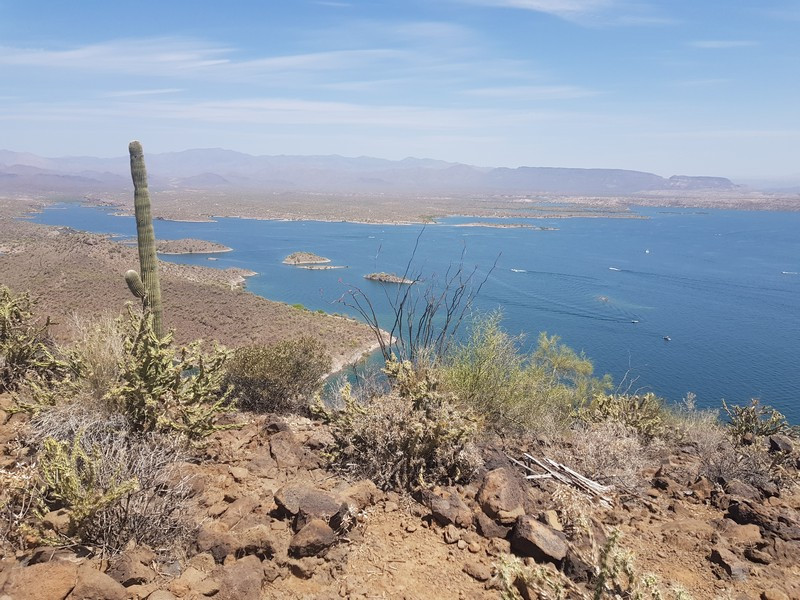
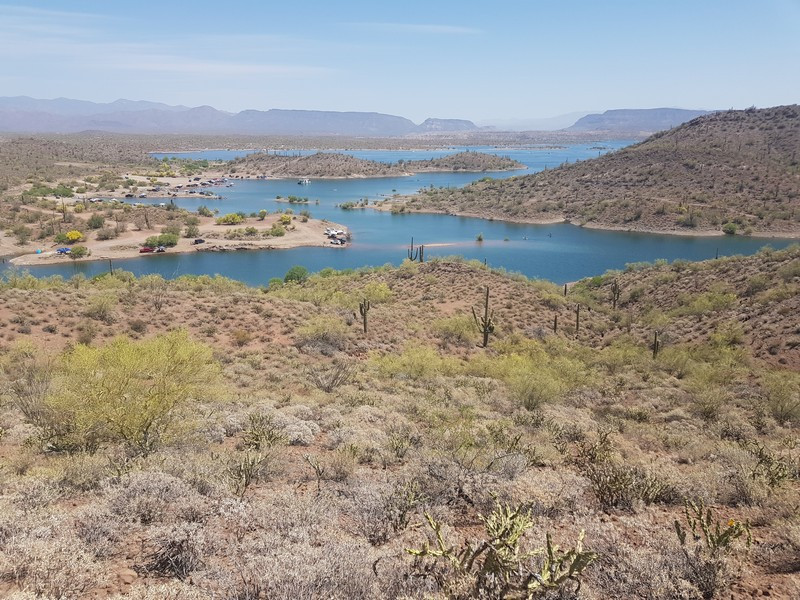
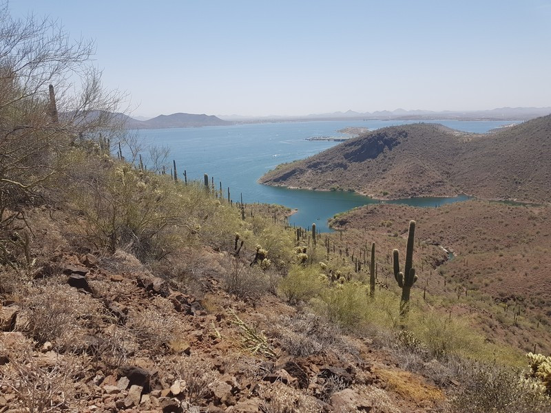
Hike the Yavapai Lookout trail near Lake Pleasant, Arizona.
From the signed trailhead for the Pipeline Canyon trail, hike into the desert surrounding Lake Pleasant. This trail is well worn and easy to follow and the trail junctions are all signed. Shortly after starting, you'll pass the signed junction with the Cottonwood trail. Stay left here and stay on the Pipeline Canyon trail. After 0.15 miles you'll reach the signed junction with the Yavapai Lookout trail. Turn left here. The trail begins to climb and you'll get good views of Lake Pleasant as well as the nearby Pipeline Canyon trail. After 0.6 miles, you'll reach a signed junction for a connector trail that goes to the Pipeline Canyon trail. Stay left here. From this point it is 0.9 miles to the lookout and impressive views of Lake Pleasant.
