
Wave Cave

Location
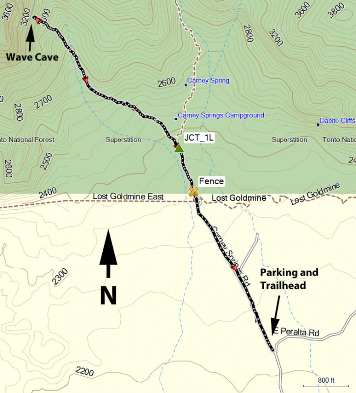
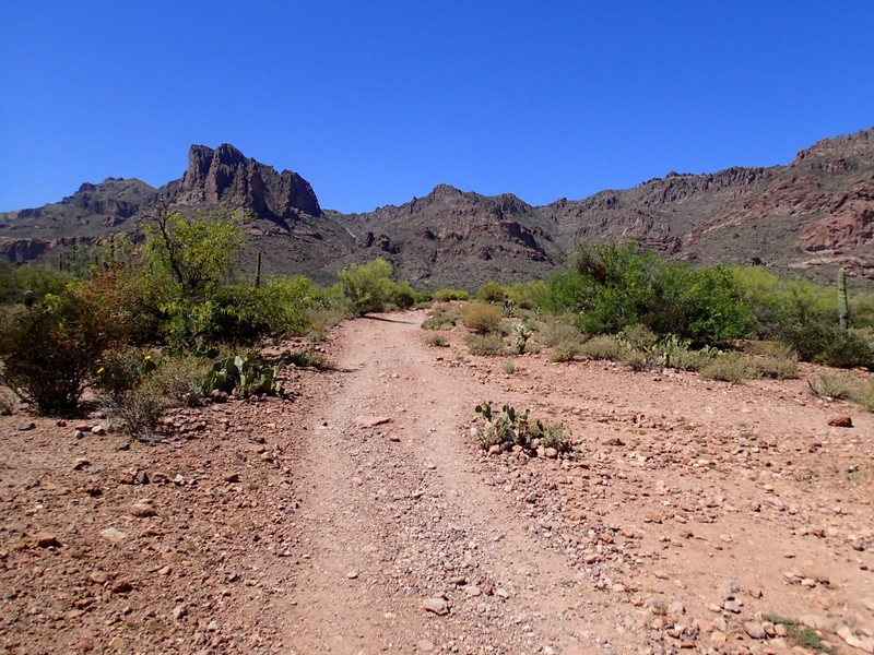
From the Phoenix area, take US-60 East, leaving the city limits. After leaving Apache Junction, continue about 8.5 miles, turning left onto signed Peralta Road (FR 77). After starting out as a paved road, this quickly turns into a maintained dirt road. After 5.6 miles, you'll stay left at the signed junction that heads towards the Peralta Trailhead. Go another 0.6 miles and park at the unsigned parking area and trail on your left. If you reach the obvious Peralta Trailhead, you've gone too far. This area is on Arizona State Trust land and requires a permit.
Hike details
Season
- January
- February
- March
- October
- November
- December
Solitude
Difficulty
Permits
Hike up to the Wave Cave in the Superstition Wilderness, Arizona.
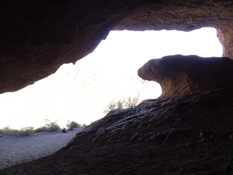
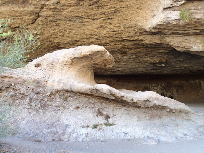
The Wave Cave has grown significantly in popularity as a hiking destination in the Superstition Wilderness. People are flocking to take a social media worthy picture of the signature wave formation inside this cave. If you'd like to take your own photo, or more importantly, enjoy a fun hike in the Superstition Wilderness, then read on!
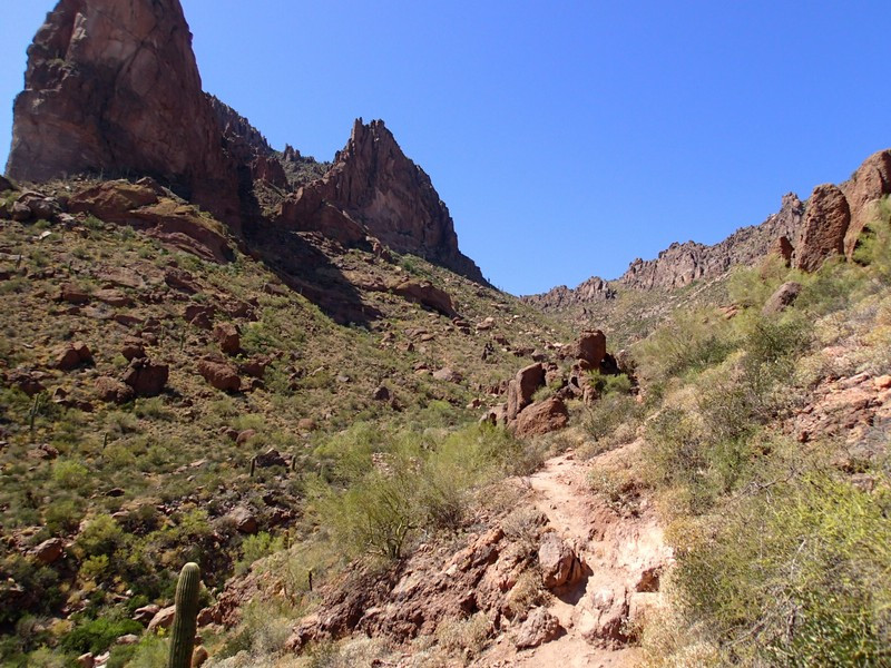
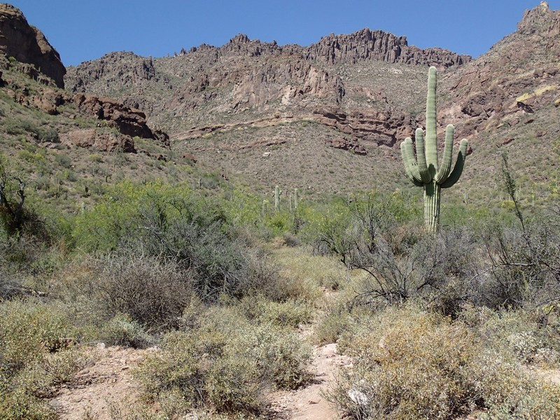
From the parking area, follow along the wide, closed dirt road heading towards the Superstition Wilderness. This old road used to lead to the Carney Springs campground, but has since been closed to cars. You'll soon arrive at the site of the old campground and a fence marking the wilderness area (marked Fence on the map). On the other side of the fence, the road goes away and you'll follow rocky but well worn trail for the remainder of the hike. About 0.2 miles from the fence, you'll reach a carned unsigned trail junction. Stay left here (JCT_1L on the map) to head towards the Wave Cave. There are white arrows spray painted on rocks to help guide you towards your destination.
The trail drops into a wash and on the other side begins a steep climb. This section can be a bit slick, with small rocks and pebbles on the trail, so be cautious. I managed to slip and fall when descending this section.
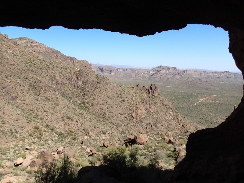
After about 1.5 miles of hiking, you'll reach the obvious Wave cave. There are great views from this vantage point as well as the fun exploring this shallow cave and the interesting wave rock formation within. Snap that perfect picture and head back when you're ready.
