
- Hikes in Arizona
- Phoenix Area and Central Arizona
- Ridgeline-McDowell Mountain Preserve
Ridgeline-McDowell Mountain Preserve
Location
In the Phoenix area, take state HWY-87 towards Payson. Turn left onto Shea Blvd into Fountain Hills. From Shea Blvd, drive 3 miles and turn right onto Palisades Blvd. Take Palisades Blvd for 1 mile and turn left onto signed Eagle Ridge Drive. Take this paved road 2.2 miles through the neighborhood to the signed trailhead and parking. There are restrooms and water at the trailhead.
Hike details
Season
- January
- February
- March
- April
- October
- November
- December
- July
- August
Solitude
Difficulty
Skills
Permits
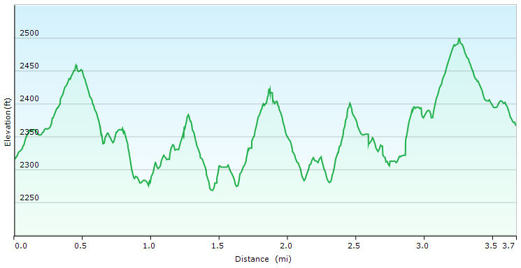
Hiking the Ridgeline trail from the Adero Canyon Trailhead in the McDowell Mountain Preserve near Fountain Hills, Arizona.
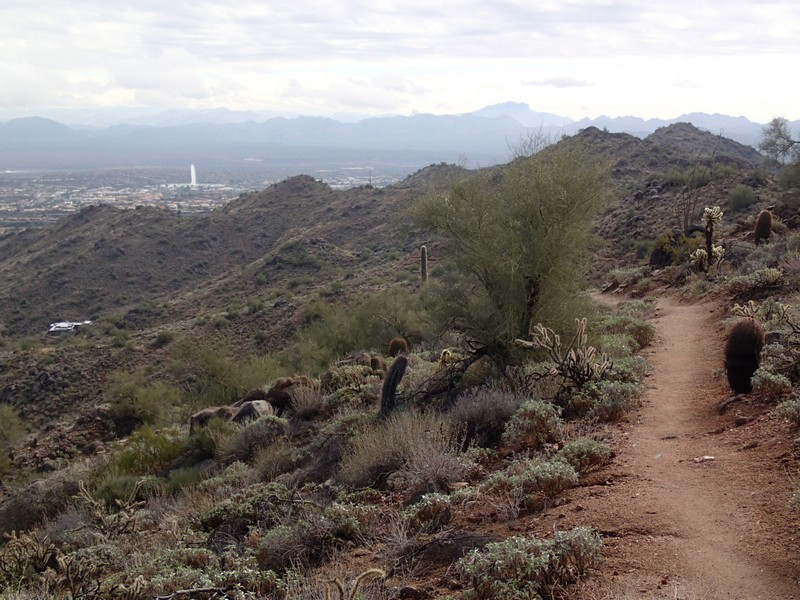
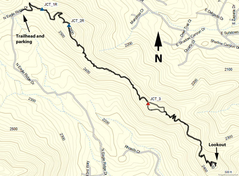
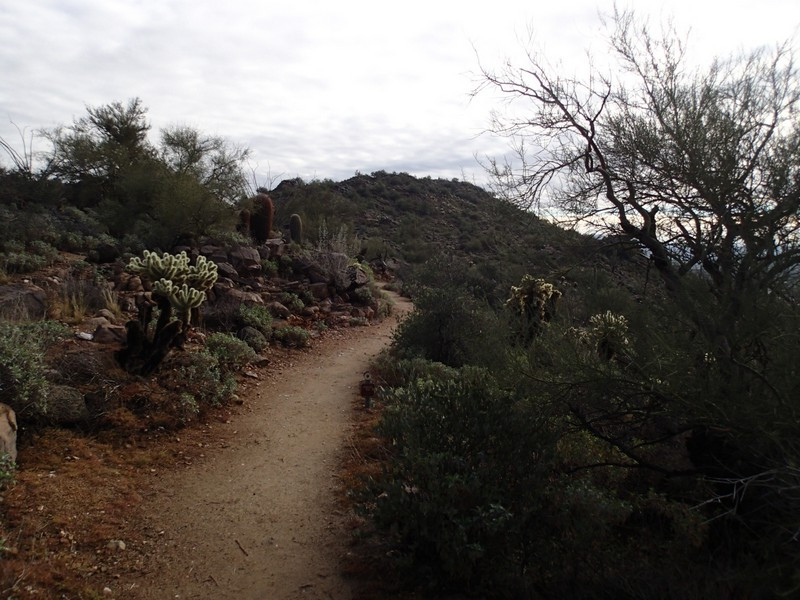
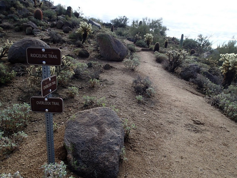
From the parking area, follow the signs to the Overlook trail (immediate right when leaving the parking area). Although there is route finding on this hike, thankfully, the trail junctions are well signed.
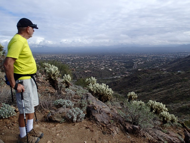
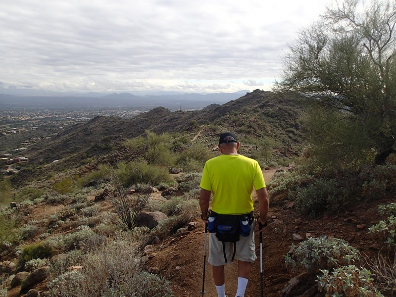
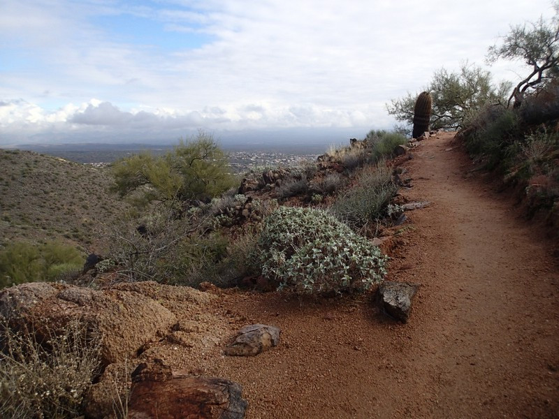
Follow the Overlook trail by staying right and following the signs. You'll enjoy the impressive views of Fountain Hills and the Four Peaks to your left. If you're lucky, you'll enjoy good views of the Fountain Hills fountain going off, as you're hiking right towards it. After about 0.2 miles of hiking, you'll reach the signed junction with the Wayne Tall Loop (JCT_1R on the map). Stay right here and continue another 0.4 miles to the next signed trail junction with the 'Easy trail access' and shortly after the Ridgeline trail (JCT_2R on the map). Stay right here take the signed Ridgeline trail. The trail lives up to its name, as it stays mostly on a ridgeline jutting out towards Fountain Hills. As a result, the views of the area are quite nice. Its another 1.4 miles to a prominent overlook and the turn around point of the hike.
