
- Hikes in Arizona
- Grand Canyon / Marble Canyon
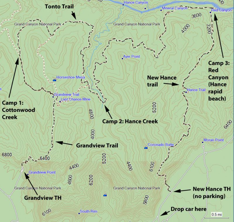
- Grandview Trail to New Hance Trail (via Tonto Trail)
Grandview Trail to New Hance Trail (via Tonto Trail)
Location
For the Grandview Trailhead: From Flagstaff, take HWY 180 north towards the Grand Canyon. Once you enter the park, you'll head east on the East Rim Drive (Yaki point turnoff). About 9 miles on the East Rim Drive will get you to the Grandview Point. The parking area is a little less than a mile drive away. There are restrooms here, but no water.
For the New Hance Trailhead: From Flagstaff, take HWY 180 north towards the Grand Canyon. Once you enter the park, you'll head east on the East Rim Drive (Yaki point turnoff). You'll drive about 9 miles to the Grandview Point lookout, then another 5.6 miles from the Grandview lookout to the New Hance trail. There is no parking at the New Hance trailhead and besides a "No Parking" sign, the trailhead is not signed from the road (just past mile marker 257). The best place to park is a paved fire road about 0.5 miles on the right before you reach New Hance trailhead.
Hike details
Season
- March
- October
- June
- July
- August
Solitude
Difficulty
Permits
Hike and backpack the Tonto trail from Grandview point to the New Hance trail in Grand Canyon national park, Arizona.
The Tonto trail stretches some 70 miles along the Tonto plateau in Grand Canyon. As one of the few trails that doesn't reach the rim of the canyon, access to the Tonto trail is typically a backpacking adventure. Many sections of the Tonto are remote, allowing for rare Grand Canyon hiking solitude and a true wilderness backpacking experience. One great backpacking adventure along the Tonto trail is the section from Grandview trail to the New Hance trail. This is not a trivial endevour. You need to be very comfortable with Grand Canyon hiking, backpacking, route finding, and water management to safely complete this trek. Be sure to check with the Back Country office before starting out to see what the water report is on the Tonto plateau so you can plan accordingly.
Day one: Grandview Trail to Cottonwood Creek (4.6 miles, 3700 ft elevation loss) - Back country use area BG9
Day two: Cottonwood Creek to Hance Creek (4.4 miles) - Back country use area BE9
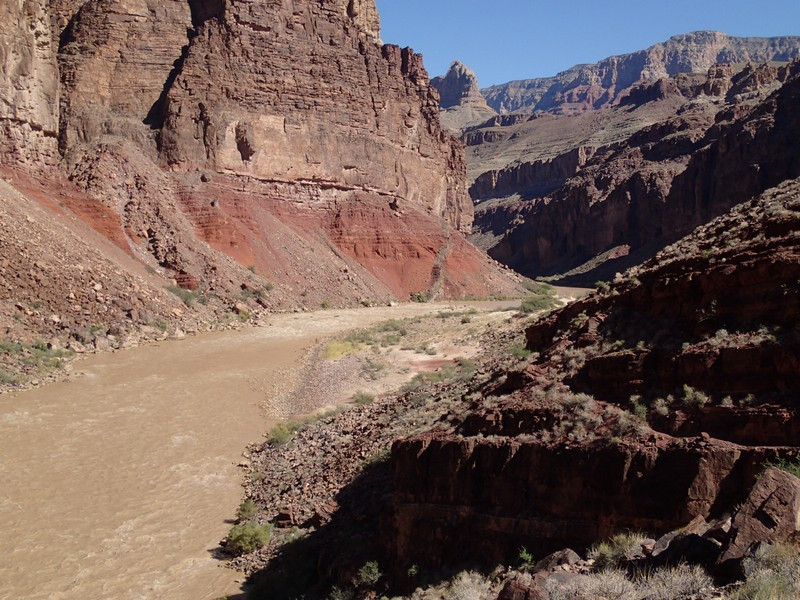
Day three: Hance Creek to Red Canyon/Hance Rapid beach (5.0 miles, 1400 ft elevation loss) - Back country use area BD9
Day four: Red Canyon to New Hance trailhead (6.9 miles, 4500 ft elevation gain)
The adventure starts at the Grandview trail (make sure you drop a vehicle at the paved fire road near the New Hance trailhead, as there is no parking allowed at the New Hance trailhead). There are restrooms at the Grandview trailhead, but no water.
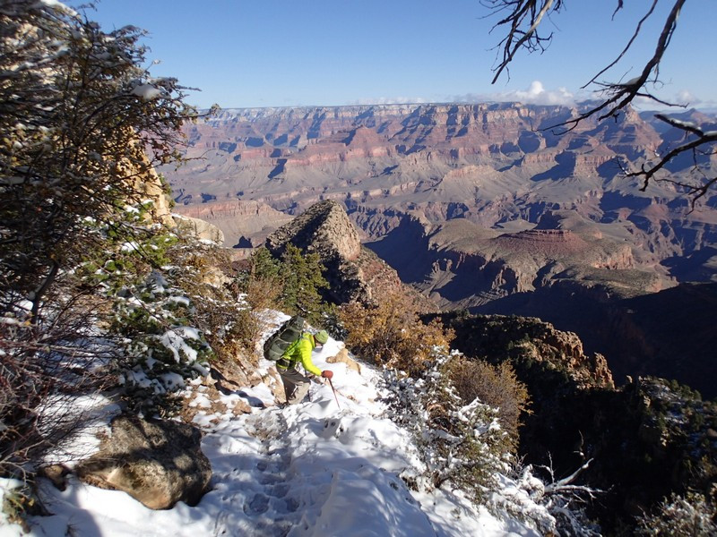
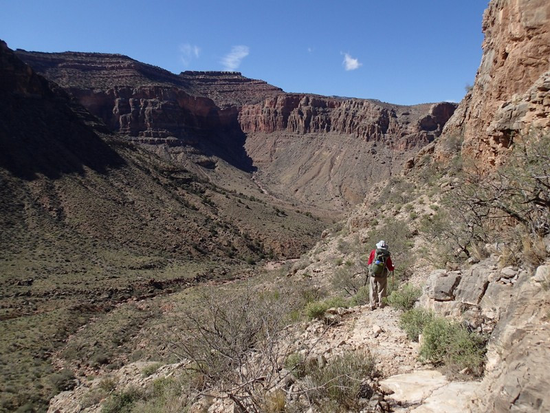
From the Grandview trail parking area, follow the well worn trail down into Grand Canyon. As are most trails from the South rim, this trail is steep most of the way. This trail was reconstructed by an old miner in 1892 from a Native American route.
As you walk down the trail, there are a few spots that are a tight squeeze with a full pack. It's also interesting when you realize there are parts of the trail that are held up by juniper logs that have been there for over a hundred years. whew!
Eventually, you will cross a saddle and close in on Horseshoe Mesa after 3.2 miles of hiking. Just before Horseshoe Mesa, you'll reach a signed junction with the trail to miner's spring. Stay left at this signed junction. Not long after that, you'll reach the signed junction with the Tonto trail. Before turning left here to continue your hike to Cottonwood creek, check out the ruins of Pete Berry's cabin. He's the guy that rebuilt the trail. Be sure to thank Pete and leave his ruins alone for other hikers to enjoy. There's also some mining implements scattered around rusting. Leave these be as well. There is a toilet nearby, but no water.
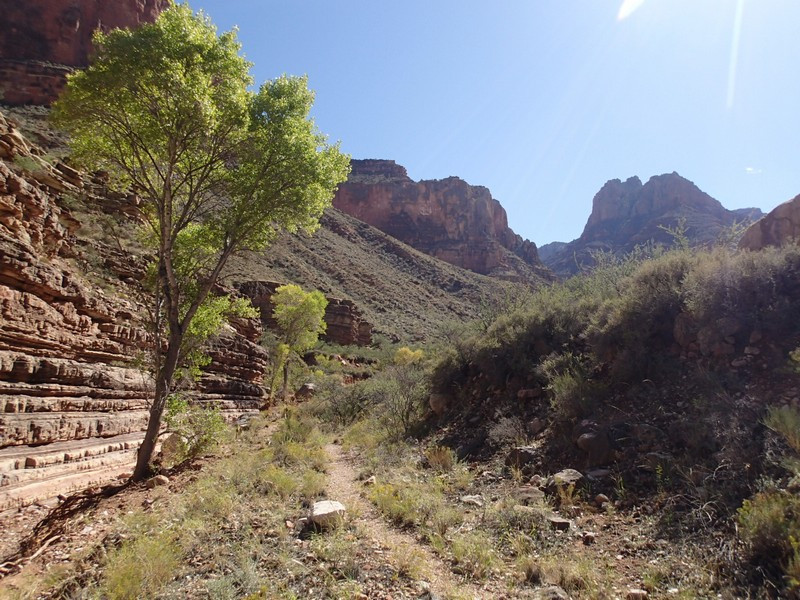
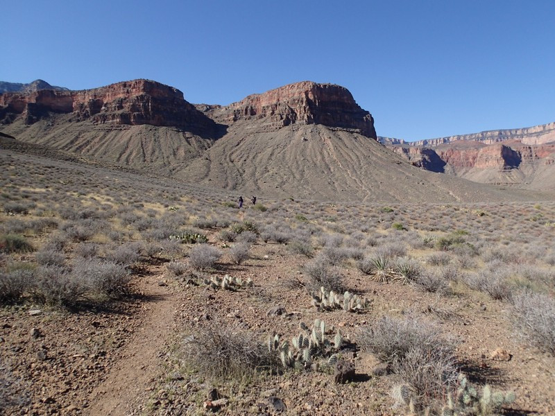
Continue back West along the Tonto trail. This section of trail drops quite steeply into Cottonwood Creek. Watch your footing here and keep an eye out for cairns to stay on the trail. Cottonwood creek is your first night camp and is a reliable source of water. There are a number of scenic campsites along this creek and it makes an excellent place to spend your first night of camp.
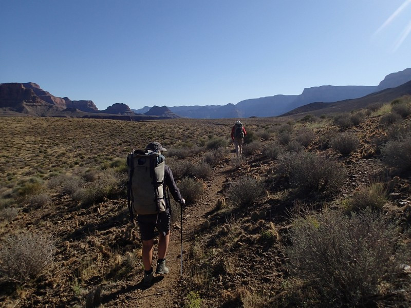
The next day starts out with a short climb out of the Cottonwood Creek drainage. The Tonto trail is well worn and easy to follow as it heads east along the base of Horseshoe mesa. You'll enjoy great views of the inner Grand Canyon gorge along this path. After about 2.4 miles of hiking, you'll reach the edge of the Hance Creek drainage. Hiking along the west side of this huge canyon can be quite exciting at times, as the trail gets quite close to the edge in places. After about 3.9 miles of hiking, you'll reach the signed trail junction for Horseshoe mesa. Stay left here to continue along the Tonto trail for another 0.5 miles and your camp site at Hance Creek. This is another good source of water and there are really lovely camp sites along the Cottonwood trees.
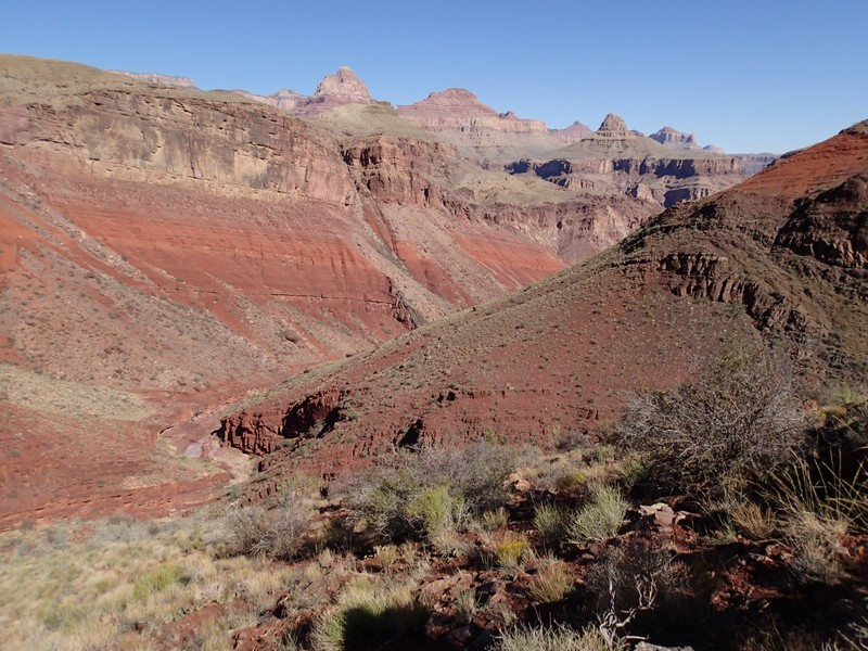
On day 3, you'll continue on the Tonto trail out from Hance creek now contouring along the East edge of Hance creek. After leaving Hance creek canyon, the Tonto trail continues into dry Mineral canyon. Soon you'll spot glimpses of the Colorado river as this trail descends towards the beach at Red Canyon/Hance rapid beach. There is great camping along the beach at Hance rapid, but you'll be treating water directly from the Colorado river here, as Red Canyon rarely has water.
Day four is the long but scenic climb out. From your campsite, it's 6.9 total miles to the rim road (plus another 0.5 miles to where you likely parked your vehicle. The climb from the mouth of Red Canyon is gradual at times, but gets really steep for the last 1.5 miles of the hike. There are big steps, small scrambles, and some exposure in this section, so expect to make slow but steady progress. After 6.9 miles of hiking and 4500 feet of climbing from your morning camp at Hance Rapid, you'll finally reach the South Rim of the Grand Canyon. Congratulations!
