
- Hikes in Arizona
- Prescott Area
- Watershed trail to FR52A
Watershed trail to FR52A
Location
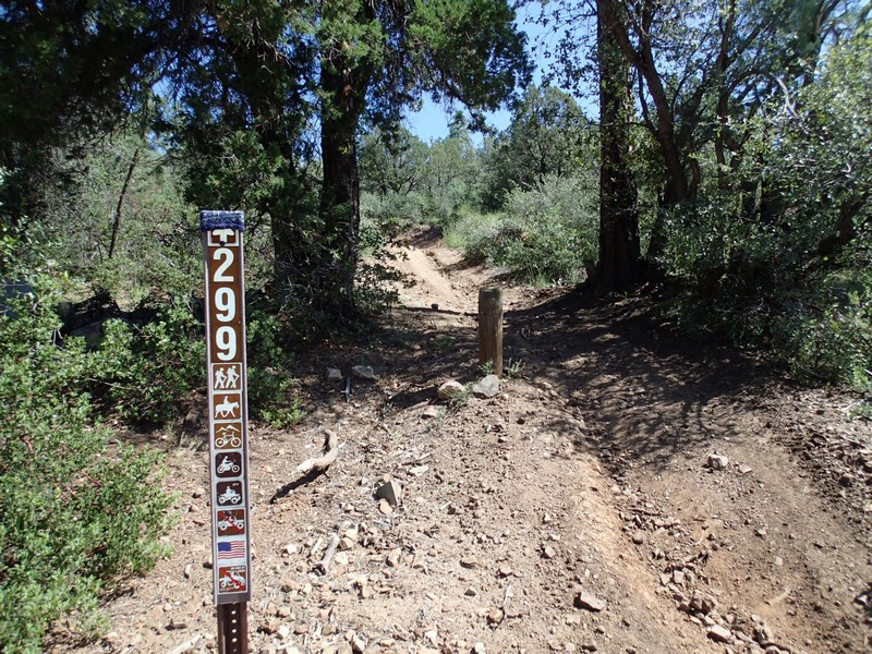
From the Phoenix area, take I-17 to the junction of HWY-69. Turn left onto HWY-69 towards Prescott. At the intersection between HWY-89 and HWY-69 towards the town of Prescott, turn left (HWY-69) and head towards the town of Prescott on Gurley Street. Turn left on Mount Vernon Avenue which eventually becomes the Senator Highway. Take this road 4.1 miles to the large parking area on the left. There are several trails that leave from this location. You want the northernmost trail (to your left when facing the parking lot) that is signed for #299.
Hike details
Season
- April
- May
- September
- October
- January
- February
- December
Solitude
Difficulty
Permits
Hike up the Watershed trail to FR52A near Prescott, Arizona.
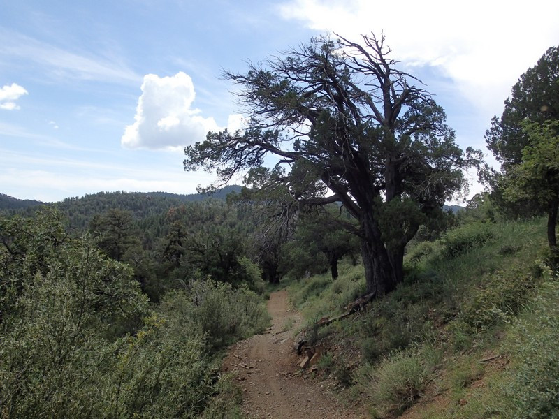
The Watershed trail is a multi-use trail that seems to be best suited for hiking. ATVs are allowed on this trail. While we didn't share the trail with any during our hike, you may not have the same luck.
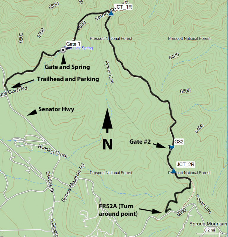
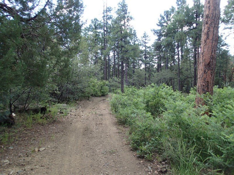
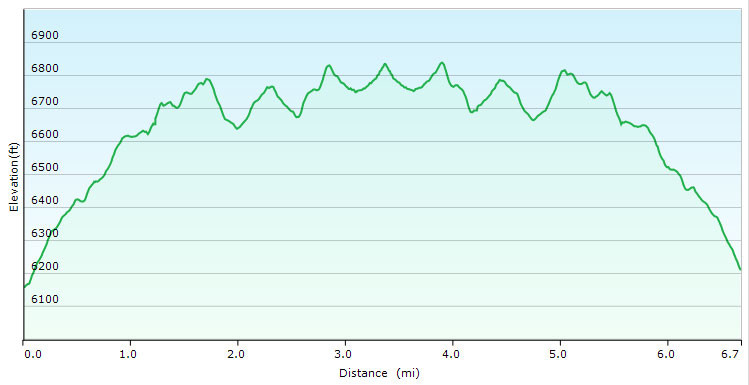
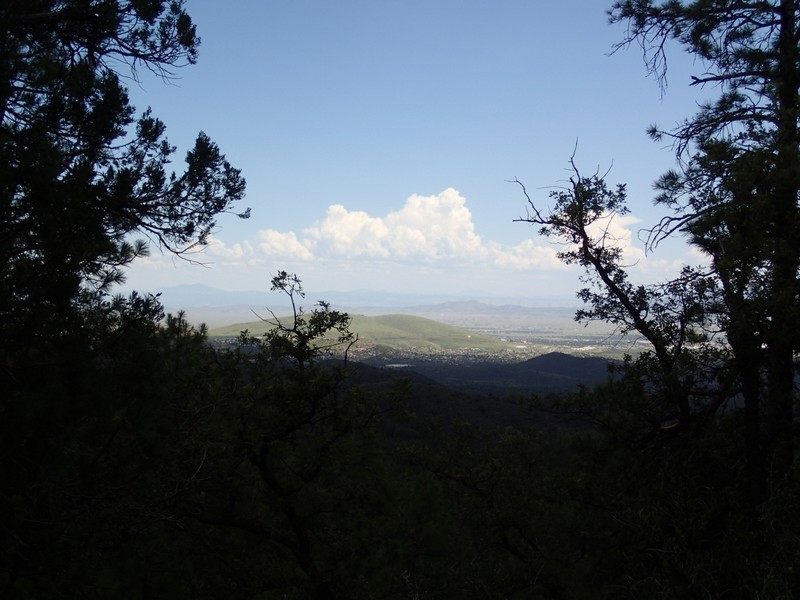
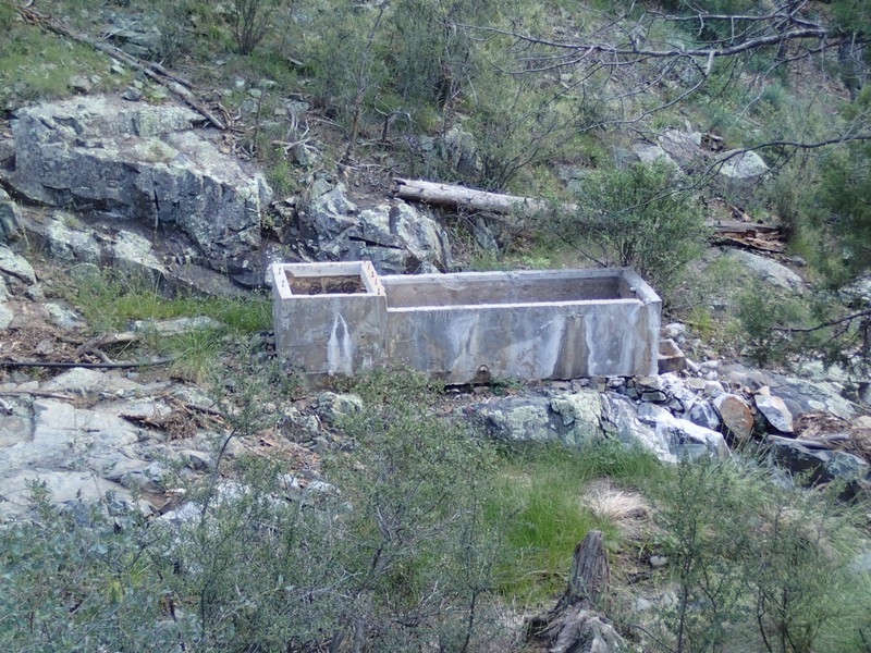
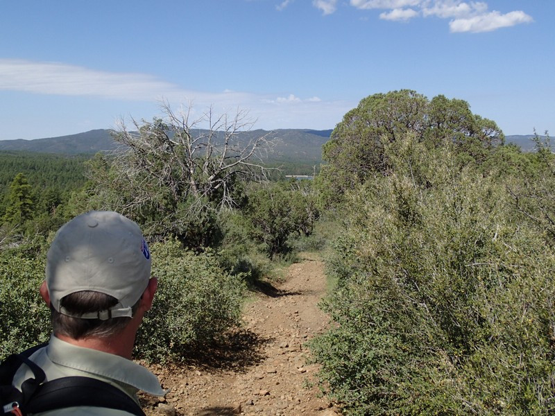
From the parking area, head to the North (left if you are facing the parking lot) and walk towards the large signed map. Past this map are two trails. You want the one marked as #299. This narrow dirt road heads up through a pine forest with sporadic shade. After 0.6 miles, you'll go through a gate (close it behind you) and you'll see a concrete tub that marks Deer Lick Spring on your right. This are is actively grazed by cattle, so you may see some on this trail. The trail continues to climb and after 1.2 miles of total hiking you'll reach a signed trail junction with the Seven Mile Gulch trail (JCT_1R on the map). Turn right here to stay on the Watershed trail. The rest of the trail alternates between flat, up, and down as it heads towards FR52A. You'll also alternate between shade and good views of Prescott and the surrounding forest.
1.3 miles from the previous junction is another gate (G82 on the map). Close this gate behind you as well and walk an additional 0.2 miles to an obvious power line and a trail junction. Stay right here (JCT_2R on the map) and climb steeply for a bit.
From this point, it's an additional 0.6 miles to FR52A and our turn around point. When ready, return the way you came.
