
- Hikes in Arizona
- Prescott Area
- Feldmeier-Goldwater Lake Loop Hike
Feldmeier-Goldwater Lake Loop Hike
Location
From the Phoenix area, take I-17 to the junction of HWY-69. Turn left onto HWY-69 towards Prescott. At the intersection between HWY-89 and HWY-69 towards the town of Prescott, turn left (HWY-69) and head towards the town of Prescott on Gurley Street. Turn left on Mount Vernon Avenue which eventually becomes the Senator Highway. Take this road 4.1 miles to the large parking area on the left. Pick up the signed trailhead for the Goldwater Lakes Trail #396 by walking across the Senator highway from the parking area.
Hike details
Season
- April
- May
- September
- October
- January
- February
- December
Solitude
Difficulty
Permits
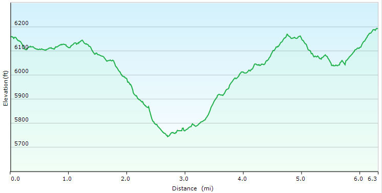
Loop hike around the Goldwater lake via Feldmeier and Goldwater Lake trails near Prescott, Arizona.
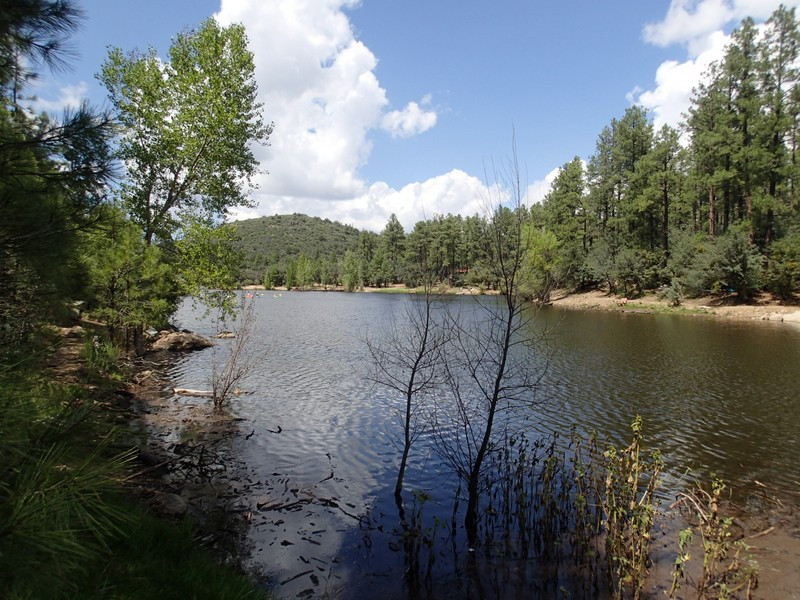
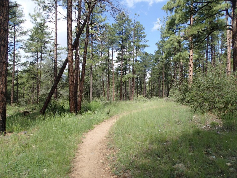
Goldwater lake is a scenic forested Lake near Prescott. There is a very pleasant and enjoyable loop hike around this lake and forest area made up by the Feldmeier and Goldwater Lakes trails.
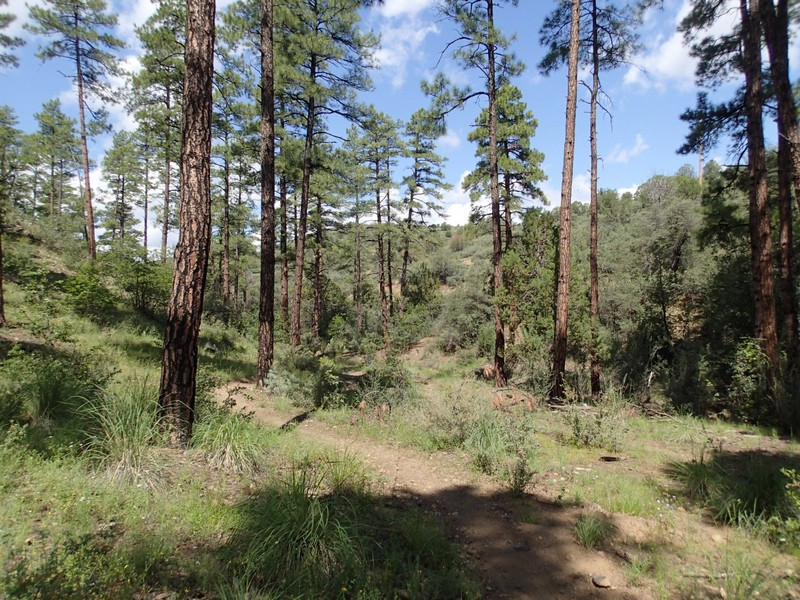
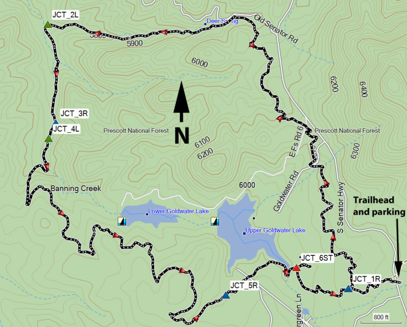
From the parking area, cross the Senator highway and start walking west on the #396 trail (Goldwater Lakes trail). After 0.2 miles, you'll reach the signed junction for the Feldmeier trail (JCT_1R on the map). Turn right and take the Feldmeier trail (#303) north. This section of the Feldmeier trail parallels the Senator Highway and is easily followed through the pine forest. After about 1.2 miles from the previous trail junction, the trail will bend west and you'll pass deer spring on your right. From Deer spring, it is about 0.6 miles to Banning Creek and the junction with the Goldwater Lakes trail (#396) (JCT_2L on the map). Turn left here.
There are a number of trail junctions on this section of the hike. Luckily, they are all signed so if you are confused about which direction to go, look for the signs marking trail #396. If there is no trail marker, look along the ground as it may have been blown down or knocked over. After hiking an additional 0.4 miles, you'll reach JCT_3R (Stay right) and JCT_4L (Stay left).
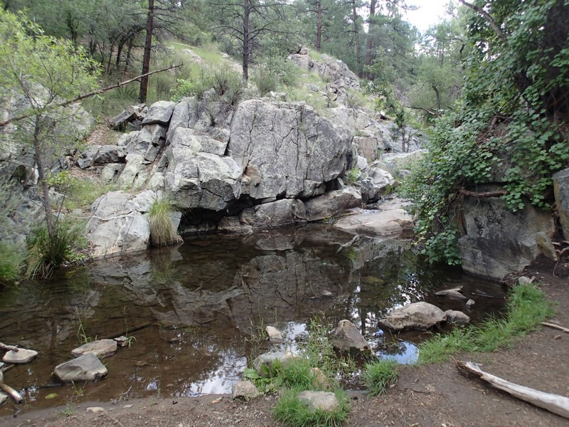
This section of the Goldwater Lakes trail skirts Banning creek for a while until you reach a very pleasant section of Banning creek that forms a small pool as it flows over some rocks.
Continuing along the trail, you'll soon see lower Goldwater Lake peaking through the trees. These fleeting glimpses of the lake will stay with you for a while as the trail contours along the hillsides. Continue until you reach a signed trail junction for a spur trail that goes to the lake (JCT_5R on the map). Stay right here to stay on trail #396.
The trail soon reaches the edge of Upper Goldwater Lake. Cross the creek here and soon you'll reach a confusing trail junction (JCT_6ST on the map). You'll want the trail straight ahead of you that quickly bends to the right (look for those #396 trail marker signs). Soon the trail will head east again and after a final 0.4 miles of hiking, you'll return to the trailhead and parking .
