
- Hikes in Arizona
- White Mountains and Eastern Arizona
- Buena Vista Trail
Buena Vista Trail
Location
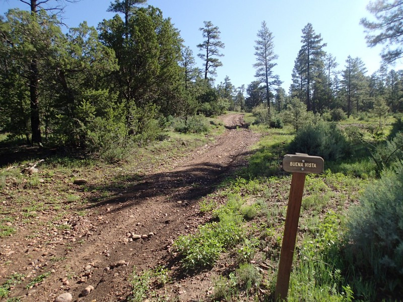
To the Trailhead: From the Heber-Overgaard area, head south-east on HWY-260 towards Show Low. At the intersection with US-60, turn right. Take US-60 for 3 miles and turn left onto the signed Rim Road (also signed for the Buena Vista trailhead. Take this well graded dirt road about 0.2 miles to the parking area and signed trailhead on the left.
Hike details
Season
- June
- July
- August
- January
- February
- December
Solitude
Difficulty
Permits
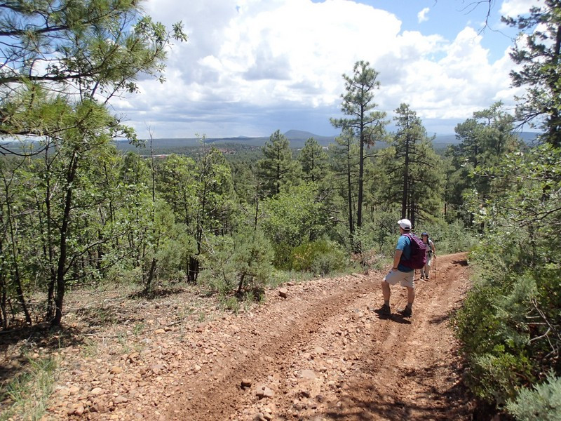
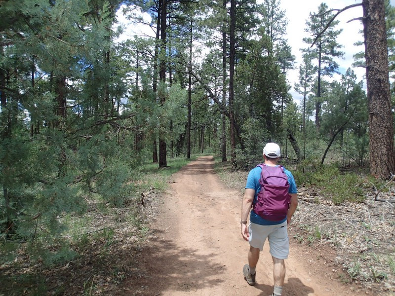
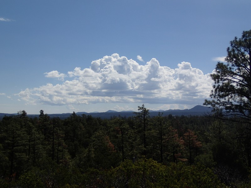
Hike along the Buena Vista trail near Show Low in Eastern Arizona.
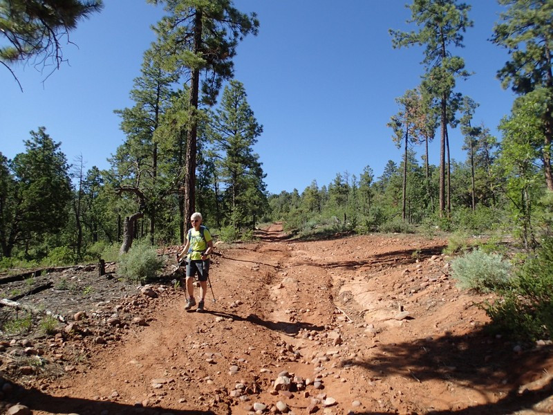
From the signed trailhead, walk along the dirt road generally east through the pine forest. The trail has many dirt roads and game trails that intersect it, so you'll need to stay alert to stay on the trail. The trail is marked periodically with white diamonds. You'll be sharing this trail with mountain bikers and possibly ATVs, so yield when appropriate.
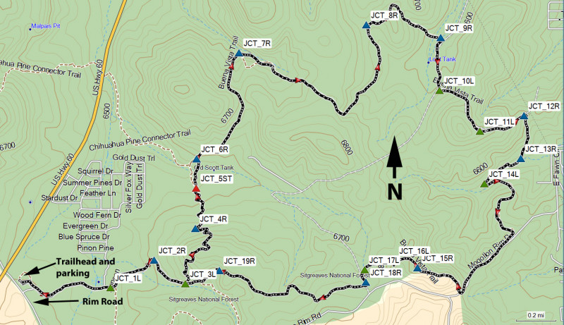
Details of each trail junction follows:
From the trailhead, you'll walk 0.4 miles to the first trail junction (JCT_1L on the map). Turn left here.
Continue 0.3 miles to the next trail junction (JCT_2R on the map). Turn right here.
Continue 0.2 miles to the next trail junction (JCT_3L on the map). You can take the hike in either direction. We arbitrarily chose clockwise and turned left here.
Continue 0.5 miles as the trail goes over a hill for some nice views. At the base of the hill you'll reach the next trail junction (JCT_4R on the map). Turn right here.
Continue 0.2 miles to the next trail junction (JCT_5ST on the map). Go straight here.
Continue 0.1 miles to the signed junction with the Chihuahua trail (JCT_6R on the map). Go right here and stay on the signed Buena Vista trail.
Continue 0.7 miles to the next trail junction (JCT_7R on the map). Go right here.
Continue 1.1 miles to the next trail junction (JCT_8R on the map). Go right here.
Continue 0.5 miles over a small hill, dropping down into a wash where you'll reach the next trail junction (JCT_9R on the map). Turn right here.
Continue 0.3 miles to the next trail junction (JCT_10L on the map). Go left here.
Continue 0.3 miles to the next trail junction (JCT_11L on the map). Go left here.
Continue 0.2 miles to the next trail junction (JCT_12R on the map). Go right here.
Continue 0.2 miles to the next trail junction (JCT_13R on the map). Go right here.
Continue 0.2 miles to the next trail junction (JCT_14L on the map). Go left here.
Continue 1.1 miles to the next trail junction (JCT_15R on the map). Go right here.
Continue 0.1 miles to the next trail junction (JCT_16L on the map). Go left here.
Continue 0.1 miles to the next trail junction (JCT_17L on the map). Go left here.
After a short distance, you'll reach the next trail junction (JCT_18R on the map). Go right here.
Continue 0.8 miles to the next trail junction (JCT_19R on the map). Go right here.
Continue 0.2 miles to the start of the loop (JCT_3L on the map). Stay left here.
You'll continue the final 1 mile to reach the trailhead and parking area (stay left at JCT_2R and stay right at JCT_1L).
