
- Hikes in Arizona
- Superstition and Mazatzal Wilderness
- Spanish Ruin
Spanish Ruin
Location
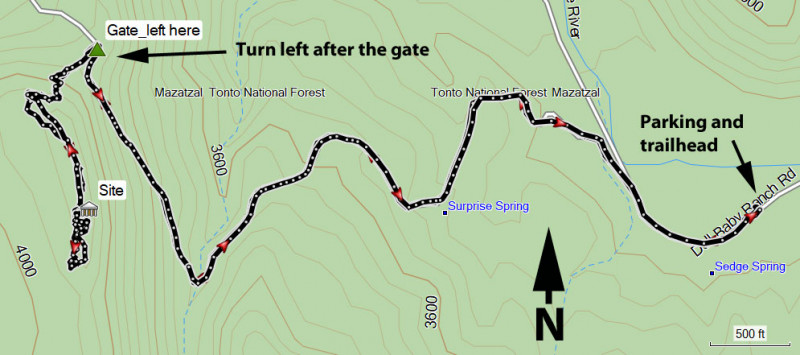
To get to the trailhead: From the Phoenix area, take HWY87 North, leaving the city limits. Once you enter the city limits of Payson, you'll quickly turn left onto signed Phoenix street. Take this paved street 0.4 miles to a T intersection and turn right onto signed Mc Lane road. Take Mc Lane road 0.4 miles to Main street and turn left. Take this road about 10.4 miles to the end of the road and the signed Doll Baby trailhead. This road is mostly paved, but the last few miles require a high clearance vehicle.
Hike details
Season
- April
- May
- September
- October
Solitude
Difficulty
Permits
Hike to the Spanish Ruins (native american site) near Payson Arizona.
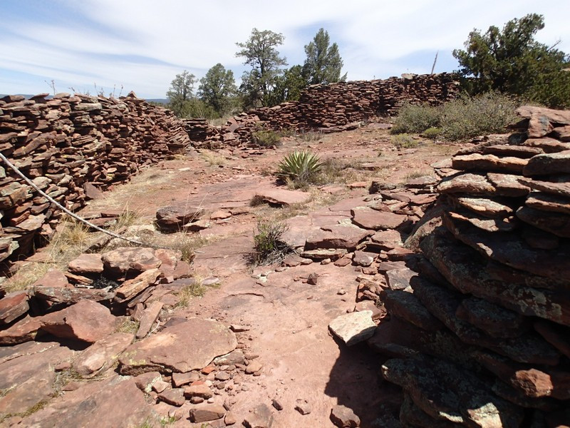
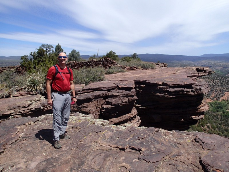
Arizona is blessed with many native american sites that remain for us to enjoy even hundreds of years after the people that built them moved on. An interesting site is located near Payson and features not only impressive walls, but great views. This area is known locally as the Spanish Ruin.
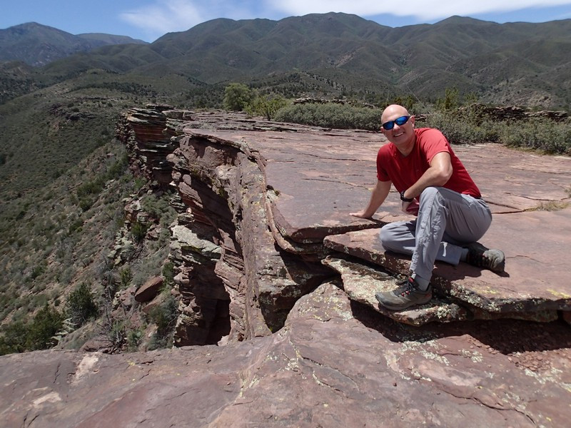
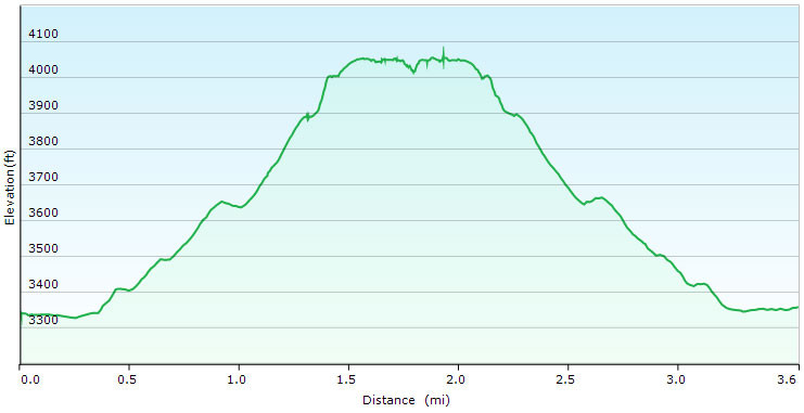
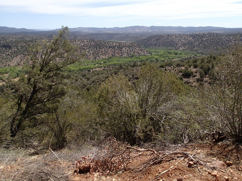
From the parking area and Doll Baby trailhead, walk through the gate and follow the closed dirt road west. Looking up west you can see the flat mesa that will be the ultimate destination of this hike. The road/trail gains steady elevation and is easy to follow. After 1.4 miles of hiking, you'll reach a gate. Go through this gate (close it behind you) and take the faint trail immediately left of the gate that heads towards the mesa. This section is more difficult to follow, so watch for cairns. You'll reach a spot to scramble up to the mesa. Thankfully there isn't much exposure, but you will need to use hands and feet to get to the top of the mesa. From the top, follow the cairns across the mesa to the easily spotted rock walls of the site.
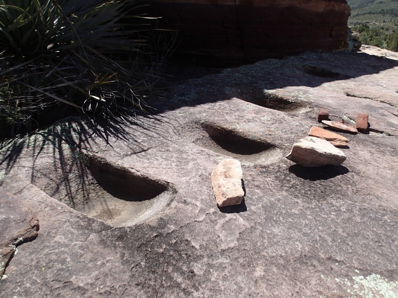
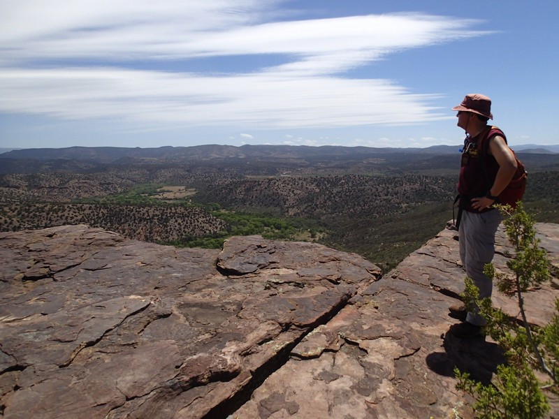
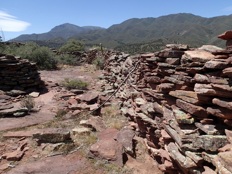
The site is pretty large and worth spending some time to explore. There are also great views to be enjoyed from this mesa. A bit south of the ruins are some metates (grain grinding holes) to check out.
Please be gentle with the fragile walls here and leave any arrowheads or pottery shards where you find them. When ready, return the way you came.
