
- Hikes in Arizona
- Phoenix Area and Central Arizona
- Indian Mesa
Indian Mesa
Location
From the Phoenix Area, take I-17 North to exit #236 (Table Mesa Road) and turn left (West). Follow this well graded dirt road for about 5 miles where it ends in a large parking area.
Hike details
Season
- January
- February
- March
- April
- October
- November
- December
Solitude
Difficulty
Permits
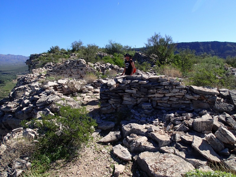
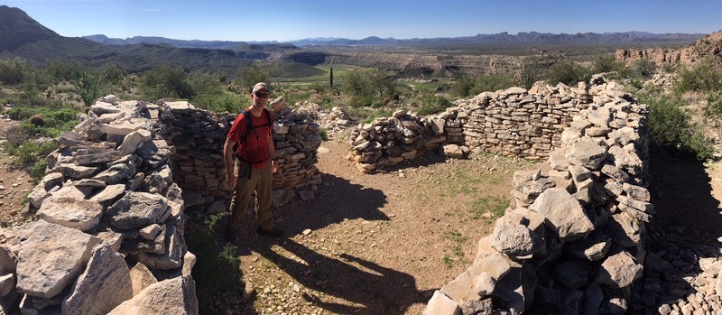
Hike up to a well preserved native american site near Phoenix Arizona called Indian Mesa.
The Hohokam tribe have been in the Phoenix area for over well over a thousand years. They left several, hidden sites that give the adventurous hiker some idea what it might have been like to live in the Sornora desert so long ago. The hike up to Indian Mesa is a great way to experience this.
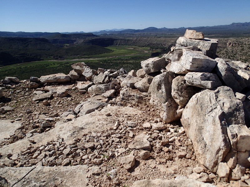
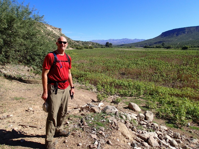
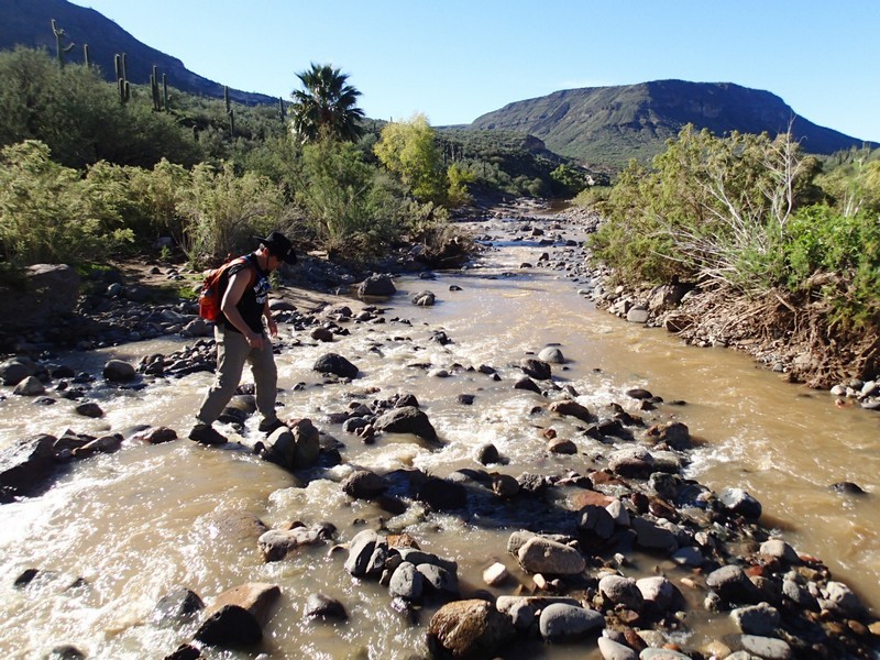
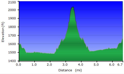
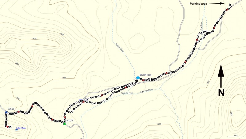
From the parking area, go around the gate and start hiking along the closed road to the Agua Fria river. Most of the time, this river is just a trickle, but we had some recent rains before this hike, so it was a little more interesting to cross and keep your feet dry. After reaching the other side, use those route finding skills to follow the now closed road generally South West. The road stays in the wide open valley of the Agua Fria river, but starts to drift away from it after about a mile of hiking. From here, the closed road gets more difficult to find and can be choked with pricker bushes. Aim for the mesa (this is Indian Mesa) you can see directly ahead of you in the distance. The trail will go up a briefly steep deteriorated road section and you'll reach a clear fork in the road after about 2.2 miles of hiking. Turn right here (JCT_1R). After 0.7 miles of additional hiking, keep an eye out for some rock cairns (JCT_2L) on your left that mark a trail heading steeply up to Indian Mesa. Follow the rock cairns on this trail all the way up to the top.
The site is well preserved, with plenty of rock walls and pottery shards to explore. Please leave the site exactly as you found it. The views from this mesa are also impressive and it is easy to see why the Hohokam picked this spot.
When ready, return the way you came.
