
- Hikes in Arizona
- Grand Canyon / Marble Canyon
- Old Bright Angel trail
Old Bright Angel trail
Updated
Location
How to Get There
This hike is located on the North Rim of the Grand Canyon.
From Flagstaff, take HWY 67 south towards the Grand Canyon. Once you enter the park, you'll head 11 miles south of the park entrance (about 2 miles north of the lodge) to the signed parking area. This is a popular trailhead, so parking can be tricky to find.
From Flagstaff, take HWY 67 south towards the Grand Canyon. Once you enter the park, you'll head 11 miles south of the park entrance (about 2 miles north of the lodge) to the signed parking area. This is a popular trailhead, so parking can be tricky to find.
city
North Rim
state
AZ
country
USA
Region
Grand Canyon and Marble Canyon area
Hike details
Distance
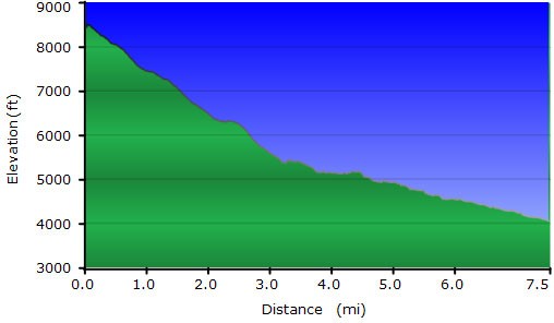
11.20 [Miles] Total
Hike Distance- Details
11.2 miles one way to the Cottonwood Campground.
Time
8.00 [Hours]
Time-details
This is a full day hike one way.
Elevation Loss
4,500 Total Elevation Loss[Feet]
Elevation Details
A monster 4500 ft !
Hike Trail Type
One Way
Special Features
Water
Season
Best Season
- May
- June
- September
- October
Worst Season
- January
- February
- July
- August
- December
Solitude
Solitude
High
Solitude Details
This trail has been lost to history. As such, you can expect to enjoy some of the best solitude to be found in the Grand Canyon.
Difficulty
difficulty detail
Due to the distance, elevation, route finding skills needed, and trail conditions, treat this hike as a Death March. You absolutely need to be at the top of your hiking game to attempt this hike. Mistakes will have serious consequences here.
Permits
Permit Info
Backcountry permits from the National Park Service must be acquired prior to this hike for camping at Cottonwood campground. See www.nps.gov for details. You can reserve up to three months in advance.
Be Aware of
Outrageous elevation changes, extreme temperature changes, bushwhacking, route finding, water crossing, exposure. The Ken Patrick trail has mules that we need to share the trail with.
Hike the Hiking the Old Bright Angel trail in Grand Canyon National Park, Arizona.
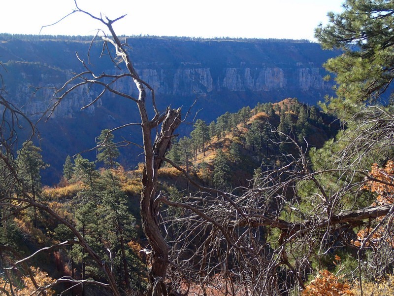
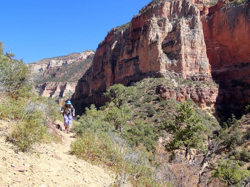
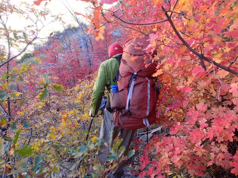
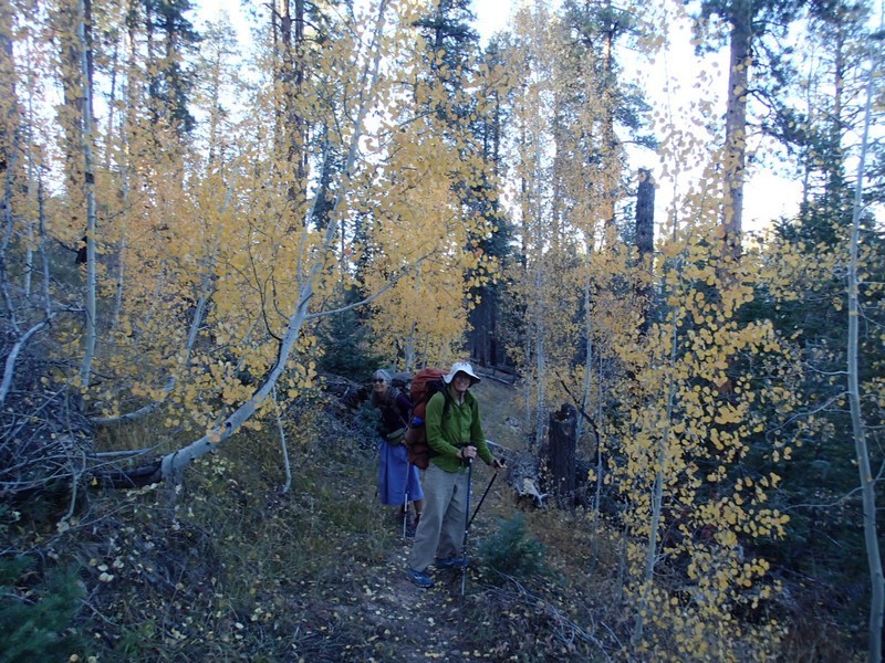
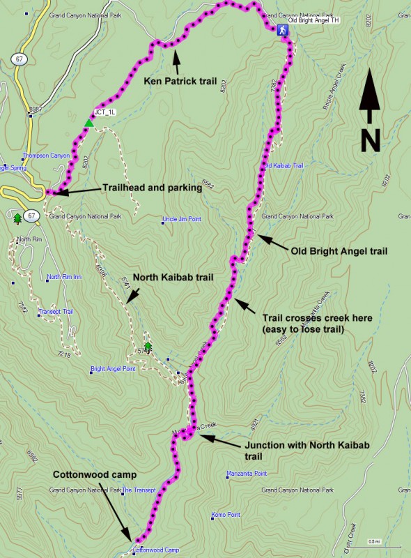
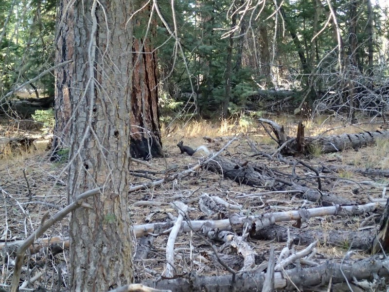
Most folks head down the well maintained and easy to navigate North Kaibab trail when hiking on the North rim of the Grand Canyon. There is another route down that not many people know about. Originally, the main route down from the North rim was called the "Old Bright Angel trail". This trail was constructed in the early 1900s and used as the main transportation route to the inner gorge from the north rim until the park service built the North Kaibab trail in the 1920s.
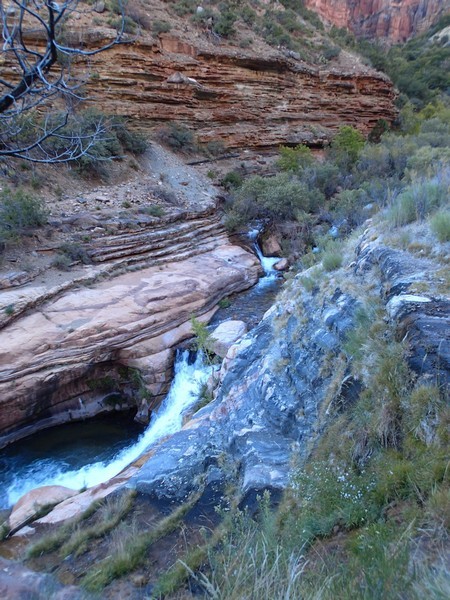
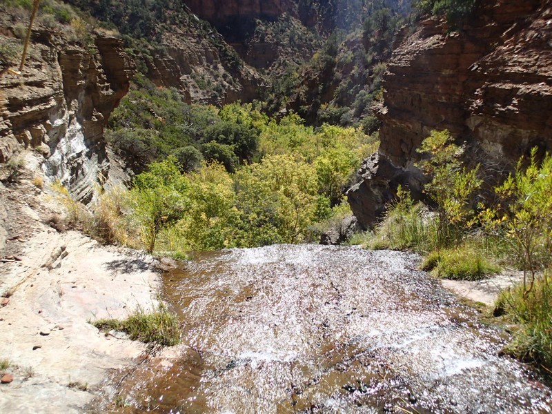
The Old Bright Angel trail is no longer maintained and presents significant additional challenges to the backpacker. Do not underestimate the difficulty of this trail. To find the trailhead, you first need to walk along the Ken Patrick trail from the North Kaibab trailhead and parking area. The Ken Patrick trail is well worn and easy to follow. After about 0.8 miles, you'll reach the junction with the Uncle Jim trail (JCT_1L on the map). Stay left here. You'll leave the mules behind as you walk an additional 2.5 miles to the signed start of the Old Bright Angel trail. The first several miles of this trail are very pretty, but also overgrown. While occasionally bushwhacking through the various trees, you'll also encounter Mexican locust, whose thorns are quite unpleasant. Wear long pants and long sleeve shirts through this section. You'll be using those route finding skills in this area. Due to the overgrowth it is sometimes difficult to find the trail. After a few miles, you'll emerge out of the overgrown section and the trail becomes easier to follow as it sticks to the west side of Bright Angel canyon. The views of the surprisingly swiftly flowing Bright Angel creek and the canyon are very impressive. The trail is easier to follow in this section, but keep an eye out for helpful cairns to make sure you stay on it. After about 2.5 miles of hiking from the start of the Old Bright Angel trailhead, you'll reach Bright Angel Creek. The trail gets quite confusing here. You need to cross the creek eventually, but not yet. Stay on the West side of the canyon up and over a hill to find a better place to cross the creek. Once you cross the creek, it is tough to pick up the trail on the other side. We missed it and painfully bushwhacked down the creek until we were able to get back on the trail on the East side of the canyon. Once you reunite with the trail on the East side, it becomes easier to follow again. You'll soon see the pump house at Roaring Springs and enjoy great views of the creek, but you won't be able to cross just yet. Continue on the trail (through some exposed sections of trail, watch your step!) until you reach the normally dry Manzanita creek and a bridge. Here you'll finally meet up with the North Kaibab trail. Walk the final 1.5 miles to Cottonwood camp and rest your weary legs. When we did this hike, we returned to the North rim via the North Kaibab trail and I'd recommend that for you as well. This trail would be very difficult to follow from the bottom heading up. Our hike was in perfect weather in October and even though we are seasoned Grand Canyon hikers, we were still tired after 8 hours of hiking this trail. The best part about it was not having to share it with another hiker, as this trail gets very little use.