
- Hikes in Arizona
- Grand Canyon / Marble Canyon
- West Tonto: South Bass trail to Hermit trail
West Tonto: South Bass trail to Hermit trail
Location
From Flagstaff, take HWY 180 north towards the Grand Canyon. Once you enter the park, you'll head towards the Grand Canyon Village. Take the West Rim drive from the Bright Angel Lodge to the west. You'll shortly reach Rowe Well Road. Turn left here and follow Rowe Well road for 4.4 miles. This road turns to well graded dirt after about 0.6 miles. Although the road is in good shape here, to get to the trailhead, you'll need a high clearance vehicle and you'll likely want one with 4WD depending on how bad the road gets. Once you enter the Kanab National forest, this road becomes FR328A. After 4.4 miles on this road, you'll reach a junction with FR328. Turn right here and follow signs for Pasture Wash. Take this dirt road 15.8 miles to the Havasupai Indian reservation boundary. Sometimes this boundary is manned and sometimes it is not. If it is manned, you'll need to pay a $25 toll (as of March 2017) to the Havasupai tribe for passing over their land here. If this is not manned, you can go through the gate without paying. Continue on this road 1.8 miles and turn right onto the signed road for Pasture Wash Ranger station. The road here is more rugged and narrow. After about 1.3 miles (and through a few gates - please close them behind you) you'll pass the now closed Pasture Wash Ranger Station. From here it is another 3.4 miles on an increasingly rocky dirt road to the rim of the Grand Canyon and the parking area for the South Bass trailhead.
Hike details
Season
- March
- April
- October
- November
- June
- July
- August
Solitude
Difficulty
Permits
SPECIAL CONSIDERATIONS FOR WINTER AND SUMMER TIMES:
For Winter Hiking: Remember that the South Rim is very cold in the winter. Snow and Ice may cover the trail for the first few miles. Crampons recommended.
For Summer Hiking (NOT RECOMMENDED!): Get an early start and don't hike during the heat of the day. Remember that the bottom of the canyon will be MUCH hotter than the top.
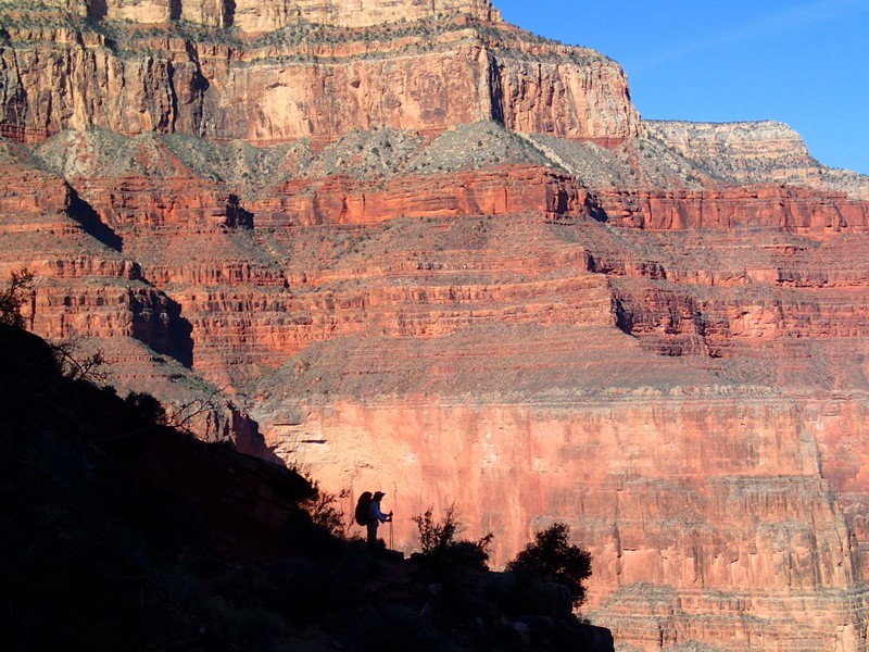
Hiking and Backpacking along the South Bass, Tonto, and Hermit trails in Grand Canyon National park, Arizona.
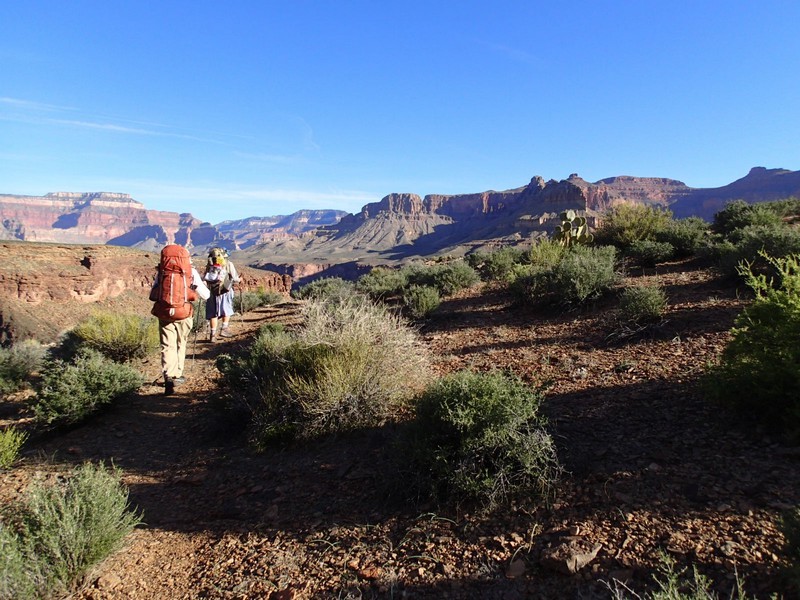
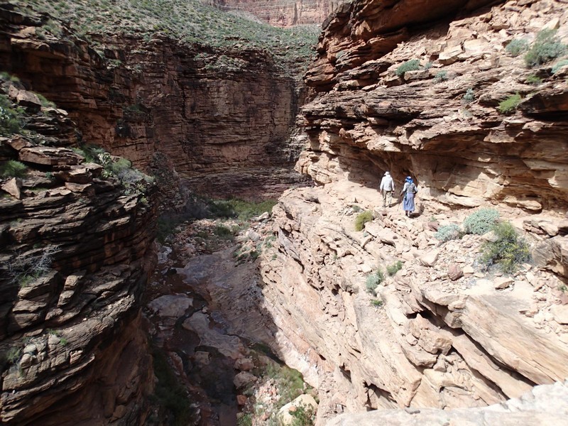
One of the most aggressive backpacking trips you can take in the Grand Canyon is known as "The Gems". Hiking down the South Bass trail and along the Tonto trail, out the Hermit trail, takes you through a series of scenic and remote canyons mostly named for gems. This is a long backpack (we took six days to complete it) but if you have the ability you'll enjoy some of the best solitude and wilderness the Grand Canyon has to offer. You will need a backcountry permit from the National Park Service. You'll also need good route finding skills, as the Tonto trail is frequently faint on this infrequently traveled place in the canyon. The trail is frequently a bit overgrown, so you'll be much more comfortable wearing long hiking pants.
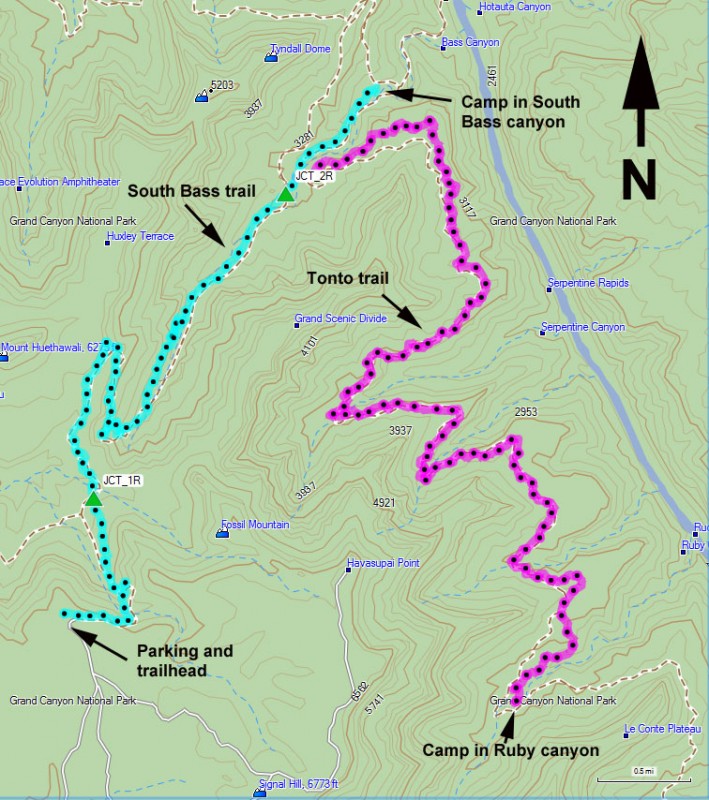
The South Bass trail is in pretty good shape, considering it is an unmaintained trail. The trail is not as good as the more popular corridor trails, so you'll move slower here. At the unsigned trail junction with the Esplanade trail to Royal Arch (JCT_1R) stay right here to stay on the South Bass trail. You'll hook up with the Esplanade trail again at JCT_2R. Stay right again. The South Bass trail goes all the way to the river and a very nice beach on the Colorado, but for your first camp, you'll drop just far enough below the Tonto layer to find seasonal water.
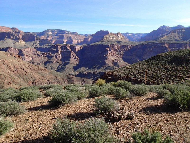
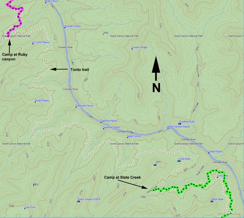
On Day 2, you'll backtrack back up to the Tonto trail. The Tonto trail on this section of the park is in much more primitive condition than elsewhere. Be prepared for more route finding (thankfully there are plenty of cairns to help this), overgrown brush conditions, and a rockier trail. From the South Bass canyon, you'll pass through Serpentine canyon, which takes you a long time since it is such a large drainage. There may be seasonal water in Serpentine creek. The next large drainage is Ruby canyon, which is where you'll set up your next camp. There is also seasonal water in Ruby canyon, along with several nice campsites.
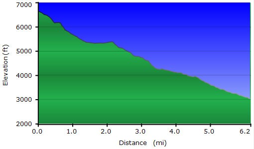
Day 3 is a long hike (~15 miles) from Ruby Canyon to Slate creek. You'll pass Turquoise canyon (seasonal water), Sapphire canyon (seasonal water) and Agate canyon (seasonal water) before finally reaching Slate creek (year round water). We camped in Slate creek, but Agate canyon is also a good place to camp if there is water there.
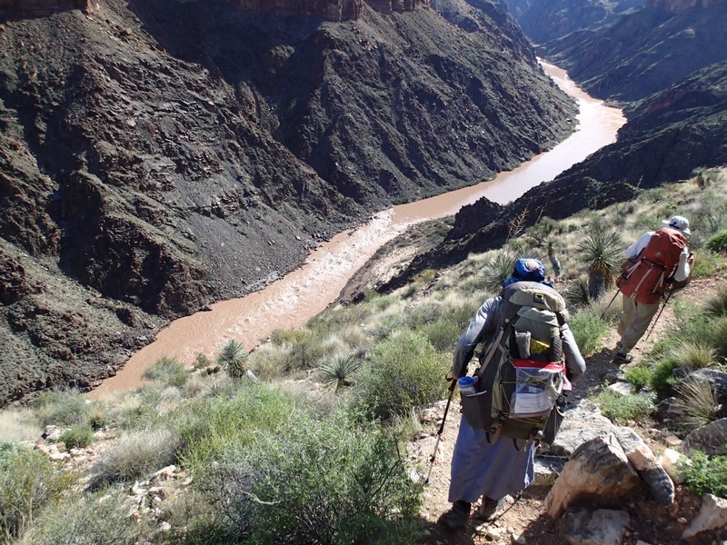
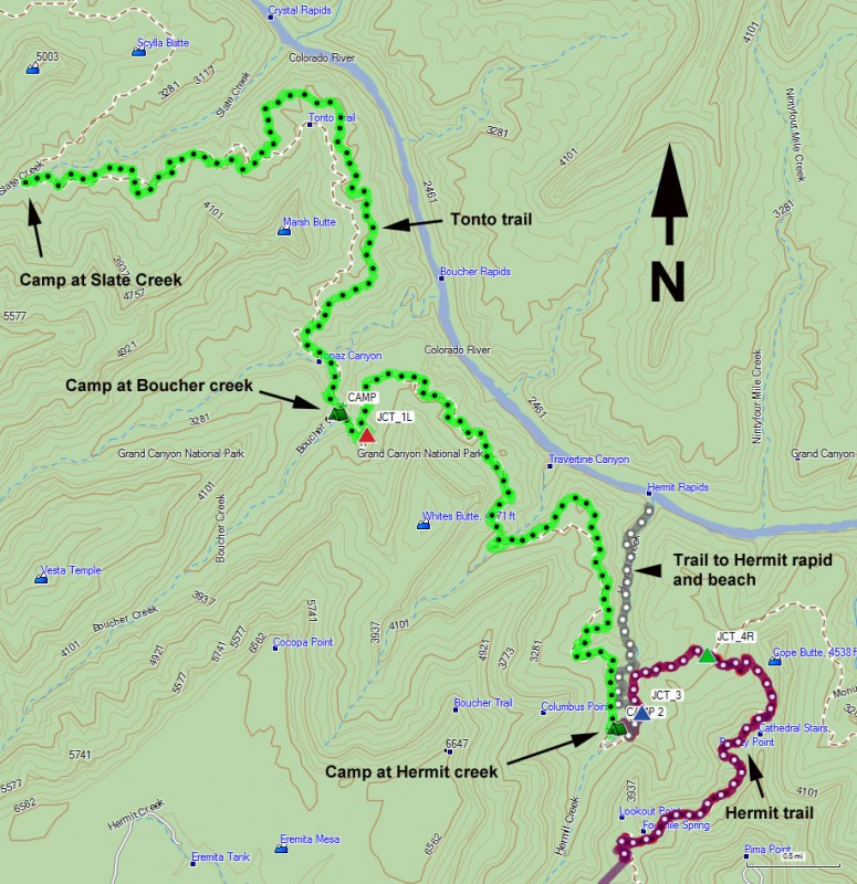
Day 4 takes you about 5 miles from Slate creek to Boucher creek. There is seasonal water at Boucher creek and if you have the time, take the 1.5 mile hike down to Boucher beach to see the Colorado River. There are several very nice campsites at Boucher canyon. Day 5 is a five mile walk from Boucher creek to the Hermit creek campground. At the junction with the Boucher trail (JCT_1L on the map) stay left to stay on the Tonto trail. The campground at Hermit creek has year round water and a bathroom. If you've got time and energy, the hike down to Hermit beach is a lovely 2 mile one way walk through an impressive canyon to one of the more difficult rapids on the river: Hermit Rapids.
Day 6 is the long climb out to the Hermit trail. Stay right at the signed trail junction with the Hermit Rapid trail (JCT_4L on the map). You'll stay right again at the signed junction with the Tonto trail (JCT_3L on the map). After 7.8 miles and 3700 ft of climbing, you'll reach the South Rim of the Grand Canyon.
