
- Hikes in Arizona
- Phoenix Area and Central Arizona
- Skyline Crest trail (Skyline Regional Park)
Skyline Crest trail (Skyline Regional Park)
Location
To get to the trailhead: From the Phoenix area, take I-10 West to the Watson Road exit. Turn right and take this road about 2 miles to the signed entrance to the Skyline Regional park. Park at the end of the road. There are restrooms here and in a pinch you could fill up your water bottles in the sinks in the restrooms.
Hike details
Season
- January
- February
- March
- October
- November
- December
- June
- July
Solitude
Difficulty
Permits
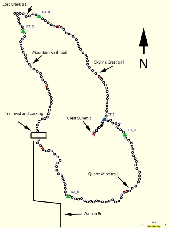
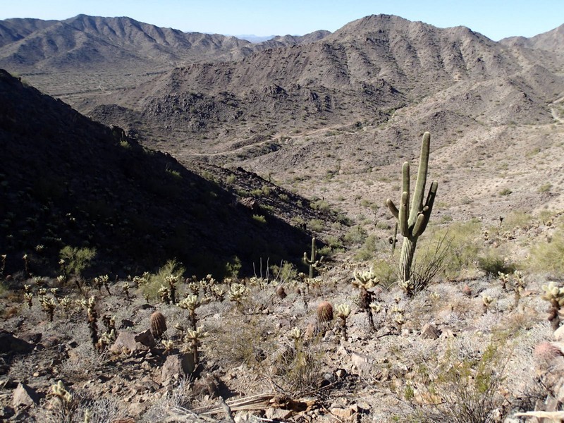
Loop hike on the Skyline crest trail in Skyline Regional park in Arizona.
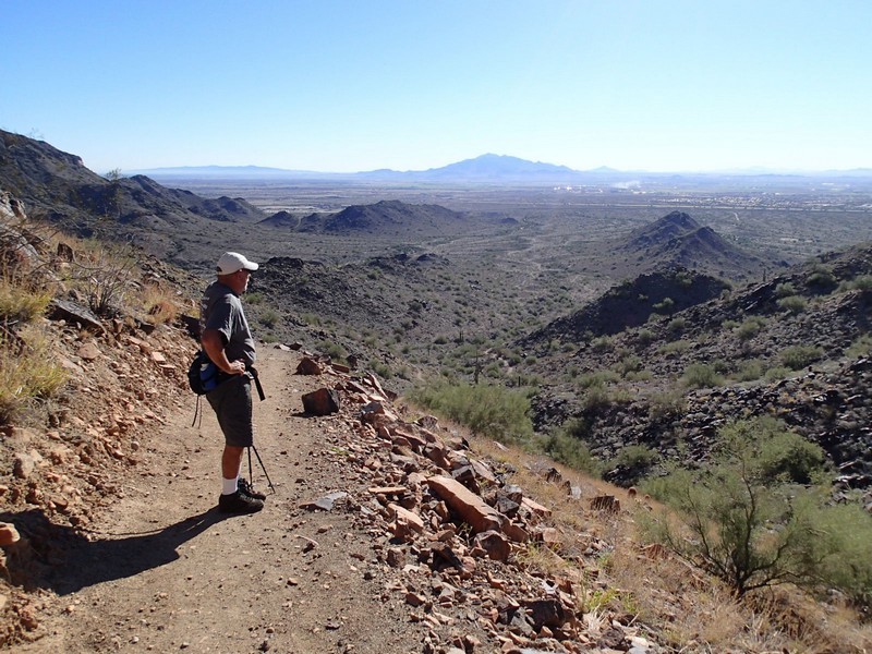
Skyline Regional park is the latest in a wave of Phoenix area municipalities creating space in the desert for hiking, biking, and horseback riding. There are several trails to choose from in this area. We chose a loop with the Skyline crest as it contained the highest point in the park and we were hoping for some good views.
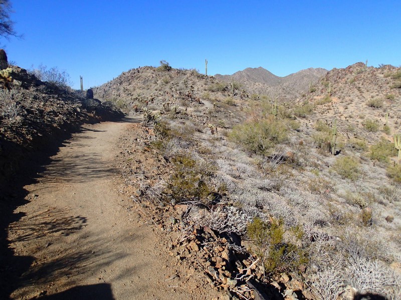
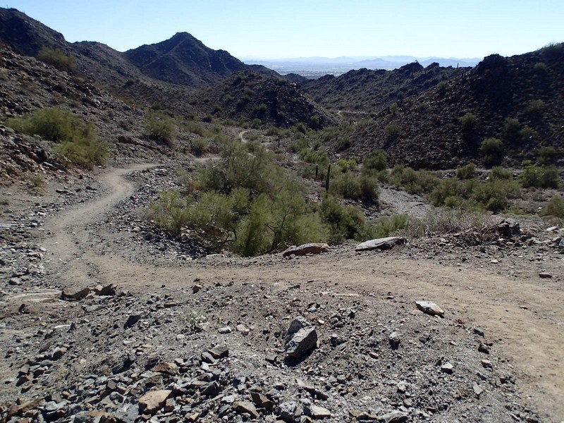
From the South end of the parking area, look for a small trail marker at a clear trail. You're looking for the Quartz mine trail. Take this well worn trail South. This is typical sonoran desert and you'll be passing Saguaro, barrel, and cholla cactus. The trail heads over a small saddle and drops back down to views of the park entrance and the city of Buckeye. Turning East, there is a trail junction near the entrance (JCT_1L on the map). Stay left as the trail takes a turn to the North and starts to gain elevation. After about 1.5 miles of hiking, you'll reach a junction with the Skyline Crest trail. Turn left here (JCT_2L on the map) and start climbing even more steeply on the Skyline Crest trail.
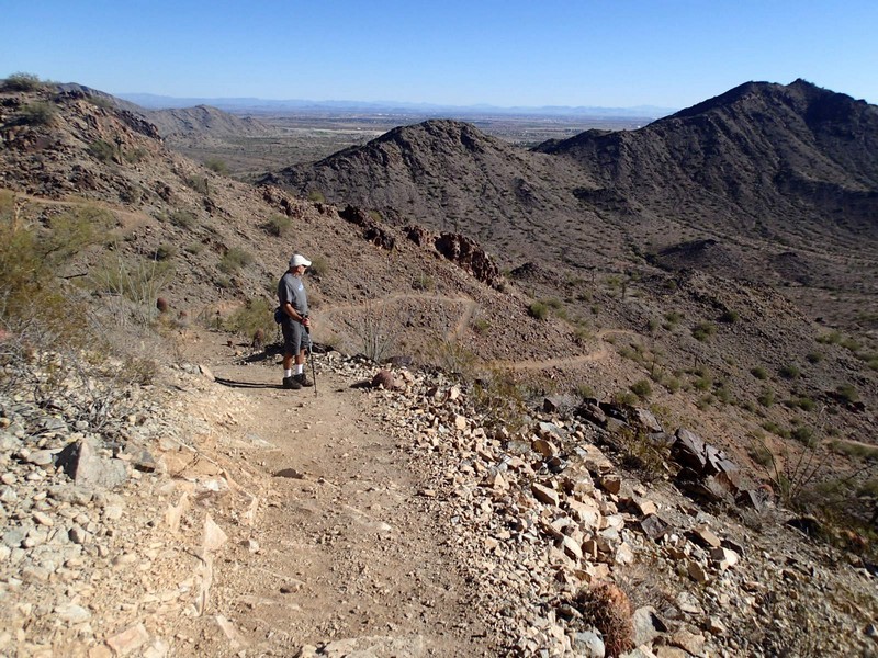
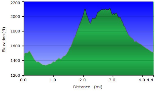
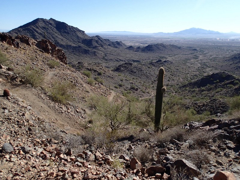
As the name implies, this trail provides hiking along the crest of a mountain range, providing good views of both Buckeye and the park desert. After 0.3 miles you'll reach a saddle (JCT_3 on the map). To your left is a short 0.15 mile hike to the Crest summit and worth doing, as the views are very good. Backtrack to the trail junction and resume hiking on the Skyline Crest trail. At the junction with the Lost Creek trail (JCT_4L on the map), turn left as the trail descends back down. Another 0.3 miles of hiking puts you at the junction with the Mountain wash trail (JCT_5L on the map). Turn left here and hike the 0.75 miles on the gradually descending trail back to the parking area.
