
- Hikes in Arizona
- Mogollon Rim
- West Clear Creek: Tramway_Maxwell Loop
West Clear Creek: Tramway_Maxwell Loop

Location
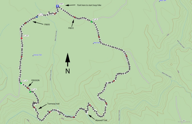
To get to the trailhead: from the Phoenix area, take HWY-87 North toward Payson. Go through the towns of Payson, Pine, and Strawberry while staying on HWY-87. About fifteen miles after Strawberry, take Lake Mary Road (also known as FH-3) North past Clint's Well and towards Happy Jack. Ten miles after passing Clint's Well, take FR81 West (signed for West Clear creek). On FR81, drive 3.1 miles to a fork. Turn left at this fork marked for the Tramway trail onto FR81E. Go 1.1 miles and stay right at the fork marked 'trail' (FR81E). Go 1.1 more miles and stay left at the fork (FR81E). After 0.5 miles, stay left at the fork (FR81E). After another 0.7 miles, there is a fork with the left signed for "Maxwell Trail". This is the junction between FR81E and FR693. Park here to start the loop.
High clearance vehicles are recommended for this road, as it is quite rutted.
Hike details
Season
- June
- July
- August
- January
- February
- December
Solitude
Difficulty
Permits
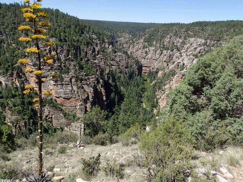
Loop hike through West Clear Creek on the Mogollon Rim in Arizona.
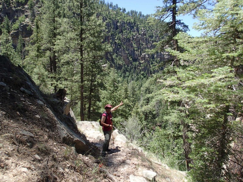
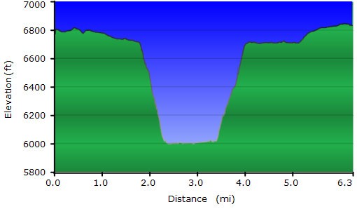
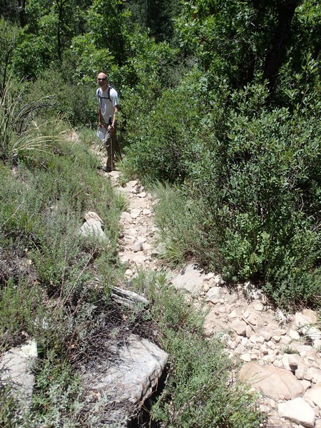
From the parking area, start on the right fork which is FR693. There was a sign for this but it had fallen over. Walking along this flat, forested road is a nice warm up to the fun ahead. After 0.4miles of hiking, stay right at the fork (JCT_1R on the map). After 0.8 miles of total hiking, go straight at the intersection (JCT_2ST on the map). After 1.3 miles of total hiking, stay left at the fork (JCT_3L on the map). Finally, 1.5 miles from the car, stay left at this fork signed for FR9293N. It's another 0.2 miles to the signed trailhead for the Tramway trail. This trail is steep as it drops into West Clear creek and there is some scrambling involved, but nothing too scary. The views of the canyon are impressive. From the top of the rim to the bottom is 0.7 miles and about 750 ft of elevation loss. At the bottom you'll end up at West Clear creek. Turn left here (heading upstream).
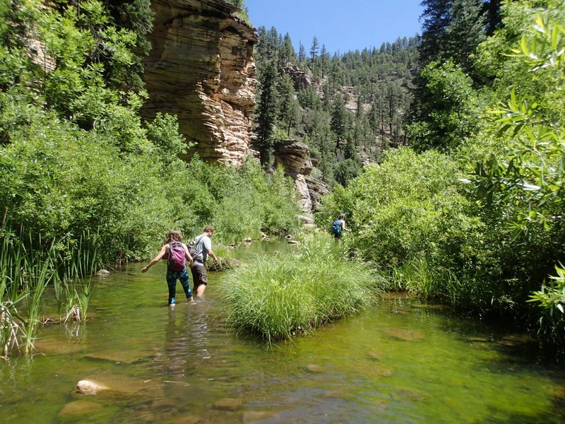
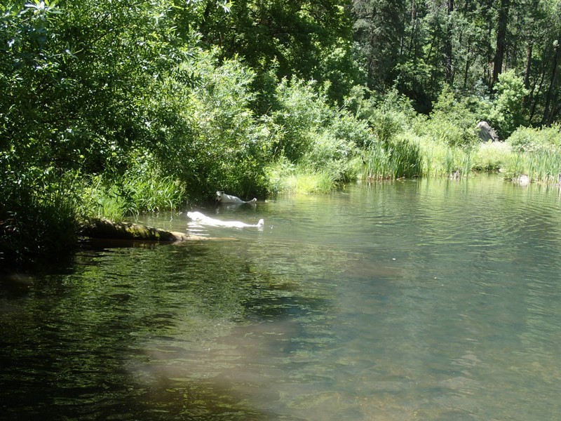
While making your way upstream, sometimes you'll be walking on a faint trail. Other times you'll be bushwhacking. Still other times the easiest progress is walking in the creek, which can sometimes be as deep as your waist. It is slow going, but very enjoyable and the water keeps you from getting too hot during the summer. Long pants (for the bushwhacking) and a hiking stick (for walking in the creek) are very helpful in this section.
You'll enjoy walking along the bottom of West Clear creek for about 0.8 miles before you see the Maxwell trail wind up the pine trees on your left. It would not be difficult to walk by this trail, so keep a sharp eye out for the trail as you walk upstream. Luckily, there will most likely be some other people at this point that hiked down the Maxwell Trail that can point you in the right direction. After walking up 0.6 miles and 700 ft on the Maxwell Trail, you arrive at the Maxwell Trail road (FR81E). 2.1 miles of hiking along this flat road (after 1.6 miles, stay left at JCT_5L on the map) will take you back to where you parked your car.
