
- Hikes in Arizona
- Phoenix Area and Central Arizona
- Lower Soldier Camp Trail
Lower Soldier Camp Trail
Location
To get to the trailhead: from the Phoenix/Mesa area, take HWY-87 about 21 miles from Mesa (15 miles North of Shea Blvd) until you reach the signed Four Peaks Road (FR143) turnoff on the right. This road is good graded dirt, OK for high clearance vehicles. Take the Four Peaks Road for 2.1 miles and turn right onto FR401. Take this good dirt road 4.3 miles to Cottonwood camp and park anywhere. Cottonwood camp is in a wide desert wash (Cottonwood Creek), with a corral and a large water tank.
Hike details
Season
- January
- February
- March
- November
- December
- June
- July
- August
Solitude
Difficulty
Permits
Hiking the Lower Soldier Camp trail near the Four Peaks wilderness in Arizona.
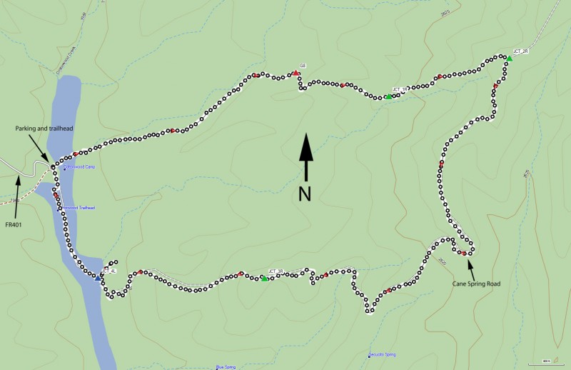
The start of this hike is Cottonwood Camp. This area is popular with both the off-road folks and the target shooting folks, so be prepared to share this area. Thankfully, once you get on the trail, you'll leave them behind.
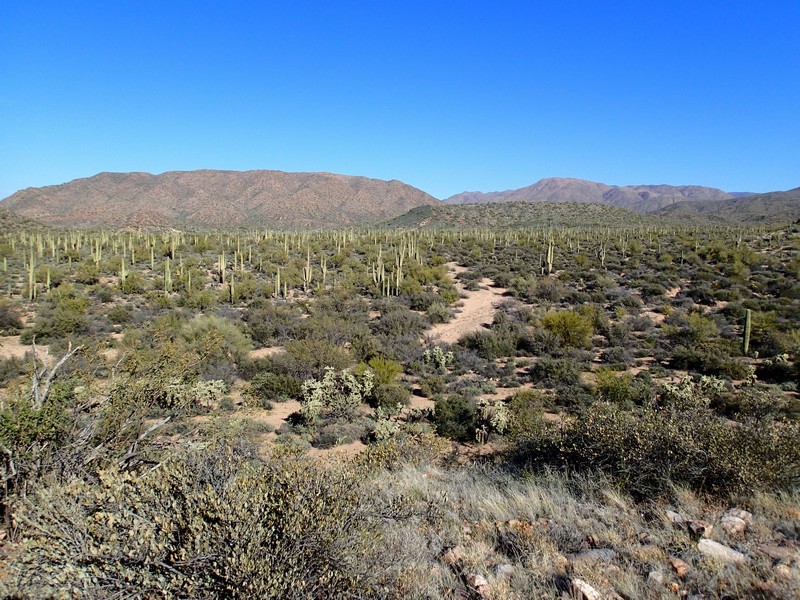
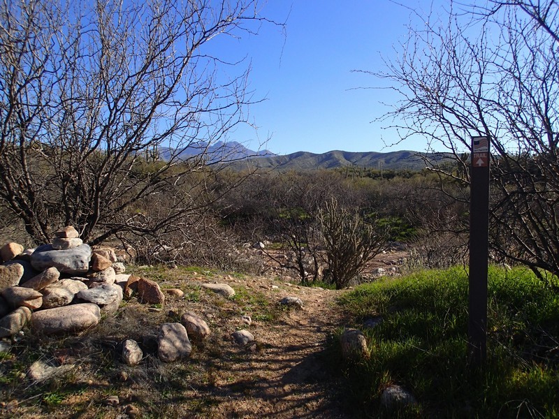
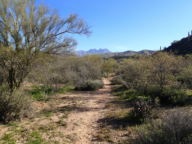
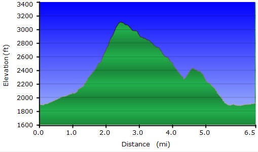
From Cottonwood Camp, look for the stone water tank. Lower Soldier Camp trail starts to the left of this tank and is signed by the brown trail markers (#84). The trail is pretty flat and stays near a desert wash for the first mile of the hike. The trail can be difficult to follow in this section, so keep an eye out for the plentiful cairns. This section of the trail is also overgrown in sections, so long pants are preferred. After about a mile of hiking along the right side of the wash, the trail starts climbing up the side of a ridge. You'll go through a break in the barbed wire fence (G8 on the Map) as the trail becomes easier to follow but steeper in elevation. The trail widens into a very rough old road as it climbs.
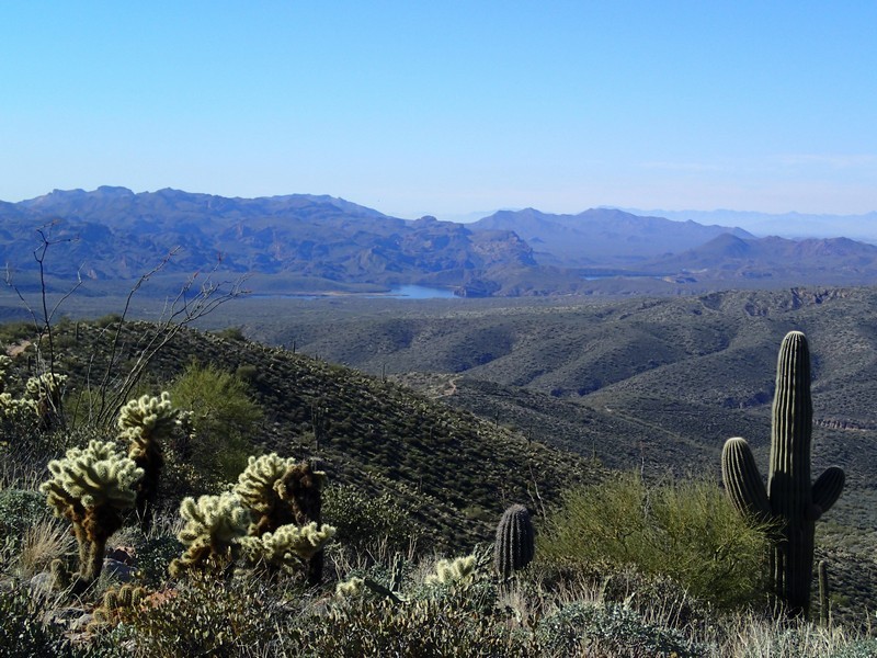
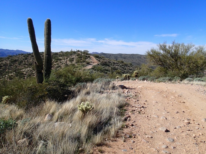
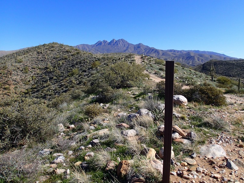
After 1.7 miles of hiking, the trail splits, with the left fork heading back down. Stay right here (JCT_1R on the map) and continue climbing. Look around to enjoy views of the Four Peaks to the North. After 2.2 miles of hiking and about 1200 ft of climbing, you'll reach Cane springs road (JCT_2R on the map), also listed as FR401. From this point you'll get great views all around of the Four Peaks Wilderness, including Saguaro Lake to the South. Turn right at this road and walk along the rough jeep road. You should have this road mostly to yourself, as the road is rough enough that most folks can't drive on it.
This road stays on a scenic ridge line as it gradually descends back to Cottonwood wash. After 4.5 miles, the road splits. Stay right here (JCT_3R on the map). After 5.4 miles of hiking, you'll get to the bottom of Cottonwood wash. There are multiple roads here. Stay in the wash (JCT_4L on the map) and continue to walk along this dirt road for another 0.5 miles to get back to your car.
