
- Hikes in Arizona
- Grand Canyon / Marble Canyon
- Grandview Trail to South Kaibab Trail (via Tonto Trail)
Grandview Trail to South Kaibab Trail (via Tonto Trail)

Location
For the Grandview Trailhead: From Flagstaff, take HWY 180 north towards the Grand Canyon. Once you enter the park, you'll head east on the East Rim Drive (Yaki point turnoff). About 9 miles on the East Rim Drive will get you to the Grandview Point. The parking area is a little less than a mile drive away. There are restrooms here, but no water.
For the South Kaibab Trailhead: From Flagstaff, take HWY 180 north towards the Grand Canyon. Once you enter the park, you'll head east on the East Rim Drive (Yaki point turnoff). The trailhead is closed to parking, so you'll either need a parking pass (you received one with your permit) or you need to take the free shuttle bus from multiple points in the Grand Canyon village to get to the trailhead. There are pit toilets, but no water at the trailhead.
Hike details
Season
- March
- October
- June
- July
- August
Solitude
Difficulty
Permits
SPECIAL CONSIDERATIONS FOR WINTER AND SUMMER TIMES:
, For Winter Hiking: Remember that the South Rim is damned cold in the winter. Snow and Ice will cover the trail for the first few miles. Crampons recommended.
, For Summer Hiking: Get an early start and don't hike during the heat of the day. Remember that the bottom of the canyon will be MUCH hotter than the top.
Hike and backpack the Tonto trail from Grandview point to the South Kaibab trail in Grand Canyon national park, Arizona.
The Tonto trail stretches some 70 miles along the Tonto plateau in Grand Canyon. As one of the few trails that doesn't reach the rim of the canyon, access to the Tonto trail is typically a backpacking adventure. Many sections of the Tonto are remote, allowing for rare Grand Canyon hiking solitude and a true wilderness backpacking experience. One great backpacking adventure along the Tonto trail is the section from Grandview trail to the South Kaibab trail. This is not a trivial endevour. You need to be very comfortable with Grand Canyon hiking, backpacking, route finding, and water management to safely complete this trek. Be sure to check with the Back Country office before starting out to see what the water report is on the Tonto plateau so you can plan accordingly. Also, be sure to being enough containers to carry two gallons of water, since your camp on night three will be dry.
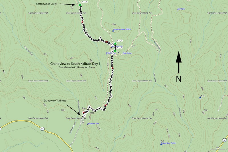
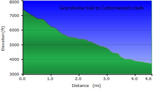
Day one: Grandview Trail to Cottonwood Creek (4.6 miles, 3700 ft elevation loss) - Back country use area BG9
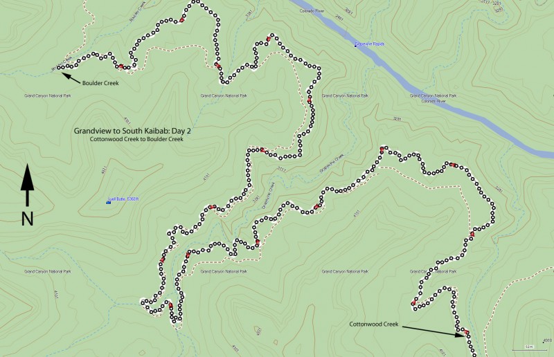
Day two: Cottonwood Creek to Boulder Creek (10.7 miles) - Back country use area BH9
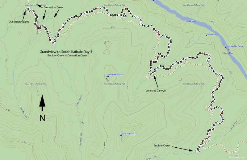
Day three: Boulder Creek to Cremation Creek (9.6 miles) - Back country use area BJ9
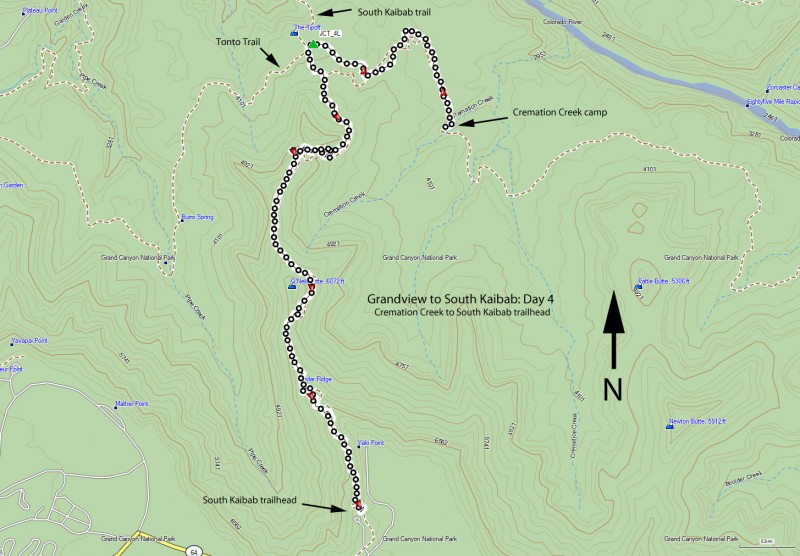
Day four: Cremation Creek to South Kaibab trailhead (5.9 miles, 3600 ft elevation gain)
The adventure starts at the Grandview trail (make sure you drop a vehicle at the South Kaibab trailhead or make other shuttle arrangements, as the free South Rim shuttle doesn't go all the way out to Grandview point). There are restrooms at the Grandview trailhead, but no water.
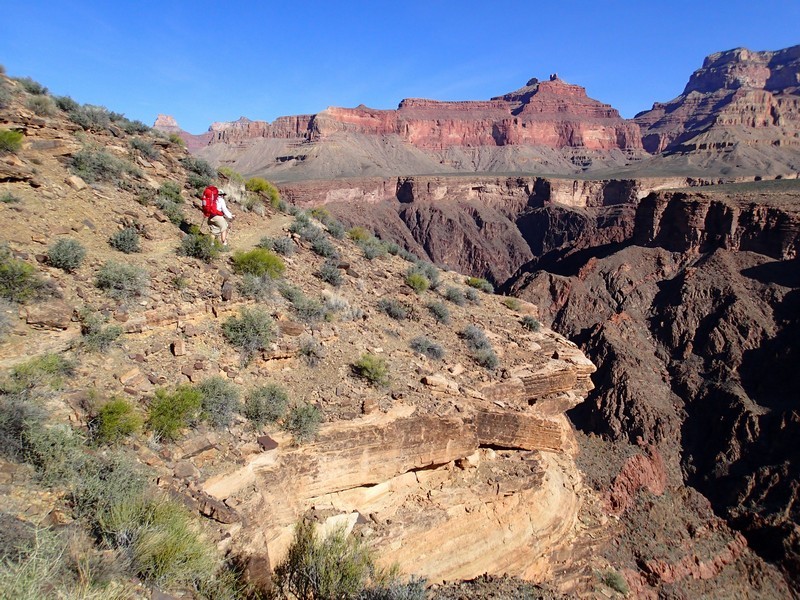
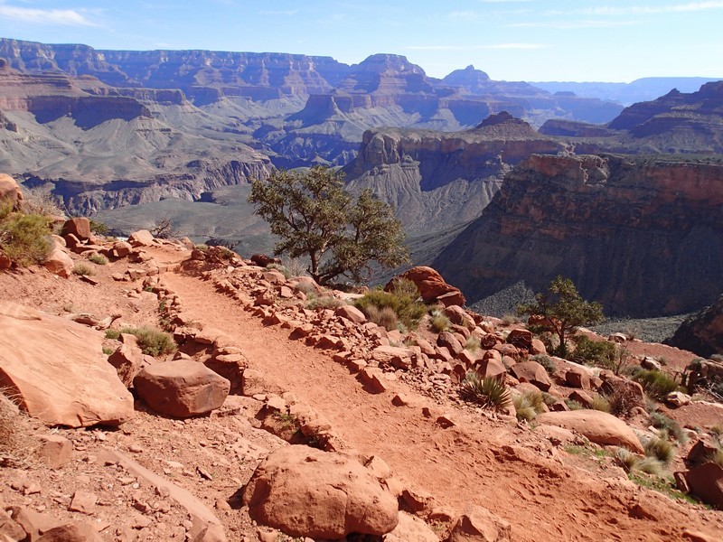
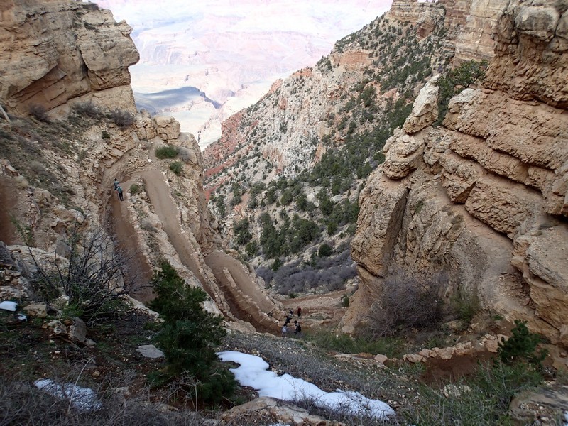
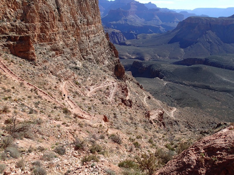
From the Grandview trail parking area, follow the well worn trail down into Grand Canyon. As are most trails from the South rim, this trail is steep most of the way. This trail was reconstructed by an old miner in 1892 from a Native American route.
As you walk down the trail, there are a few spots that are a tight squeeze with a full pack. It's also interesting when you realize there are parts of the trail that are held up by juniper logs that have been there for over a hundred years. whew!
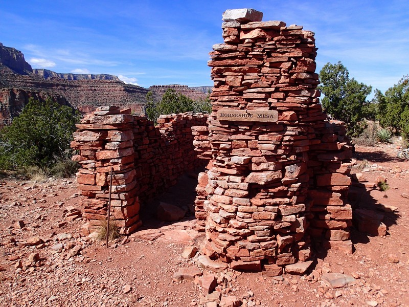
Eventually, you will cross a saddle and close in on Horseshoe Mesa after 3.2 miles of hiking. Just before Horseshoe Mesa, you'll reach a junction with the trail to miner's spring (JCT_1L on the map). Stay left at this signed junction. Not long after that, you'll reach the junction with the Tonto trail (JCT_2L on the map). Before turning left here to continue your hike to Cottonwood creek, check out the ruins of Pete Berry's cabin. He's the guy that rebuilt the trail. Be sure to thank Pete and leave his ruins alone for other hikers to enjoy. There's also some mining implements scattered around rusting. Leave these be as well. There is a toilet nearby, but no water.
Continue back West along the Tonto trail. This section of trail drops quite steeply into Cottonwood Creek (JCT_3L on the map). Watch your footing here and keep an eye out for cairns to stay on the trail. Cottonwood creek is your first night camp and is a reliable source of water. There are a number of scenic campsites along this creek and it makes an excellent place to spend your first night of camp.
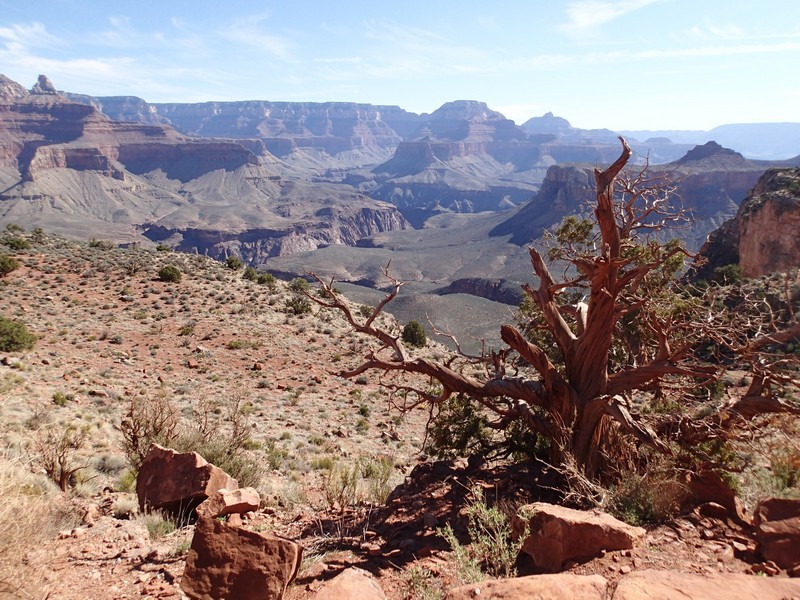
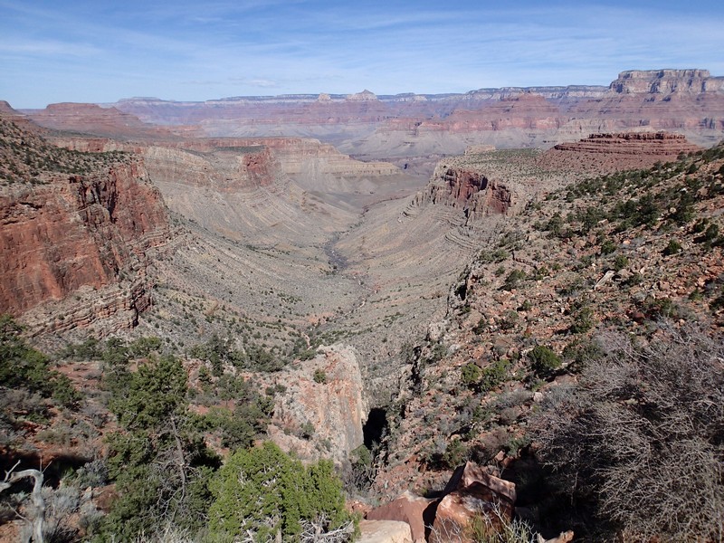
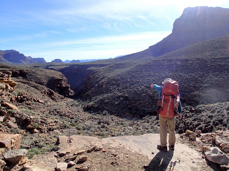
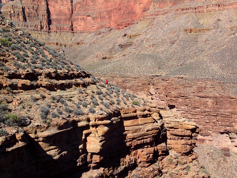
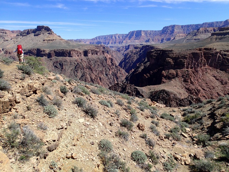
The next day starts out with a short climb out of the Cottonwood Creek drainage. The Tonto trail is well worn and easy to follow as it heads towards the huge Grapevine creek drainage. Although you'll be able to see your destination on the other side of Grapevine creek, the path to get there requires a long detour around the drainage. The trail gets quite close to the edge, making for some dramatic and exposed hiking. After about 5.0 miles of hiking, you'll reach Grapevine creek. This is another good source of water and depending on the water availability at Boulder creek, you may need to carry water from here.
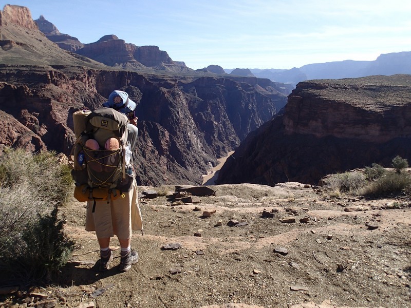
When we did this hike in March, there was water at Boulder creek, so thankfully we didn't need to carry extra water to dry camp. The Tonto trail continues from Grapevine creek around the North Western edge of the canyon. You'll enjoy similarly dramatic views that are not as exposed as before. After leaving Grapevine creek canyon, the Tonto trail follows along the contour of the inner gorge of the Grand Canyon. The Colorado river will peak out and you'll enjoy great views of the inner gorge as you continue towards Boulder Creek canyon. After hiking 3.5 miles from Grapevine creek, you'll reach an unnamed dry wash. Don't mistake this for Boulder Creek. Continue another 2.2 miles (5.7 miles from Grapevine creek) to Boulder Creek. Water is a little more difficult to find in Boulder Creek, but in the fall and spring, if you hike up canyon a bit, you can usually find water. There are some very lovely campsites in this lush area.
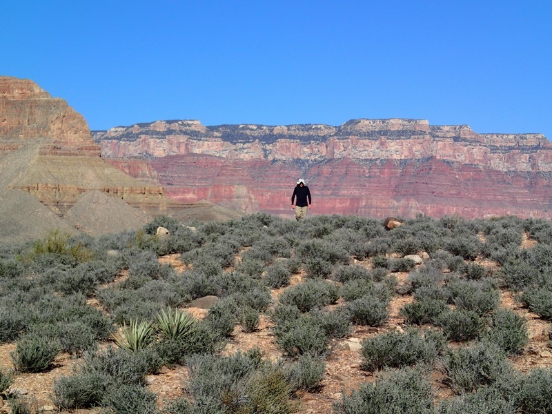
Day three brings more scenic flat hiking along the Tonto plateau. From Boulder Creek to Lonetree canyon is about three miles. This is the last somewhat reliable source of water for the remainder of your trip, so you'll need to carry enough water for the duration of your adventure. When we did this hike in March, there was plenty of water in Lonetree canyon and we each carried about two gallons of water per person.
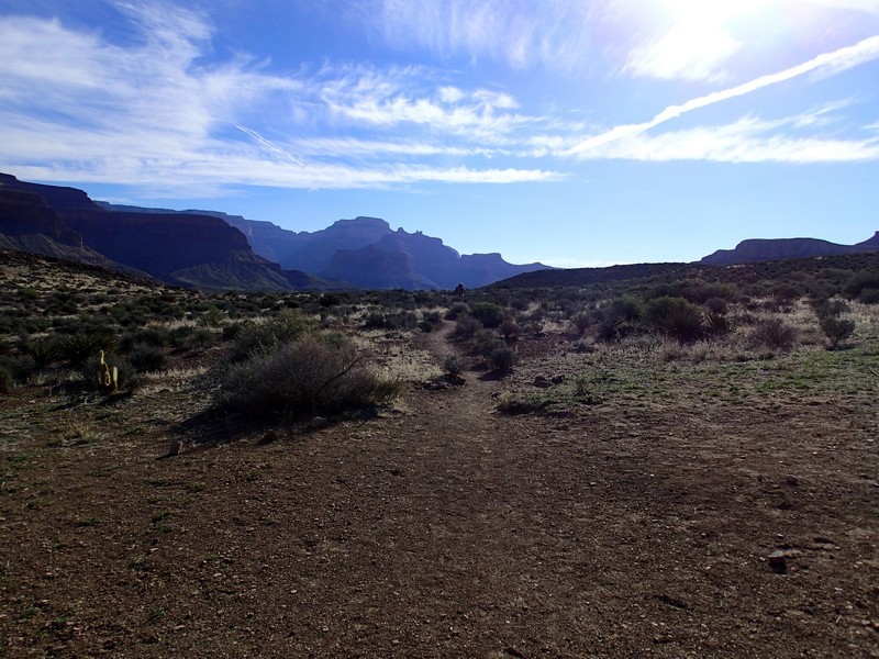
From Lonetree canyon the trail is mostly flat, thankfully, since you're carrying all that extra water weight. After about 2.7 miles of hiking from Lonetree canyon, you'll reach the first fork of Cremation creek. The trail drops steeply into the creek bed and can be difficult to follow, so watch for cairns. You'll climb out of the first fork and another 0.4 miles gets you to the second fork of Cremation creek, again descending deeply. Climb out of the second fork yet again and go another 0.4 miles as you descend into the third fork of Cremation creek. This section of the trail for both the climb and the decent are not easy to follow, so again, keep your eye out for cairns. To reach your campsite on day three, you'll have hiked about 3.9 miles from Lonetree canyon. You are now right at the edge of the day use area and this is the last point you can camp before hiking out. There are several nice camps in this area.
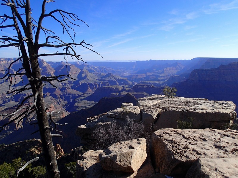
Day four is the long but scenic climb out. From your campsite, it's 1.4 miles to the Tip Off. There are restrooms here, but no water. The solitude you've enjoyed for the past few days will also disappear, as you are now hiking in the main corridor and the South Kaibab is a popular trail. Turn left at the signed junction for the South Kaibab trail (JCT_4L on the map) and start the long, steady climb out of the canyon. With a backpack, this is a tough slog. To lift your spirits, be sure to stop and look around at the increasingly spectacular views of the Grand Canyon. From the Tip off, you'll hike about one mile up steep switchbacks to Skeleton point. Thankfully, the elevation lets up a little for the next 0.5 miles but gets steep again for 0.3 miles after that. About 2.4 miles from the Tip Off, you'll reach Cedar ridge. There is a bathroom here, but no water. While it's only 1.4 miles to the rim from here, it is also 1000 feet of climbing still left. You'll likely have lots of company in other hikers during this section, as hiking from the rim to Cedar ridge is a popular day hike. After 5.9 miles of hiking and 3600 feet of climbing from your morning camp at Cremation creek, you'll finally reach the South Rim of the Grand Canyon. Congratulations!
