
- Hikes in Arizona
- Prescott Area
- Mount Union (via Dandrea trail#285 and Yankee Doodle Trail#284)
Mount Union (via Dandrea trail#285 and Yankee Doodle Trail#284)
Location
To get to the trail head: from the Phoenix area, take I-17 North toward Flagstaff. At Cordes Junction, take HWY-69 towards Prescott. Just after leaving Prescott Valley, you'll turn left onto Walker Road (near the Costco). Take this road 10.5 miles where it meets the junction with Poacher's Row road. Walker road starts out paved and stays that way for the majority of the time. However, it does change to well graded dirt. There were passenger cars on this road, but I felt more comfortable with a medium clearance vehicle. You'll go through a residential area, so please keep a low profile so we can continue to have access to this trailhead. At the signed intersection with Poacher's Row road, turn left and drive 0.4 miles to the end of the road and the start of TR#285. There isn't much parking here, so you may need to backtrack to Walker road to park. Please don't block any of the roads when you park.
Hike details
Season
- May
- June
- August
- January
- February
- December
Solitude
Difficulty
Permits
Hike up Mount Union via the Dandrea trail and the Yankee Doodle trail near Prescott, Arizona.
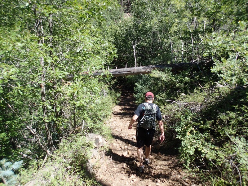
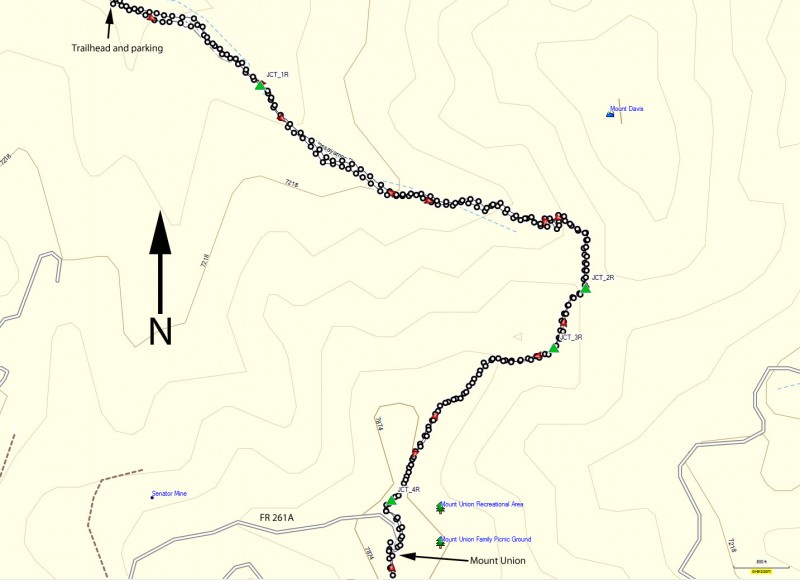
The parking area is right next to a junction of a few roads as well as the Hassayampa river headwaters, which was running when we did this hike. The start of this hike requires a bit of routefinding, so pay close attention at the beginning. Look for the brown 285 sign that marks the Dandrea trail you need to follow (it's the one on the right). Hike on this rocky road and very quickly, the road forks again. Stay left here. Then after 0.2 miles of hiking, the road forks yet again (JCT_1R on the map). Stay right here and then you can relax those routefinding skills for a while.
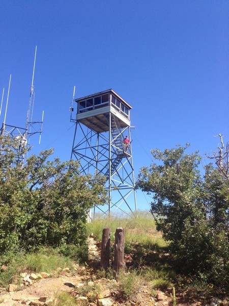
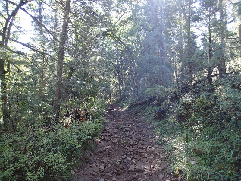
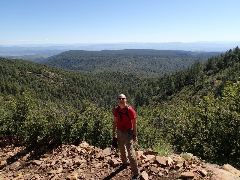
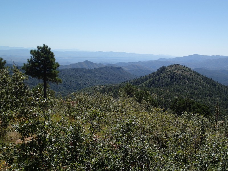
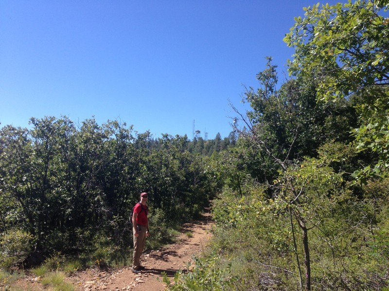
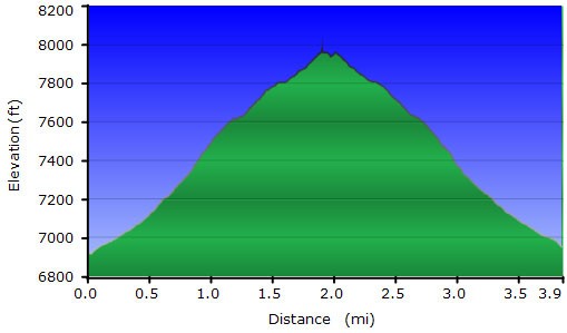
This section of the trail is well shaded by the surrounding pine trees as it heads generally South-East along the Hassayampa river. The trail is easy to follow and climbs steadily, but not too steeply. ATVs also use this trail, although considering how rocky it is, I'm guessing not many ATV folks try it. After about 1.1 miles of hiking, you reach a clearing and the signed junction with the Yankee Doodle Trail #284 (JCT_2R on the map). Turn right here and continue to follow the now narrower trail. This section of the trail is more open, so you'll get some good views of the surrounding area as you hike towards the fire lookout tower on top of Mount Union. After a short 0.1 miles of hiking along this new trail, you'll stay right at an unsigned trail junction (JCT_3R on the map). Another 0.8 miles of hiking (1.9 miles from the start) trail #284 turns left while a less clear spur trail stays straight (JCT_4R) on the map. By going right here at this short cut, you quickly reach FR261A. Turn left at the road and walk the short distance to the fire lookout and the 360 views from the top of the Bradshaw mountain range.
If the person manning the fire lookout tower is in residence, they may invite you up, but if not, you'll have to be satisfied with climbing up a little ways on the tower. You'll get clear views of Granite mountain to the North West and the Mazatzal range to the East. There's also a very nice deck on the South end of this area that makes a perfect spot for lunch.
When ready, return the way you came.
