
- Hikes in Arizona
- White Mountains and Eastern Arizona
- West fork Little Colorado River
West fork Little Colorado River
Location
To the Upper Trailhead: From the Phoenix area, take HWY-60 to Globe, turning north to Show Low. From Show Low, take HWY-260 east passing through Pinetop-Lakeside. Continue on HWY-260, turning right onto HWY-273. Drive 8.6 miles to the sign marking the Baldy Wilderness Trailhead. Turn right here and go the final 0.2 miles to the trailhead parking. There is a restroom here but no water.
To the Lower Trailhead: From the Phoenix area, take HWY-60 to Globe, turning north to Show Low. From Show Low, take HWY-260 east passing through Pinetop-Lakeside. Continue on HWY-260, turning right onto HWY-373 towards Greer. Take this paved road 4.8 miles and turn right onto the signed road for Osborne Road (just after crossing the bridge over the Little Colorado). Take this well graded dirt road 0.25 miles and park near the signed trailhead on the left side of the road. There is limited parking at this trailhead, so make sure you are completely off the road. This trailhead is in a neighborhood, so please keep a low profile and be respectful to home owners so we can continue to have access to this trailhead.
Hike details
- Water
- Wild Animals
Season
- June
- July
- August
- September
- January
- February
- December
Solitude
Difficulty
Permits
Hike along the West Fork trail on the Little Colorado River in Eastern Arizona.
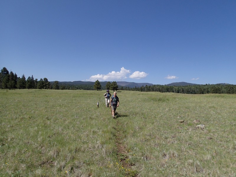
The Mount Baldy wilderness is an excellent summer destination for those of us trying to escape the desert heat. The extra drive to this area reduces the crowds significantly and the elevation rewards the added drive time. One of the more popular hikes in this area is the trail along the West Fork of the Little Colorado river to the (almost) peak of Mount Baldy. Most folks head up to Mount Baldy, but apparently, few of the hikers know you can hike the opposite direction for a peaceful walk through the forest along wide open meadows.
Before starting this one way hike, make sure you've parked your second vehicle at the lower trailhead, otherwise count on hiking twice as far!
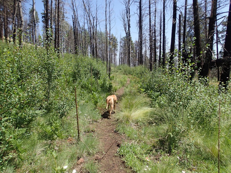
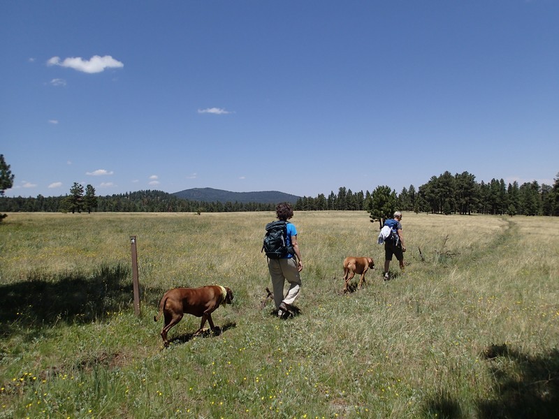
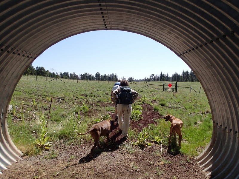
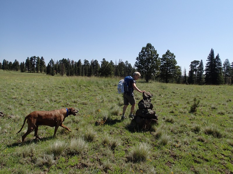
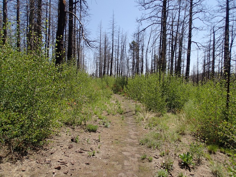
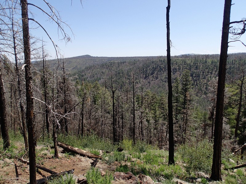
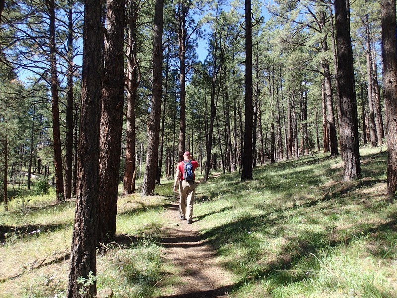
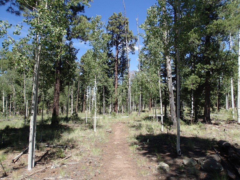
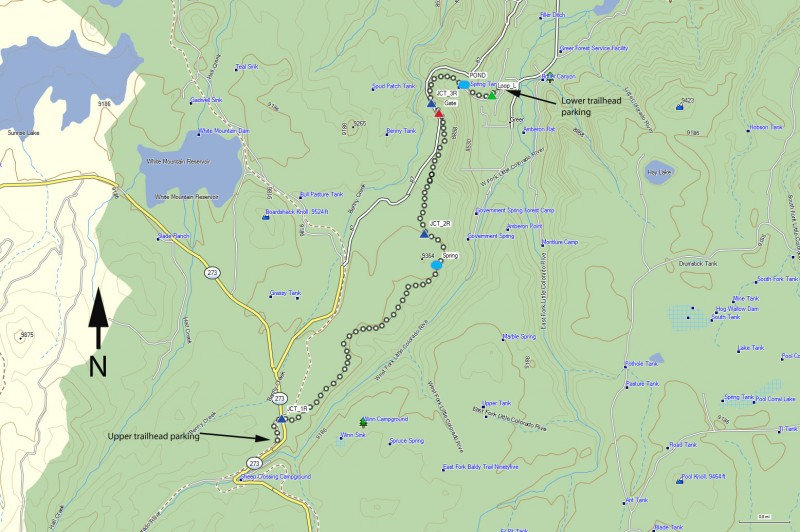
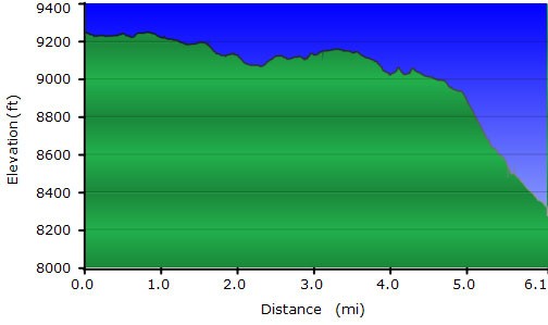
From the upper trailhead parking area, start walking along the road back towards HWY-263. The trail crosses this spur road. Head left on this trail, where you'll quickly walk through a break in the fence across a cattle guard. Cross through another gate and walk through the tunnel under HWY-263. You'll make a right here (JCT 1R on the map), leaving the cinder trail behind and following some rock cairns and hiking markers across a meadow. The route finding can be a bit tricky here so keep your eyes open. Soon you'll leave the meadow and begin walking through the forest on an easily followed trail. Some of this area was burned by the Wallow fire of 2011, but it is recovering nicely. In a few years, this trail will be spectacular as the Aspen recover fully. The trail stays on the West bank of the large canyon containing the West fork of the Little Colorado. Once in a while, the views of this canyon open up to you.
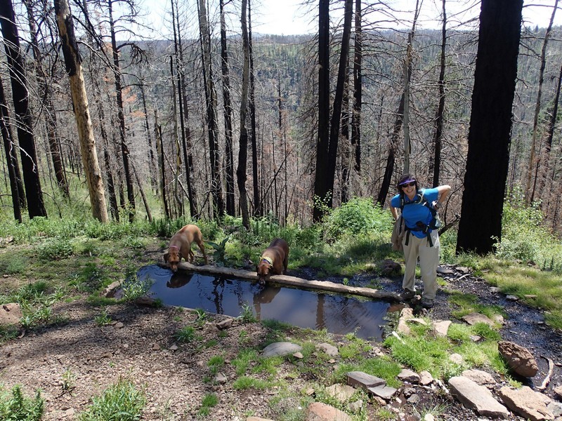
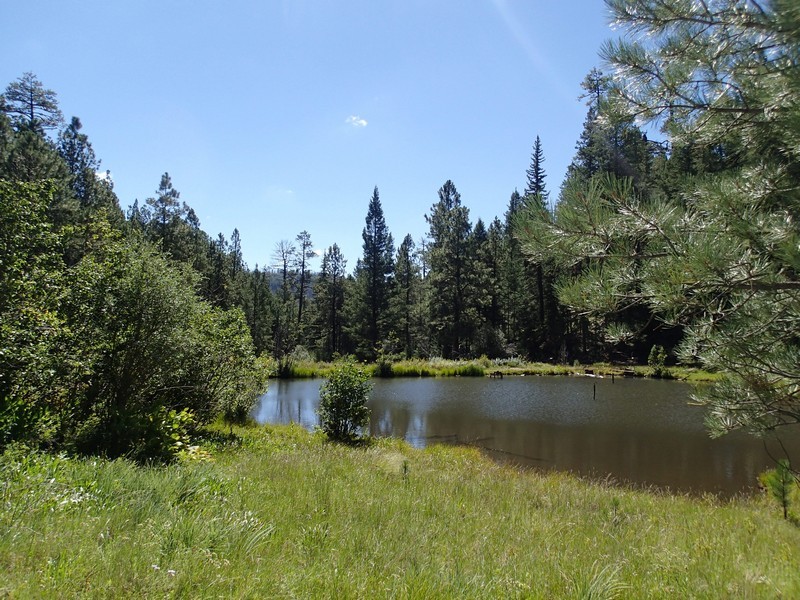
After 2.8 miles of hiking, you'll reach Potatoe Hollow Spring. There is a concrete trough here, filled by the spring water gushing from the nearby rock. After 3.2 miles of hiking, you'll reach a T intersection with a dirt road closed to vehicles (JCT 2R on the map) Turn right here and continue hiking. The trail starts to get near FR87 and you may see vehicles off to your left. Continue along the trail which is sandwiched between FR87 on your left and the West Fork of the Little Colorado on your right. 1.2 miles from the previous trail junction is a gate (GATE on the map). Go through this gate (please close it behind you) and continue another 0.1 miles to the next unsigned trail junction (JCT 3R on the map). Turn right here. From here the trail starts to descend rather steadily, but not too steeply. After hiking another 0.6 miles from the previous trail junction, you'll reach a stock pond. This location is rather scenic and worth a bit of exploring. From the pond, there are two routes you can take to the lower trailhead, both following a running creek. There are clear trails on both the left side and right side of the creek which meet up at the LOOP_L on the map. From the pond, it is a quick and lovely walk of 0.4 miles to the end of the trail and your shuttle vehicle.
The fastest way to get back to your vehicle at the upper trailhead is via FR87. Take 373 North back away from Greer and turn left at the well graded dirt road FR87 (signed for Big Lake). FR87 will get you back to HWY-273. Turn left and head back to the upper trailhead on your right.
From our experience, this is a good trail for wildlife spotting. We saw a mule deer, a group of wild turkeys, and a golden eagle.
