
- Hikes in Arizona
- White Mountains and Eastern Arizona
- Juniper Ridge Trail #640
Juniper Ridge Trail #640
Location
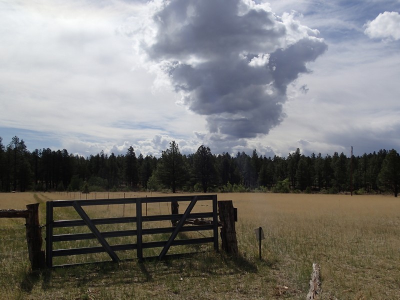
To the Trailhead: From the Show Low area, head on HWY-260 West. After you pass the town of Linden and before you reach the town of Pinedale, turn left onto Farnsworth Ranch Road. Take this well graded dirt road 2.4 miles to the signed trailhead and parking on the left.
Hike details
Season
- April
- May
- June
- October
- January
- December
Solitude
Difficulty
Permits
Hike along the Juniper Ridge Trail in Eastern Arizona.
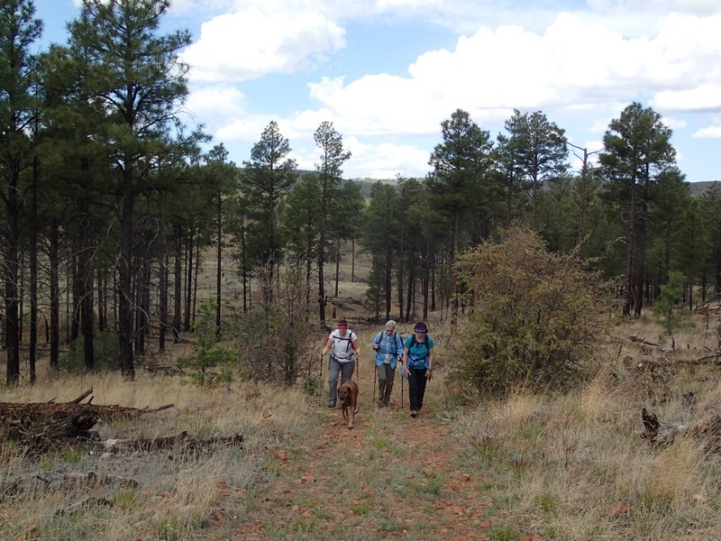
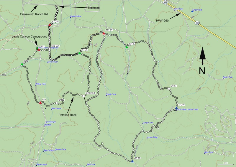
At the trailhead, take a look at the nearby map on the signpost. The first decision you have to make is to take a long loop, a short loop, or a combination of the two. As you can see from the map, there are multiple possibilities based on how long you want to hike and what you want to see. Keep in mind, whichever loop you decide on will require some route finding, so have a map with you and remain aware. There are blue diamonds on the trail to keep you on it. Make sure you look for these, as there are a number of side trails and old roads that can lead you astray.
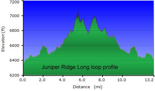
LONG LOOP
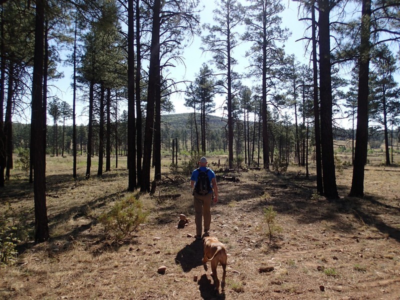
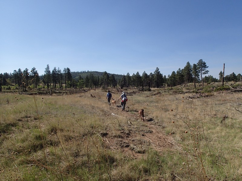
To take one of the long loops, head along the easy to follow trail leading from the parking area. This area alternates between ponderosa pine and meadows of oak. After 0.3 miles, you'll cross a dirt road (JCT_1ST on the map). This is a good example of the route finding challenges along these trails, as you'll need to look for the blue diamonds marking the trail on the other side of this road to stay on the path. After 0.9 miles of total hiking, you'll reach a junction. If you look carefully, there is a sign saying that the trail to the right leads to the Lewis Canyon Group site. If you were to turn right here, you would be on the short loop. So we'll stay left here (Loop_JCT on the map). Keep an eye out for the blue diamonds as the trail shifts East. After about 1.5 miles of hiking, you'll reach the signed junction marking the shortcut (JCT_2L on the map). To stay on the long loop, stay left here. After 2.5 miles of hiking, you'll cross a road (RD1_ST). Head straight across the road to stay on the trail. The next road crossing is at 3.1 miles of hiking. You'll stay left at the unsigned junction that can be a bit tricky to navigate (JCT_3L on the map). From here to the look out tower, there are a number of roads (some of which you'll walk along for a while) and spur trails, but as long as you find and follow those blue diamonds, you'll stay on the trail.
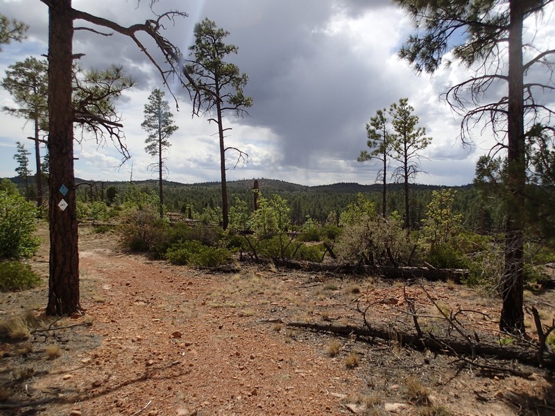
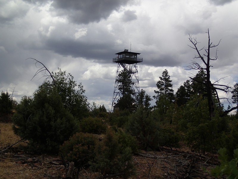
After about 5 miles of total hiking, you'll reach the junction with the lookout connector trail (JCT_4R) and the easily spotted Lookout tower. This fire lookout tower is staffed in the summer months and currently allows hikers to climb to the top for views of the area. Please be polite to the fire lookout stationed at the top! There is also a very clean bathroom here. After enjoying the views from the top of the tower, get back on trail signed as Juniper Ridge trail (remember: blue diamonds!) and head south west. You'll quickly be walking on a dirt road for a while. It is very easy to zone out and miss the blue diamond signaling where you have to leave the road, so pay particular attention in this area. From the lookout tower, it's about 1.6 miles to the next trail junction (JCT_5R on the map). Stay right here.
After two miles from the previous trail junction, you'll reach the signed turn for the shortcut (SHORTCUT on map). Alternatively, you can do what we did and simply follow this dirt road you've been walking on (FR9809L) back to the previous trail junction RD1_ST and turn left. Either way, you're on your way back (total of 13.5 long miles) to the trailhead parking area.
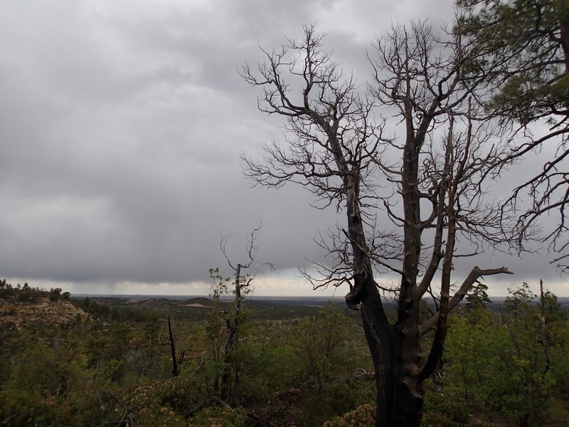
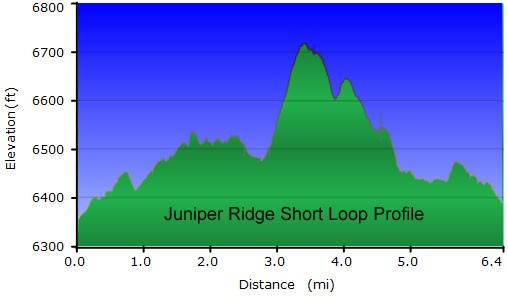
SHORT LOOP
If you're interested in a shorter hike, after 0.9 miles of hiking from the trailhead, turn right at the LOOP_JCT waypoint. After 1.1 miles of hiking, you'll pass through the Lewis Canyon campground. Again, look for those blue diamonds as you head through the campground (RD2 on map). after 1.5 miles of total hiking, you'll reach the signed trail junction with the General Crook Connector trail (JCT6 on the map). Stay left here. This section of the trail saw the worst of the Rodeo-Chediski fire in 2002, but you can see that it is rebounding nicely. After 2.4 miles of hiking, you'll cross a road (RD3 on the map) and the trail starts to climb up Juniper Ridge. As a result of the fire, the views from the ridge are impressive in every direction. Potentially even more interesting than the views are the abundance of petrified forest rocks along this section of trail. The next turn off is important, so pay attention on this stretch. You'll notice that every 0.25 miles or so, the blue diamonds are numbered. Between J14 and J15, you will reach the signed turnoff (CUTOFF on the map) for the shortcut that returns you to the trailhead. Turn left here to head back to the trailhead and parking area. From the cutoff trail junction, it's about a mile of hiking before you reach JCT_2L on the map, where you'll turn left and walk the remaining 1.5 miles back to your car.
