
- Hikes in Arizona
- Phoenix Area and Central Arizona
- Union Peak hike (Phoenix Sonoran Preserve)
Union Peak hike (Phoenix Sonoran Preserve)
Location
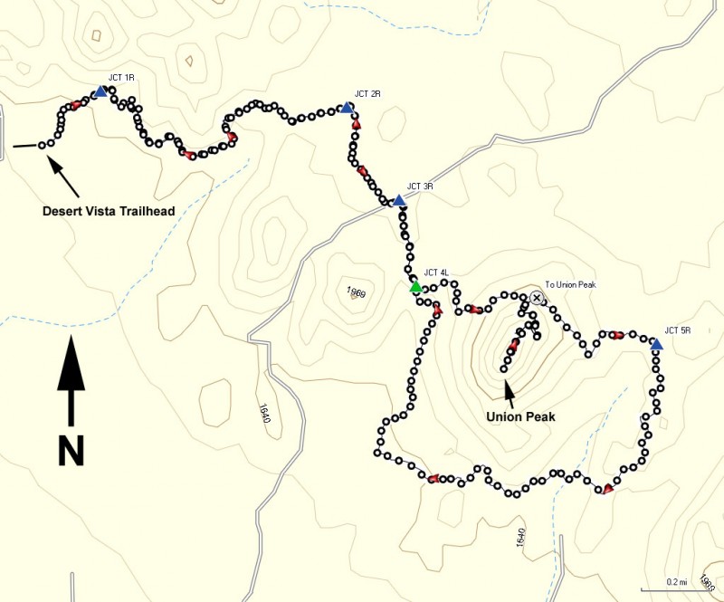
From the Phoenix Area, take I-17 North to the Jomax road exit. Take the exit and turn right onto Jomax road. After 0.3 miles, turn left onto Norterra Parkway. Drive 1.3 miles and turn right onto North Valley Parkway. Go 0.3 miles and turn left onto Copperhead trail. After 0.1 miles, turn left onto Melvern trail. After 0.2 miles, turn right onto Desert Vista trail. After 0.3 miles, you'll see the signs for Desert Vista trailhead and the parking area. There is no water or facilities at this trailhead.
Hike details
Season
- January
- February
- March
- April
- October
- November
- December
Solitude
Difficulty
Permits
Hike up Union Peak in the Phoenix Sonoran Preserve in Phoenix, Arizona.
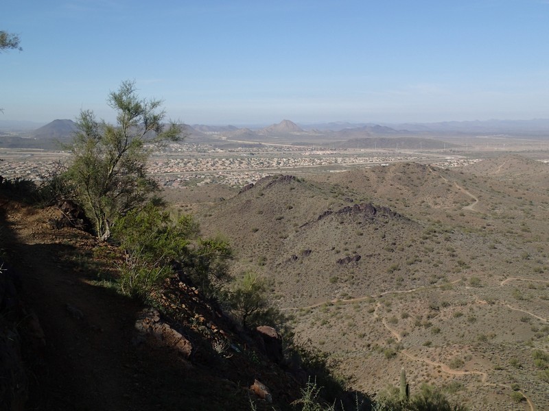
The cities of Phoenix and Scottsdale should be applauded for making a sincere effort to preserve the desert areas within their borders. Scottsdale has done an excellent job with the McDowell Sonoran Preserve and now Phoenix is also doing an excellent job with the Phoenix Sonoran Preserve. The Desert Vista trailhead is a good starting point for hiking access to the southern section of the Phoenix Sonoran Preserve. Although there are numerous trails in the area, we recommend a great hike and climb to the top of Union Peak.
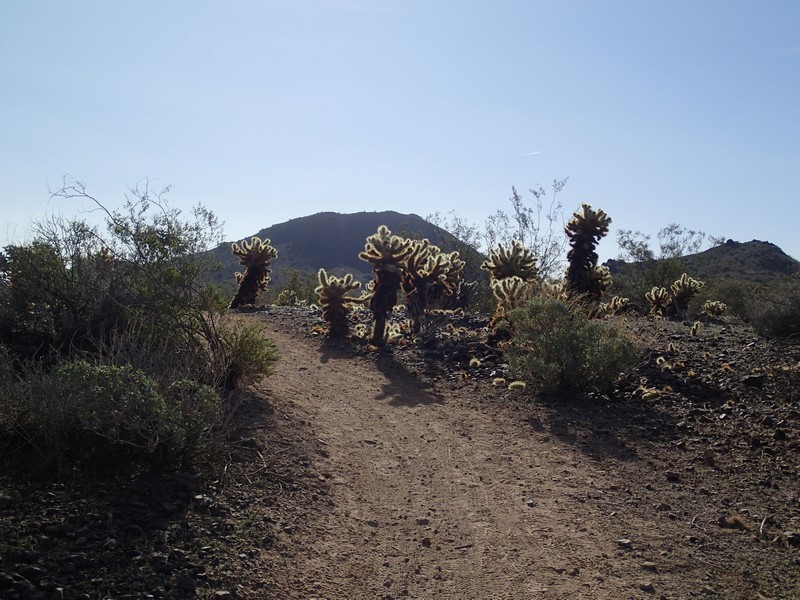
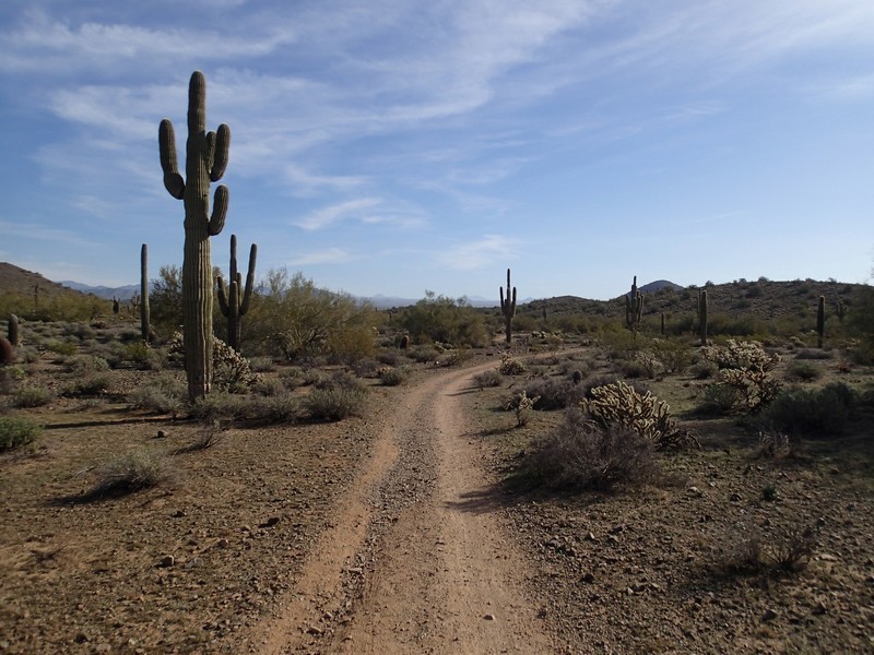
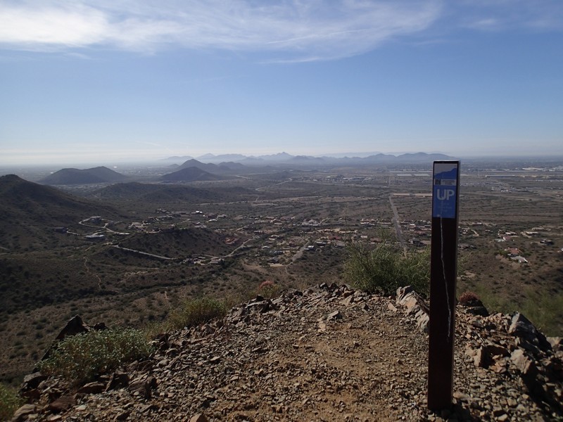
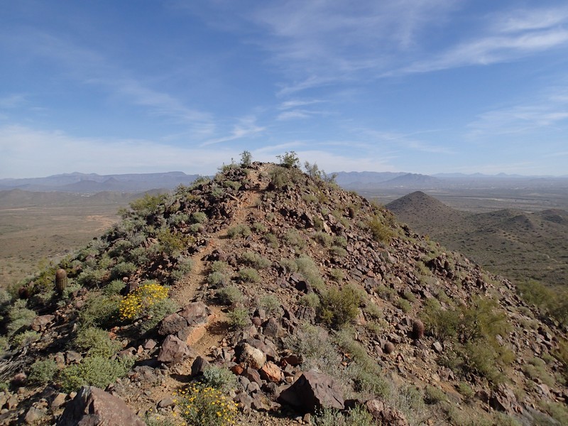
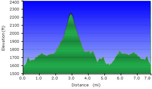
From the parking area, start hiking on the Hawks Nest trail. The trail junctions in this area area all marked, so trail navigation is pretty straight forward. The easy to follow trail heads generally East through Sonoran desert. Saguaro, prickly pear, and barrel cactus abound. After 0.25 miles of hiking, turn right at the junction with the Desert Tortoise trail (JCT 1R on the map). You'll walk an additional 1.1 miles past a few trail junctions leading to the nearby neighborhood and then turn right onto the signed junction for the Valle Verde trail (JCT 2R on the map). Continue through the wide open desert for 0.4 miles and stay right at the junction with the Cactus Wren trail (JCT 3R on the map). From here, you can see Union Peak dead ahead of you. Walk 0.2 miles then turn left at the signed junction with the Horned Owl trail (JCT 4L on the map). The trail will gradually climb and after 0.5 miles, you'll reach the signed junction for the Union Peak summit (To Union Peak on the map). Turn right here and hike the 0.5 miles trail up 550 feet to the top of Union peak.
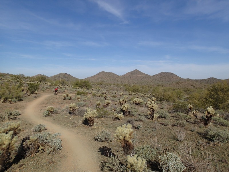
Enjoy the well earned 360 degree views from this prominent summit. After a short break, backtrack 0.5 miles to the Horned Owl trail and turn right at the signed junction (To Union Peak on the map). After 0.5 miles, turn right at the signed trail junction with the Cactus Wren trail (JCT 5R on the map) and continue around the Horned Owl loop in the clockwise direction, circling Union peak. After 2.1 miles of hiking around the mountain, you'll reach the signed junction with the Valle Verde trail again (JCT 4L). Turn left here and start retracing your steps to head back to the parking area. After 0.2 miles, turn left at JCT 3R on the map. After 0.4 miles, turn left at JCT 2R on the map. And finally, after 1.1 miles, turn left at Jct 1R on the map. It's a final 0.25 miles to the trailhead for this total 7.8 mile hike.
Since this is a popular area, it is also enjoyed by mountain bikers and equestrians. Please be polite and move to the side to let these folks pass so we can all continue to share access to this area.
