
- Hikes in Arizona
- Phoenix Area and Central Arizona
- Waterfall trail (White Tanks)
Waterfall trail (White Tanks)
Location
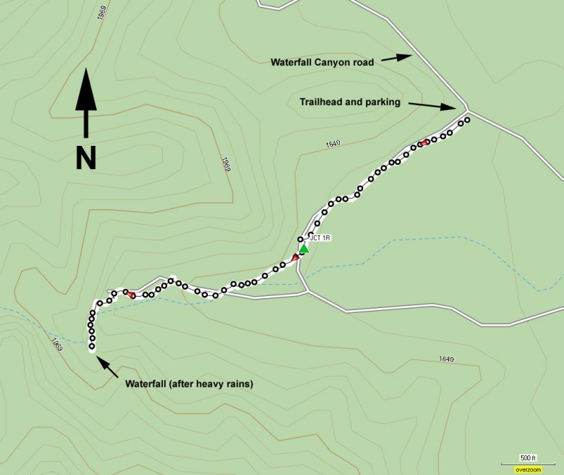
To get to the trailhead: From the Phoenix area, take I-10 West to HWY-303. Take HWY-303 North (Right) to Olive Road. Turn left on Olive Road (West) and go five miles to the White Tank Mountain Regional Park. From the park entrance, follow Mountain Road North to the Waterfall Canyon Rd. Make a left here and park at the signed trailhead for the Waterfall trail on your left. There are restrooms at the trailhead.
Hike details
Season
- January
- February
- March
- November
- December
Solitude
Difficulty
Permits
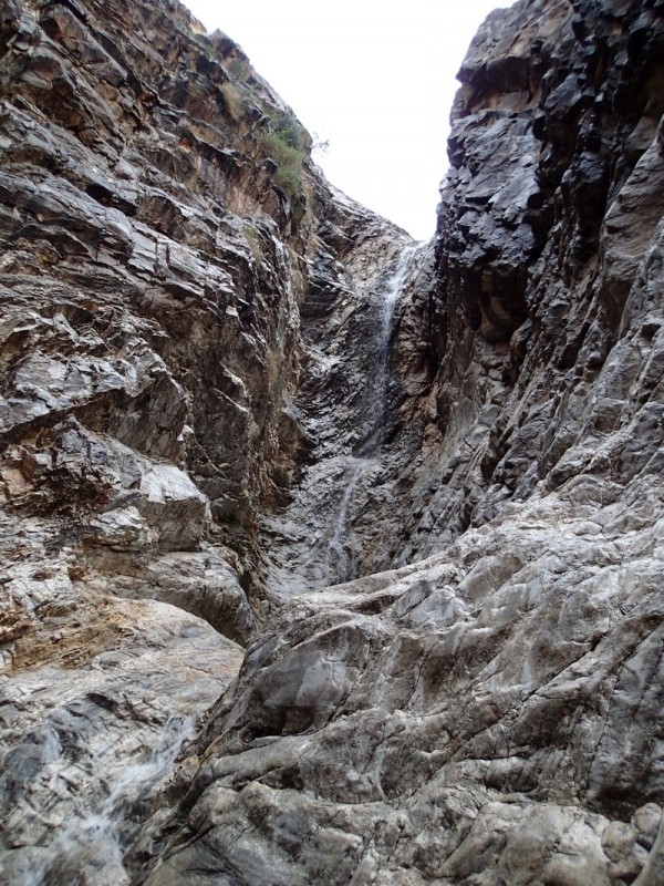
Hike along the Waterfall trail in the White Tanks regional park near Phoenix, Arizona.
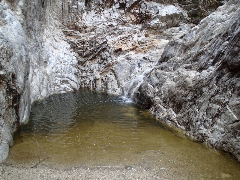
Rain in the desert is a special time. The scent of the Creosote bush in the air, the cooler temperatures, and the greening of the desert, all transform the area into something new. Waterfalls are rare in the Phoenix area due to the desert climate, but in the rare event we get to enjoy the rain, some hidden waterfalls make themselves seen. The Waterfall trail in the White Tanks regional park is one of those seasonal waterfalls that are worth seeking out after a rain.
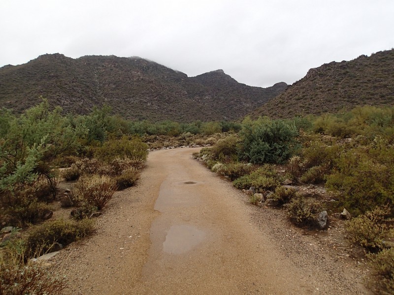
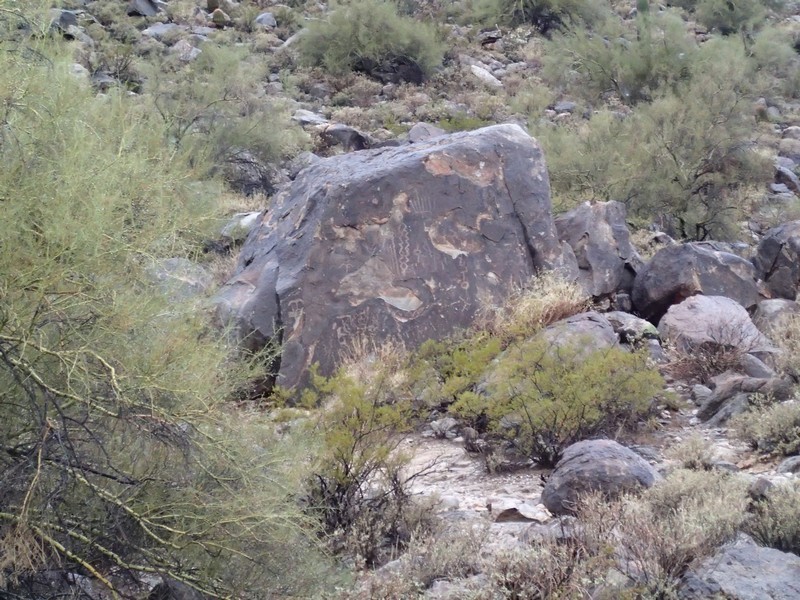
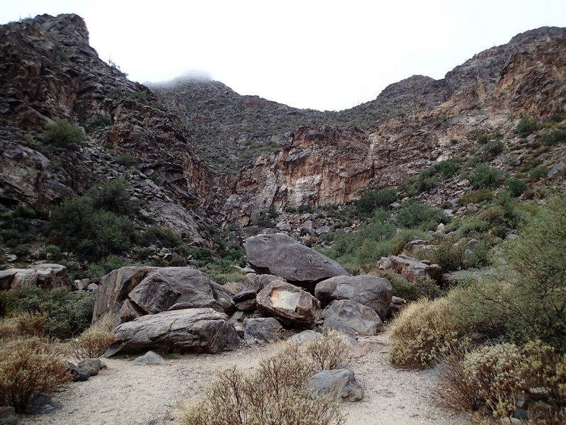
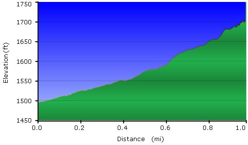
From the parking area, follow the well signed and wide trail towards the mountains. The trail is well marked and easy to follow for it's entire length. It's a pretty flat hike too, so this is a good hike to take those who are just getting introduced to desert hiking. About 0.5 miles along the trail you'll reach a signed junction with the Black rock trail (JCT_1R on the map). Stay right here to stay on the Waterfall trail. There are also well done interpretive signs here describing the petroglyphs in the rocks nearby. After 0.6 miles of total hiking, the wide trail becomes more narrow and it's another 0.4 miles to the narrow canyon that features the waterfall.
If you've taken this hike just after a rain, there will be a deep pool in front of you and to your right a waterfall will be emptying into an upper pool. Pictures don't do this waterfall justice, it really is quite lovely and worth seeking out after a rain.
After taking some time to enjoy the waterfall, return the way you came.
