Ready for a hike?  We've got hundreds of well documented Arizona hikes.
This is the source for everything you need to know about Arizona Hiking.

Main menu

Cart Empty

You are here: ArizonaHiking.org

Railroad Grade Trail

Updated
Elk along the Railroad grade trail
Railroad grade trail
Ridgebacks give chase to a Pronghorn along the Railroad grade trail
Views of Sunrise ski park along the Railroad grade trail
Railroad grade trail
Hikers on the Railroad grade trail
Map: Railroad grade trail
Elevation plot: Railroad grade trail

Location

How to Get There
This hike is located near McNary, AZ.

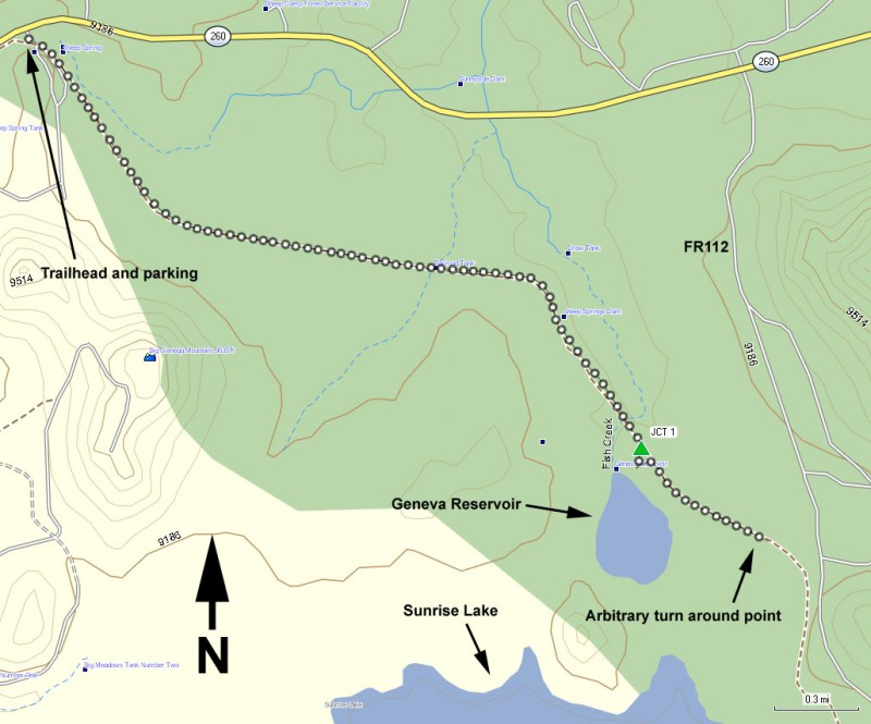
To the Trailhead: From the Show Low area, go East on HWY260. You'll pass the turn for HWY-273 and the Sunrise ski resort. Stay on HWY 260, driving another 1.6 miles and look for the parking area and signed trailhead on your right. There is a restroom here but no water.
city
McNary
state
AZ
country
USA
Region
White Mountains and Eastern Arizona

Hike details

Distance
7.30 [Miles] Total
Hike Distance- Details
This trail is over 20 miles one way, so the turn around point is arbitrary. We turned around near the Geneva reservoir and the total distance ended up to be 7.3 miles.
Time
3.75 [Hours]
Time-details
Our hike took us 3.75 hours
Elevation Change
200 Total gain/loss [Feet]
Elevation Details
Only about 200 ft elevation change.
Hike Trail Type
Out and Back
Special Features
  • Water
  • Wild Animals

Season

Best Season
  • May
  • June
  • September
  • October
Worst Season
  • January
  • February
  • December
Date Hike completed
May 26, 2013

Solitude

Solitude
High
Solitude Details
Outstanding. On a Memorial Day weekend, we had this trail all to ourselves.

Difficulty

Difficulty Rating
Easy
difficulty detail
The lack of significant elevation change makes this an easy hike. Keep an eye out for the wildlife in the area!

Permits

Be Aware of
mountain bikes

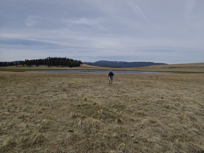
Hiking along the Railroad grade trail in Eastern Arizona.

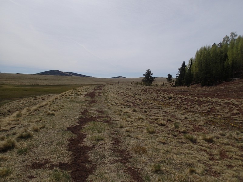
This trail used to be a railroad line servicing the logging activities in the area. After it's closure, it was converted into a gently graded hiking and mountain biking trail.

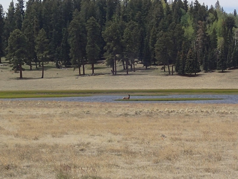
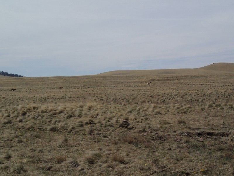
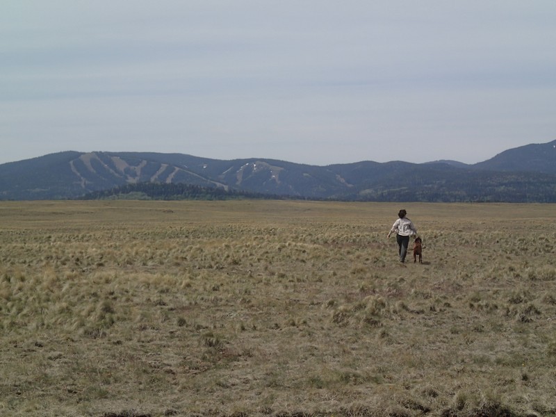
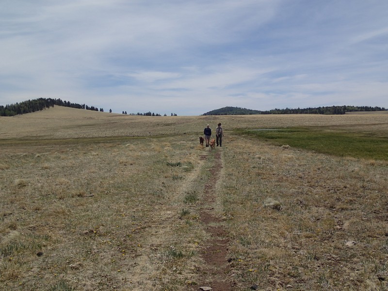
From the signed trailhead, walk along the easy to follow trail. The trail stays in the meadow, but you can see the edge of the forest here. Since there are no trees to restrict your views, this is an excellent hike to spot wildlife. During our hike we saw a Pronghorn and an Elk. The Elk was standing in the middle of Geneva Reservoir with a young calf.

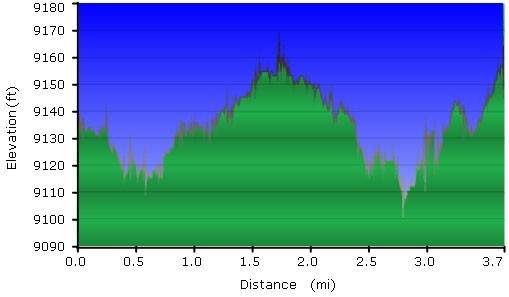
There is very little elevation change on this hike, which makes it a good mountain biking trail.

The trail goes for over 20 miles, so the turn around point is arbitrary. We turned around soon after the views of Geneva Reservoir.

Map

Swap Start/End
Adding markers to the map ...
Facebook