
- Hikes in Arizona
- Phoenix Area and Central Arizona
- Walkin' Jim Trail
Walkin' Jim Trail
Location
To get to the trailhead: from the Phoenix area, take I-17 north to the exit for the Carefree highway. Take the Carefree highway (SR-74) West (left) to Castle Hot Springs Road (Lake Pleasant exit). Turn right and drive 5.3 miles where you will see a wide pullout on the left side. Park here. The trail start is on the far right side of the parking area. Castle Hot Springs road is a popular place for ATVs and dirt bikes, so keep vigilant while driving here.
Hike details
Season
- January
- February
- March
- November
- December
- July
- August
Solitude
Difficulty
Permits
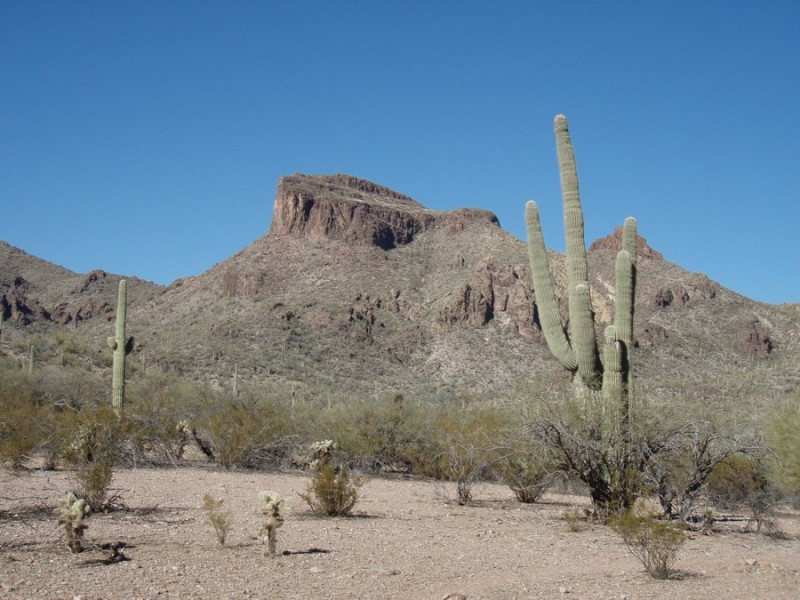
Hike the Walkin' Jim trail near Lake Pleasant, Arizona.
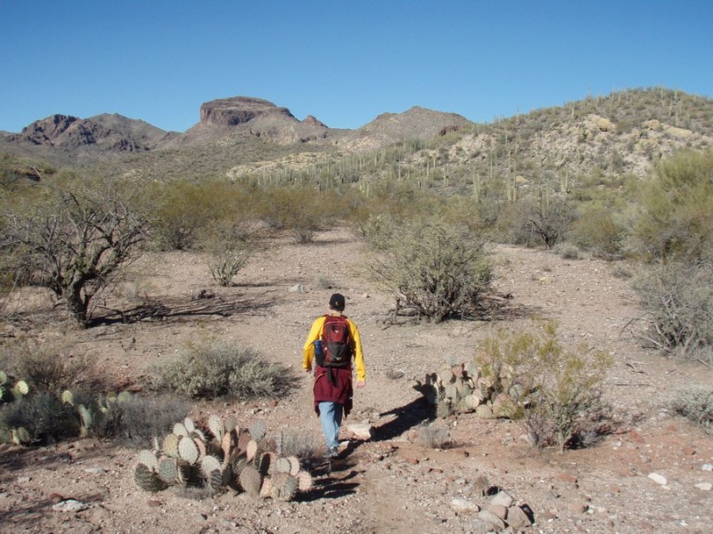
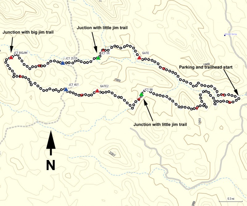
From the pullout, head to the right side of the parking area. There is an informal trail marker here, showing the way to the trail after stepping over a break in a fence. Actually, you will notice that there are two trails here leaving generally the same area. This is a loop hike and you will end up at the same place, so either way is fine. We did this hike in a counter-clockwise direction, so the write-up will reflect that. As a result, we started on the trail on the right, heading generally West.
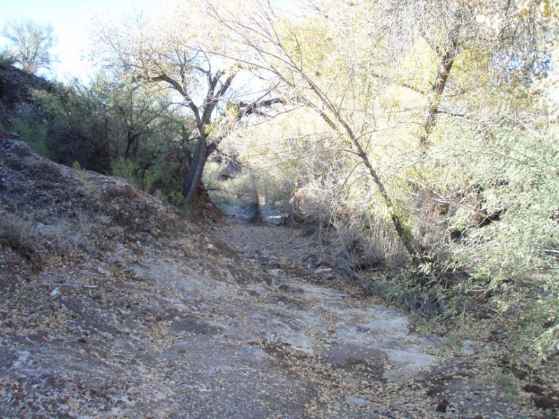
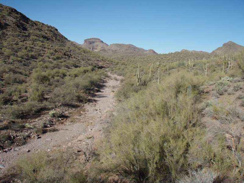
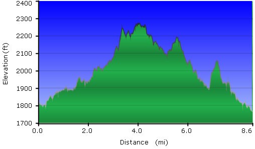
This hike travels through the typical sonoran desert, complete with Saguaros, Barrel cactus, Cholla cactus, and other desert vegetation. The trail is easy to follow here, but sometimes it can get mixed up with the game trails and washes of the area, so make sure you are using your route finding skills. There were more than a few times we found ourselves off the trail, but by looking for the generous cairns we were able to reorient correctly. Hopefully the map will help you stay on trail.
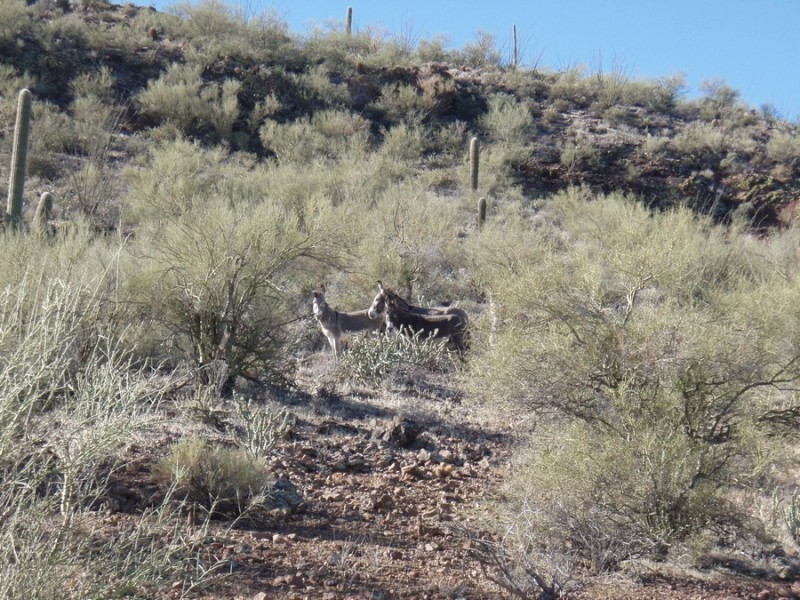
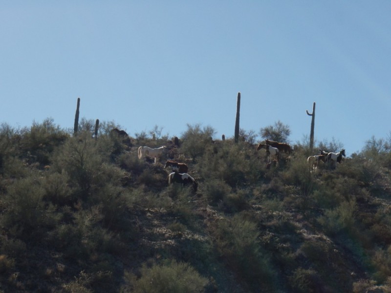
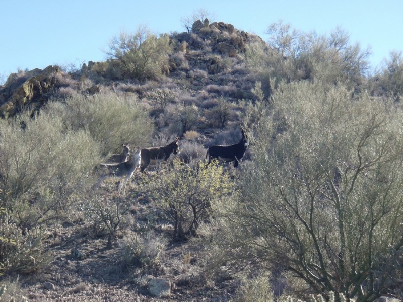
Speaking of game trails, one of the biggest reasons to do this hike is the possibility of seeking the wild burros and wild horses of the area. We were lucky and managed to spot groups of both. The other big draw of this trail is the solitude. There are numerous hikes in the sonoran desert, but not having to share it with any other hikers makes it even more special.
The first waypoint along the trail is a gate, which you'll reach after about 1.4 miles of hiking. There is a break in the fence you *may* have to unhook to get through, depending on how tall or flexible you are. You are now in the Hells gate wilderness. After 2.1 miles of hiking, you'll reach a signed junction with the Little Jim trail (Jct 1R on the map). Stay right to stay on the Walkin' Jim trail. If you wanted to shorten the loop, you could take the Little Jim trail junction here, as it meets the return trail. Continue heading West towards the obvious flat peak in the distance. After about 2.6 miles of hiking, you'll cross an old road (Jct 2STR on the map). At roughly the halfway point of the hike, you'll reach the signed junction with the Big Jim trail (Jct BIGJIM on the map). Stay left here to stay on the Walkin' Jim trail. The trail now bends South and turns East as you begin the return back to the trailhead. You'll cross that same road again in a different place (Jct 4ST on the map) and you'll go through the same gate again in a different place (Gate2 on the map). You'll also reach the other side of the Little Jim trail at a signed junction (Jct 5R on the map). Stay on your return trail by keeping right here. Continue to use those route finding skills to stay on trail, as I felt this section was the most faint and had the most game trails intersecting. Look for the cairns! After about 8.9 miles of total hiking, you'll see Lake Pleasant off in the distance and you will reach your car soon after.
