
- Hikes in Arizona
- Grand Canyon / Marble Canyon
- Vermillion Cliffs
Vermillion Cliffs
Location
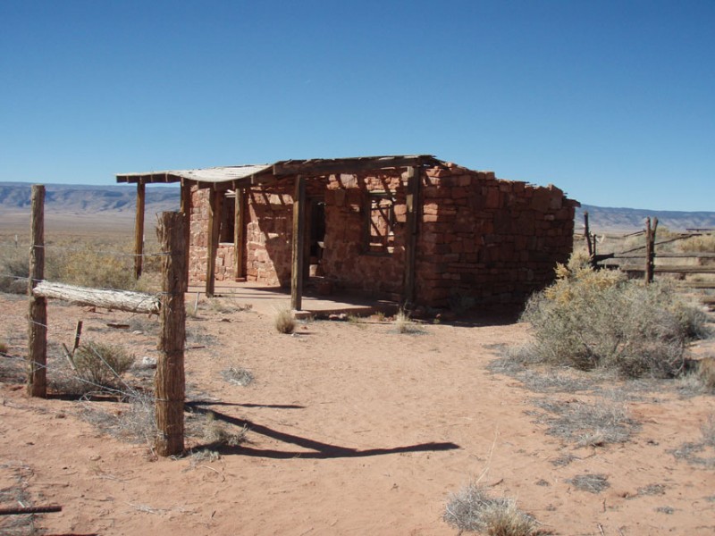
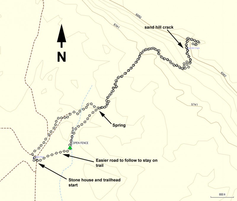
From Flagstaff, take US Highway 89 toward Page, AZ. At the intersection of 89 and 89A (near the small town of Bitter Springs), turn left and take 89A towards Marble Canyon. You'll continue about 33.4 miles from this junction to mile marker 557.3. Look for an unsigned dirt road on your right that heads through a closed fence. This is easy to miss. If you reach the signed Historic marker, you've gone about 0.5 miles too far. Drive through the gate (closing it behind you) and take the sandy dirt road towards the Vermillion cliffs. High clearance is needed here, as when we took this road it was quite crowned. We didn't need 4WD though. After 1.0 miles of driving you'll cross a wash (which was bone dry and easy to cross when we did this). After 1.7 miles you'll cross another wash that has a bit of a drop. I drove over the drop with no problem and on the way back realized that you could take a bypass dirt road to the right that went around it. After 1.9 miles of total driving, you'll reach an old stone house and the start of the hike. Park here and look for the dirt road that continues to the North East. This road will be the start of your hike.
Hike details
Season
- March
- April
- September
- October
- November
- June
- July
- August
Solitude
Difficulty
Permits
Hike the Vermillion cliffs of northern Arizona
For those of us that crave solitude and adventure, this is the perfect hike. It is very likely you will have this hike all to yourself. It is easy to lose yourself in the beautiful desolation of this area.
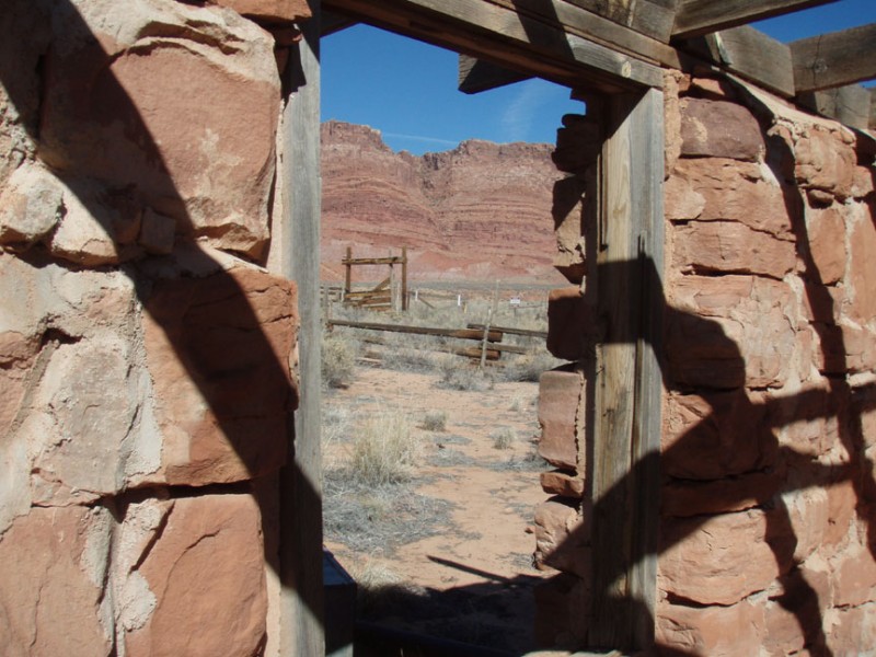
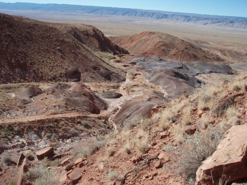
Before you start, explore the old stone house a bit. It looks like a homestead straight out of a Zane Grey novel. Chances are you'll have this area all to yourself, so the abandoned stone house is that much more interesting. From the stone house, continue on the dirt road, now changing direction and heading North East through the desert. If you look at the map, I actually started out on a more Northerly road from the stone house, but the trail was harder to follow, so I recommend the more Southern route pointed out on the map. After 0.2 miles of walking on this dirt road, you'll pass through an open fence blocked by rocks (to keep motor vehicles out). Continue on this dirt road as you enter some badlands... grey and purple dirt mounds with plenty of reminders of homestead activity (stone walls and water piping). After 0.6 miles of hiking, you'll reach a spring. It fascinates me that water could exist in such a barren place, but there's plenty of it here. I wouldn't recommend drinking it unless you treat it first. From this point, you will leave the dirt road behind and start an exercise in route finding that will continue until you reach the top of the cliffs.
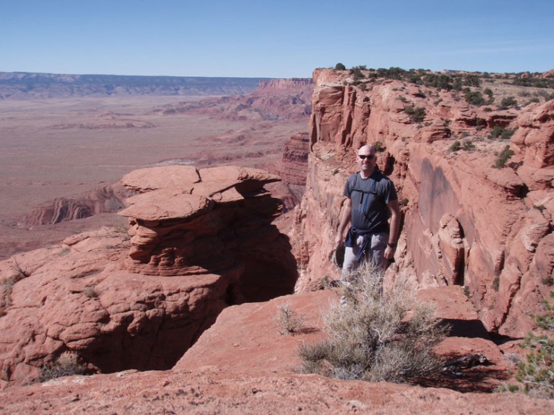
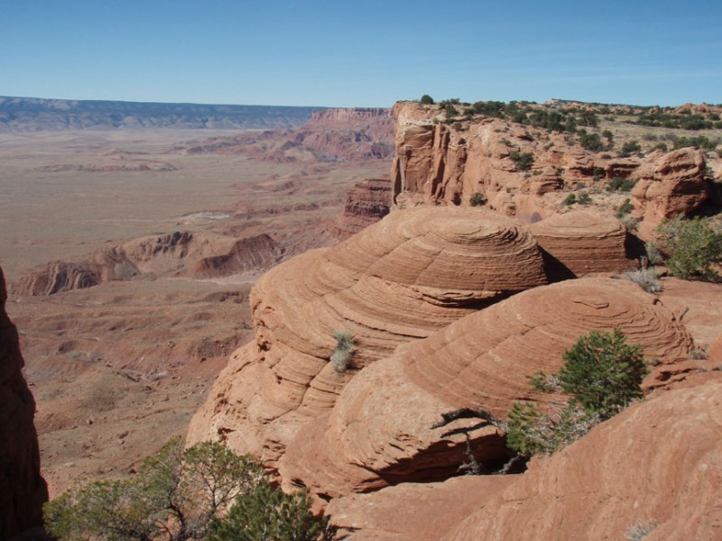
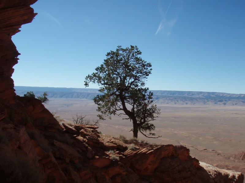
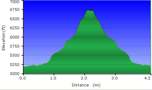
If you look to your left of the spring, there is a hill here. Try to spot the trail heading up it and stick to it. The trail has cairns most of the way to the top, but they can be tough to spot sometimes. If you get off trail, it is well worth it to backtrack to get back on trail. After steeply climbing up this hill, you'll continue to follow the light trail with sporadic cairns to keep you on the right track. As you gain elevation, look back once in a while to appreciate the views. The view of the badlands and spring from above is impressive. The trail heads North-east towards the cliffs. As you get closer to the cliff, you'll see the notch (known as the Sand Hill Crack) that will allow you access to the top. However, you won't head directly for it yet. The trail heads abruptly East, gaining elevation as it parallels the cliff. The sand becomes deeper here and makes walking slower than usual. The trail then turns abruptly North (it is easy to lose the trail here in the sand) and begins climbing more steeply. Be very careful to follow the cairns in this area all the way to the top so you don't get off trail. If you are able to follow the cairns, the path to the top is a class 2 climb... not bad at all. You'll head up through the gully known as Sand Hill Crack to emirge at the top of a mesa. After you pass the last cairn in the gully, simply head briefly South to the edge of the Vermillion cliffs and the views that signify your reward for the hard work. If you're lucky as we were, you'll be treated to the California Condors soaring along the cliff edge looking for their next meal. Make sure it isn't the sandwich you brought for lunch!
When ready, return the way you came.
