
- Hikes outside of Arizona
- Outside AZ
- Asia
- Mount Takao
Mount Takao
Location
From Tokyo, the trailhead is easily accessed by train. From Shinjuku, you have two choices. You can take the Chuo line to the Takao stop, changing trains to the Keio line for the final stop to Takaosanguchi. I recommend taking the Keio line from Shinjuku that goes all the way to Takaosanguchi. The Takao line ticket is cheaper and sometimes you can get a limited express that saves time. It takes about 45 minutes if you get the limited express. From the train station, follow the people towards the cable car and chair lift area that marks the base of all the trails. The start of both trails detailed here are along the left side of the easily recognized cable car station.
Hike details
Season
- March
- April
- October
- November
Solitude
Difficulty
Permits
Hike up Mount Takao in Japan
Mount Takao (known locally as Takao-san) is conveniently located about a 45 minute train ride from the skyscrapers of Tokyo. This mountainous and forested region is considered a "Quasi National Park", whatever that means. For visitors and locals alike, it represents an excellent way to escape the big city and enjoy nature.
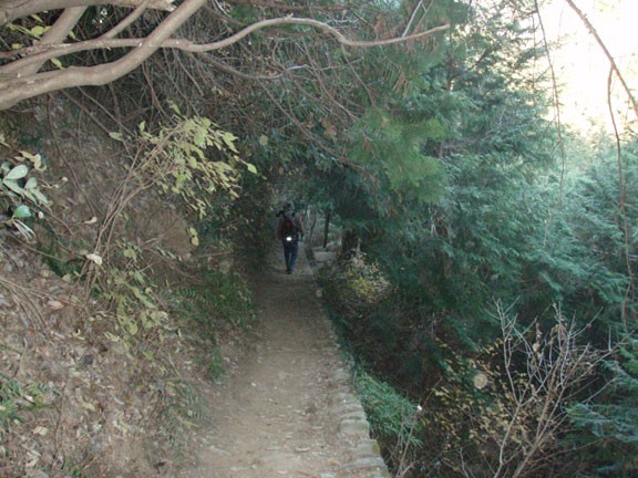
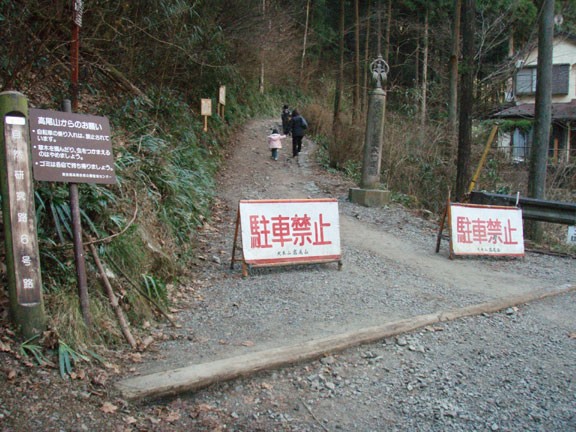
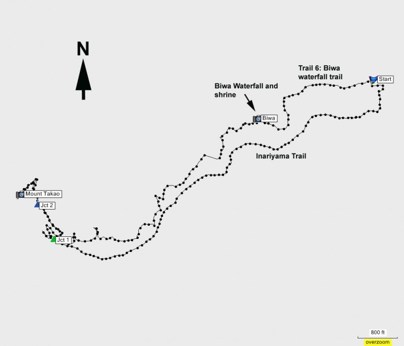
From the busy area next to the cable car station, start walking along the left side of the cable car station along a small road. To your left, you will see the dirt trail start of the Inariyama trail. Leave it for now, we'll return along this route. Continue up the paved road past private houses along side the creek. After about 10 minutes, you'll see a signed dirt trailhead to your left that starts climbing. Unfortunately, the signs are in Japanese, so you'll have to use some special route finding skills here! One way to do this is to memorize the Kanji (Japanese lettering) of the Route 6 trail and double check the sign has these same characters. This method worked well for me for the entire hike.
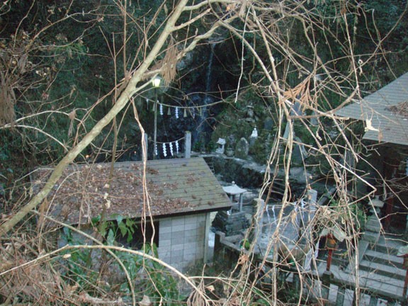
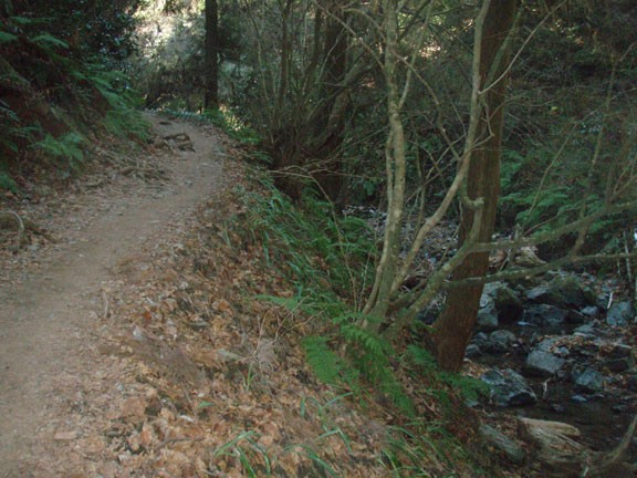
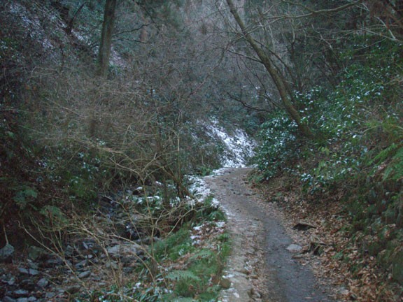
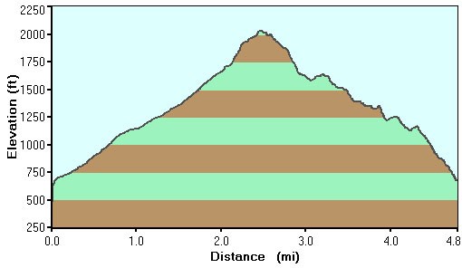
Now that we're on dirt, the trail continues it's gentle climb towards the top of Mount Takao. This section of trail is well shaded by Cedar trees and follows a creek for much of it's length. There are several spots of interest in this section, including two small caves and the Biva Waterfall. The waterfall isn't very spectacular, but the shrines along this trail and at the waterfall are. This area has been a popular pilgrimage in Japan for over 1000 years.
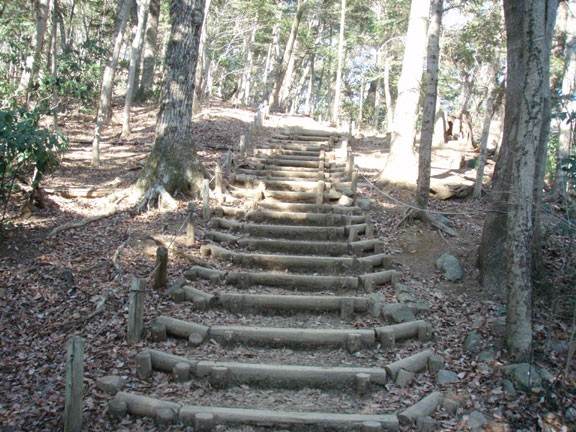
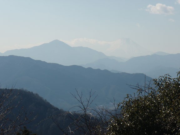
At the waterfall, stay left (going right takes you to close up views of the shrine and falls). Continue walking up the easy to follow trail, eventually reaching a trail junction (marked as Jct 1 on the map). Go right here to stay on Trail #6. The trail starts to climb more steeply here, although you'll be helped by some log stairs. Just before reaching the top viewing platform, you'll reach another complicated trail junction (marked as Jct 2 on the map). Go straight here to stay on Trail #6 and walk the final stretch to the top. The viewing platform is sure to be crowded, but it is large enough to accommodate everyone. There are bathrooms and food restaurants up here, along with a decent view of Mt. Fuji (if it's a clear day).
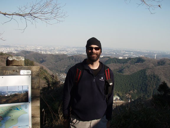
After enjoying the views (and hopefully your lunch) backtrack along Trail #6 until you get back to Jct 2. Now take the right fork and enjoy the Inariyama trail, also known as the ridgeline trail. This trail stays along the southern ridgeline of the valley of Trail #6. The views of the surrounding forest and city shyly peek at you from between the trees to your right. About halfway down this trail, you'll reach a viewpoint (with a bathroom) where you'll finally get some satisfying views of the city in the distance.
Continue down this trail to it's conclusion at the base of the cable car station. The cable car (or chair lift, whichever you choose) will take passengers to the 400m mark. I skipped this ride, as I came out here to get away from the conveniences of civilization!
For more information on how to get to the trailhead, the Meiji Memorial Forest website has pretty good instructions.
For a map and description of all the trails in this area, click here.
