
- Hikes in Arizona
- Prescott Area
- Watershed trail to Sevenmile Gulch trail
Watershed trail to Sevenmile Gulch trail
Location
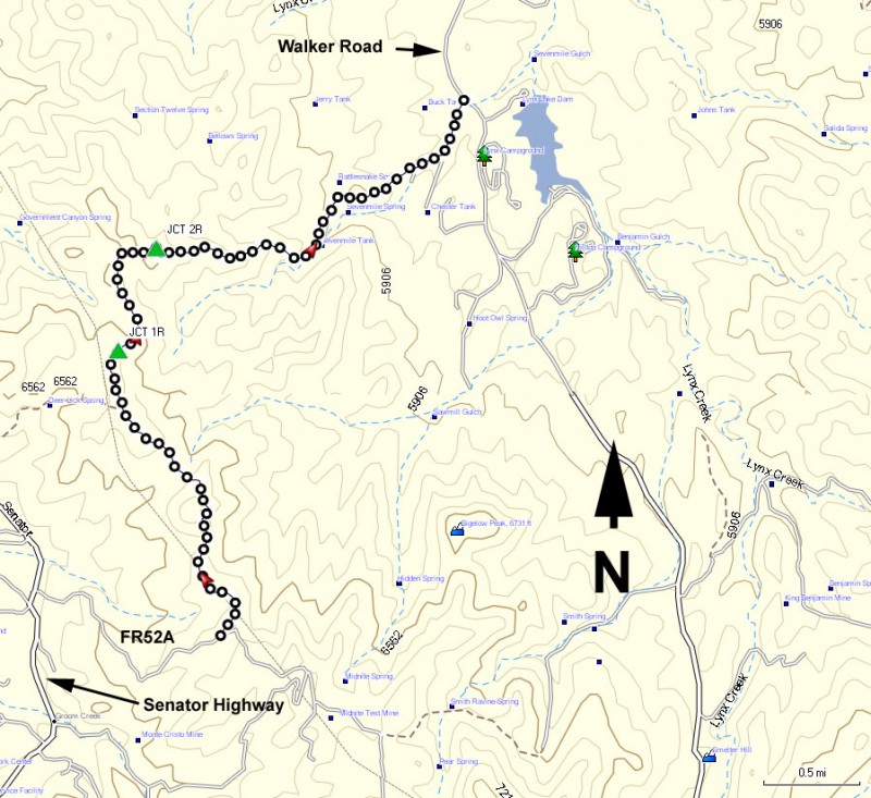
To get to the trail head: from the Phoenix area, take I-17 North toward Flagstaff. At Cordes Junction, take HWY-69 towards Prescott. Before you reach downtown Prescott, turn left onto the Senator Highway (signed as Mount Vernon Ave). Take this paved road 4.8 miles to the signed turn onto the Spruce Mountain road. Turn left here (FR 52A) and drive 1.4 miles on this well graded dirt road to the signed trail head on your left for the Watershed Trail (TR 299). Please note there is another trail head for the Watershed trail on Senator Highway, but this hike description starts out at the higher elevation trail head described.
Hike details
Season
- May
- June
- July
- August
- January
- February
- December
Solitude
Difficulty
Permits
Hike the Watershed trail and the Sevenmile Gulch trail near Prescott, Arizona.
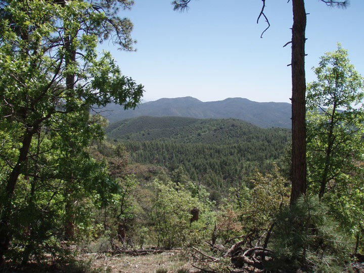
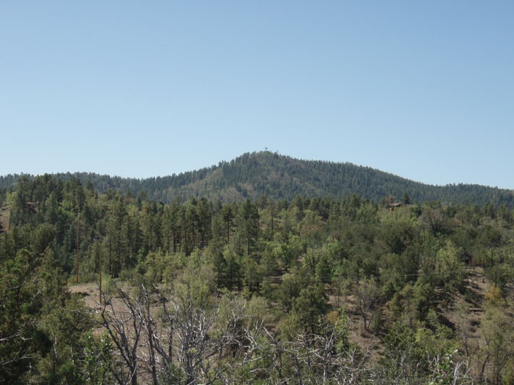
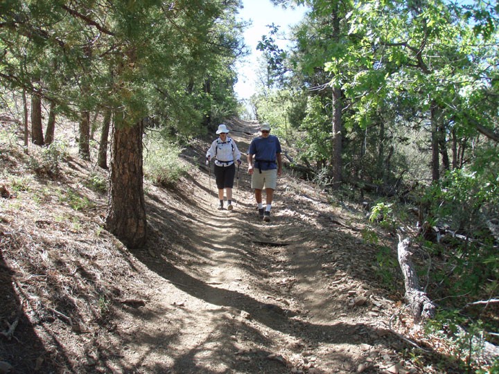
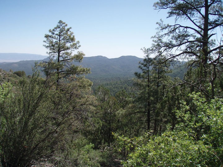
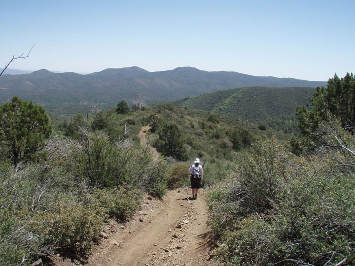
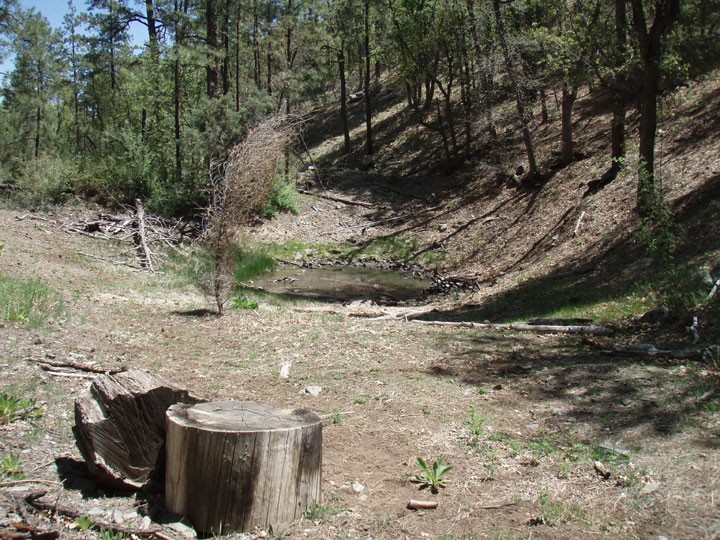
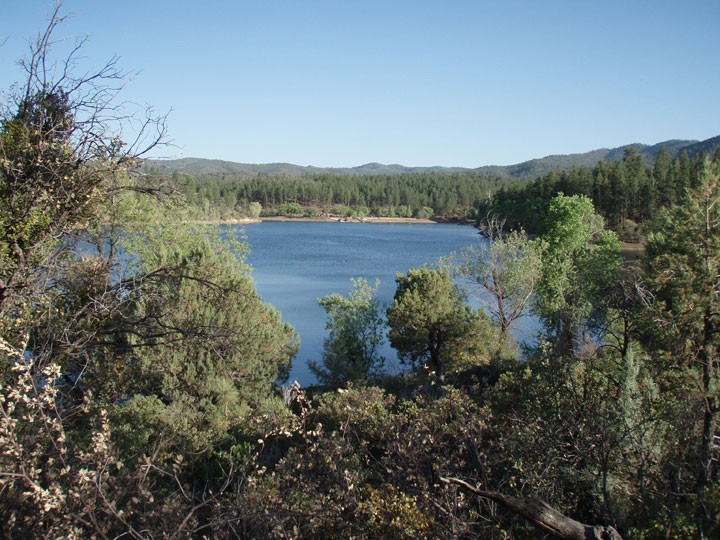
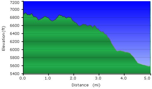
This is a good day hike possibility if you happen to be camping at the Lynx lake campground (like we were). We managed to talk my mother into dropping us off at the upper Watershed trailhead (TR#299) and we walked all the way back to the campground. The hike starts at the signed trailhead and the trail is easy to follow. It is a bit rocky at times and can descend steeply in places. The reward is the impressive views of Spruce Mountain and the Prescott area. The only drawback to this hike is that the trail is approved for off road vehicles, so you may need to share the trail with them. The first two miles of this trail will be on the Watershed Trail, which follows a ridge line generally to the North. The trees of this area are mostly pine with a few oak trees. After about 2 miles of hiking, you'll reach the signed junction with the Sevenmile Gulch trail (TR #9854). Stay right at this intersection (JCT 1R on the map). Now you are on the Sevenmile Gulch trail and the descent becomes a bit steeper. After 0.8 miles from the previous trail junction you'll reach another trail junction, this time with the Ranch trail (TR #62, marked as JCT 2R on the map). Stay right again to stay on the Sevenmile Gulch trail. The final 2.2 miles of hiking brings a more open skyline, as the pine trees give way to Juniper, allowing more views and less shade. The trail drops into a lush canyon and you'll pass Sevenmile Tank on your right. Continue on the easily followed trail all the way to Walker Road. After finishing this hike, reward yourself by walking to Lynx lake for a lovely view of this picturesque forest lake.
