
- Hikes in Arizona
- Grand Canyon / Marble Canyon
- Rainbow Rim trail #10
Rainbow Rim trail #10
Location
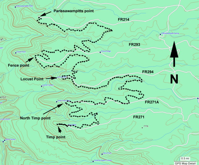
From the North rim entrance to the Grand Canyon, go 12 miles North on HWY-67. Turn left (West) at the signed junction with FR222. Go 10.5 miles on this well graded dirt road to the signed junction with FR206. Turn left here and go 4.7 miles, staying on FR206 through several signed forks. This road will eventually turn into FR271 (signed, stay left at the junction with FR271A). Continue along FR271 for an additional 8 miles to the signed trailhead and Timp point.
To access North Timp point, while driving along FR271, turn right at the junction with FR271A and drive 3 miles to the parking area.
To access Locus point, take FR206 to the signed junction with FR294. Turn right onto FR294 and follow it about 8 miles to the parking area.
To access Fence point, take FR206 to the signed junction with FR293. Turn right onto FR293 and follow it about 8 miles to the parking area.
To access Parissawampitts point, take FR206 to the signed junction with FR214. Turn right and follow FR214 about 8 miles to the parking area.
Hike details
Season
- June
- July
- August
- January
- February
- March
- December
Solitude
Difficulty
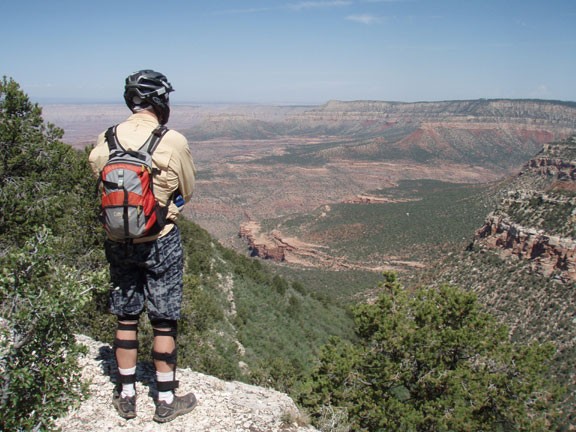
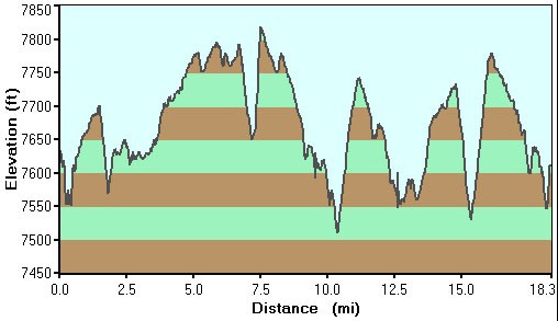
30 yr old Recommendation: This turned into a great mountain bike ride for us, visiting five great Grand Canyon viewpoints. Depending on which section of the trail you hike, it can be anything from Easy to Difficult.
Permits
Hike the Rainbow rim trail in Grand Canyon National park, Arizona.
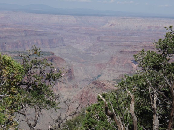
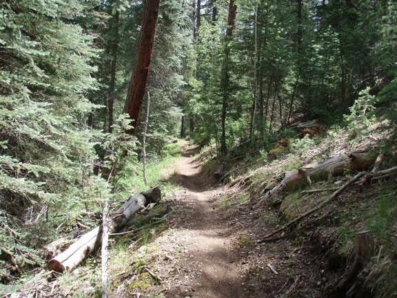
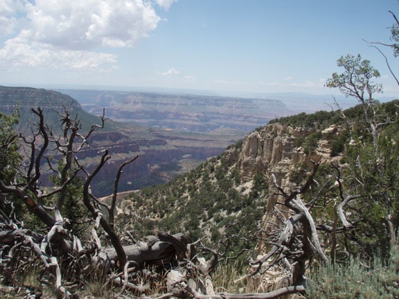
The Rainbow rim trail is designed to be a mountain biking trail that links five different viewpoints along a remote section of the North rim of the Grand Canyon. Doing the entire trail probably isn't feasible (or even necessary) so pick a section and start hiking. We did this entire length as a one way mountain bike ride and it was a blast! The trails between each of the points has the same pattern. The trail starts with great views of the Grand Canyon, heads away from the rim through an easy to follow trail through a Ponderosa pine and Aspen forest, before heading back to the rim for more great Grand Canyon views. The map is very helpful and the distances between each of the points are provided below. This way you can pick a section to hike based on your ability and desire.
Key Milestones:
Between Temp point and North Temp point 3.0 miles
Between North Timp point and Locust point 6.5 miles
Between Locust point and Fence point 3.0 miles
Between Fence point and Parissawampitts point 5.5 miles
All of the viewpoints are well signed and have maps of the area. From any of the viewpoints, you can see the Esplanade, along with Powell Plateau, Tapeats Amphitheater, Surprise valley, and even Mount Trumbull on a clear day.
Enjoy!
