
- Hikes in Arizona
- Superstition and Mazatzal Wilderness
- Superstition Ridgeline
Superstition Ridgeline
Location
For the Carney Springs Trailhead:
From the Phoenix area, take US-60 East, leaving the city limits. After leaving Apache Junction, continue about 8.5 miles, turning left onto signed Peralta Road (FR 77). After starting out as a paved road, this quickly turns into a maintained dirt road. After 5.6 miles, you'll stay left at the signed junction that heads towards the Peralta Trailhead. Go another 0.6 miles and park at the unsigned parking area and trail on your left. If you reach the obvious Peralta Trailhead, you've gone too far.
For the Flat Iron (Siphon Draw) Trailhead:
From the Phoenix area, take US-60 East and turn North(left) onto HWY-88 (the Idaho Road Exit). From Apache Junction, drive about five miles to the Lost Dutchman State Park (on your right) and follow the signs to the Siphon Draw trailhead. You'll have to pay a few bucks to enter the Lost Dutchman State Park.
Hike details
Season
- January
- February
- March
- November
- December
- June
- July
Solitude
Difficulty
Permits
Hike along the Superstition Ridgeline in the Superstition Wilderness, Arizona.
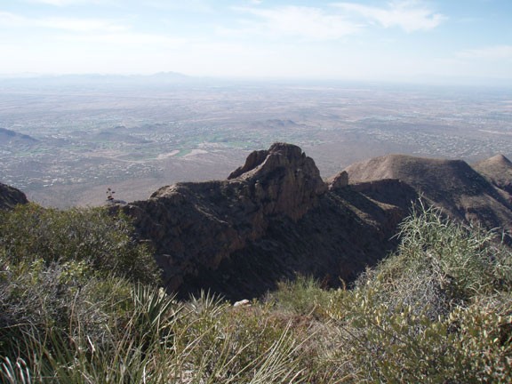
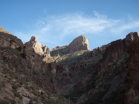
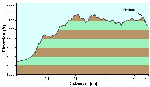
The one way hike along the Superstition Ridgeline is a worthy goal for many of us regular Superstition Wilderness hikers. The hike requires endurance, route finding, and scrambling to successfully complete. The rewards for your efforts are tremendous. You'll be treated to constantly changing views of Weavers Needle, helicopter elevation views of Apache Junction and Gold Canyon, as well as full views of the Northern Superstition Wilderness.
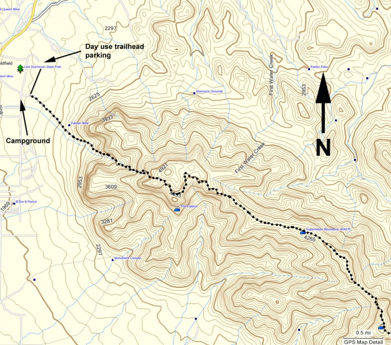
To be successful on this hike, it will take some planning. First, since this is a one way hike, you need to decide which direction you want to hike. We chose to start at the Carney Springs trailhead for several reasons. We wanted the sun at our back for the duration of the hike and we wanted the elevation gain to be more gradual. The problem is that you'll be very tired when you reach the steep down climbing section of the Flat Iron trail. If this worries you, you could start at the Flat Iron side of the hike, however this means you will start this hike with a 2500 ft climb. It's up to you. For our direction of travel, we dropped a car at Lost Dutchman State Park the night before, paying for a few nights of camping so we could park our car in peace.
Since there is much less daylight in the Winter, we got an early start (on the trail by 7am). We finished just as the sun was going down. I'd recommend you do the same, as well as bring head lamps just in case you get delayed. Spending the night up along the ridgeline because you lost the trail in the dark would be a very uncomfortable experience... perhaps even deadly.
Some additional advice, bring lots of water because there's none along this trail. We brought 130 ounces each and still ran out near the end of the hike. Make sure you have hiked both ends of this hike so you are familiar with them. Bring a really good map (and preferably a GPS) so you feel comfortable knowing which way to go. Make sure your boots are well broken in, as getting a blister in the middle of this hike would make for a miserable and painful experience. We would also recommend wearing long pants, because there are sections of trail that are overgrown with bushes and cactus. It's not really bushwhacking, but your legs will get scraped up if you don't have long pants. It's up to you if you want to take hiking sticks (Karen loves hers and I avoid them). To the hiking stick enthusiasts, there are sections of descending hiking that are made more stable with the sticks... so bring them if you like.
Now that you're fully armed with the skill and knowledge, let's get to the hike!
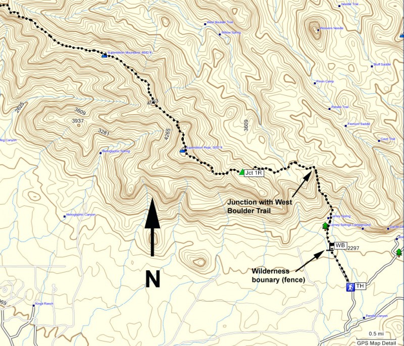
From the Carney Springs parking area, follow along the wide, closed dirt road heading towards the Superstition Wilderness. This old road used to lead to the Carney Springs campground, but has since been closed to cars. You'll soon arrive at the site of the old campground and a fence marking the wilderness area (marked WB on the map). On the other side of the fence, the road goes away and you'll follow a faint and rocky trail for the remainder of the hike.
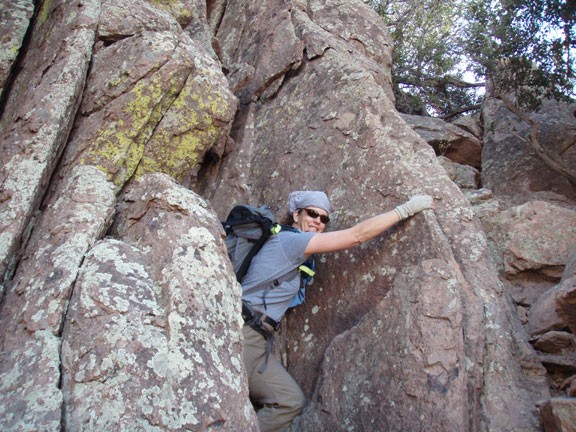
From this point, the climbing starts in earnest. Since the grade is so steep, there are a number of sections where it could be easy to loose the trail. There are cairns to mark the trail in these sections, so keep an eye out for them and use those route finding abilities. There are some minor scrambling sections as you climb as well. Make sure you turn around once in a while to enjoy the views as you go up.
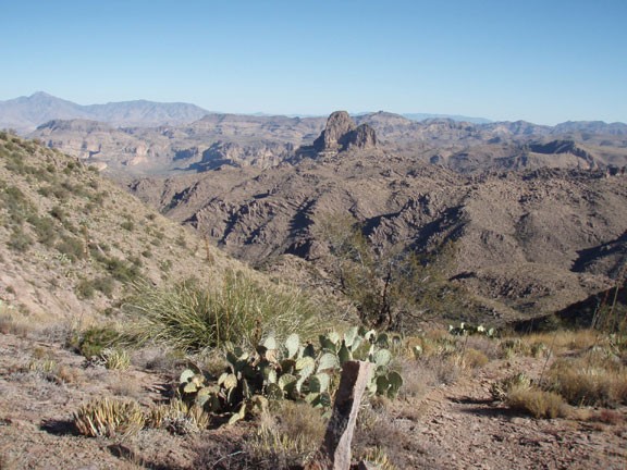
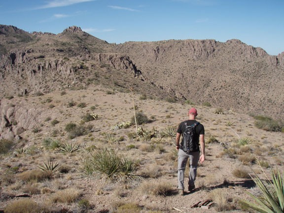
After about 1.8 miles of hiking, you'll reach the ridgeline. You'll be treated to your first views of the whole of the Northern Superstition Wilderness and specifically Boulder Canyon before you. From this saddle, the trail heads abruptly turns west (left). There is a trail down Boulder Canyon, so make sure you don't accidentally end up on this one. The trail you want should follow along the base of the ridgeline. The trail in this section is actually better than I expected. Sometimes the trail disappears along rock or at scrambling sections, however if this is the case, stop and look for Cairns to keep you on the trail. We had no problems finding the Cairns when the trail faded.
On occasion during the ridgeline section of the trail, you may run into several forks in the trail. One such fork is marked on the map as Jct 1R. Although it may be a bit disconcerting, what we found was that these trail forks generally end up in the same place. For example, going left at this junction gets you to the top of the nearby peak, while staying right (as we did) will get you to the same place without the elevation detour. Keep this in mind as you hike along the ridgeline and it will bolster your route finding confidence.
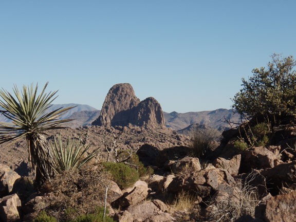
After hiking through this boulder field you'll reach one of the first peaks on this hike. Some topos show this peak as Superstition Peak (on our map) and others as Labarge Mountain. Regardless of the name, the views are great. Be sure to keep an eye on the changing condition of Weavers Needle. At this point, you'll just see the top of it peaking over the mountain.
From here you'll lose some elevation as you head over to Superstition Mountain. Unfortunately, any time there is an elevation loss on this hike, the trail tends to be covered in small rocks, which makes the footing unstable. Always take your time in these sections and watch your foot placement. You'll also see Hieroglyphic canyon to your left as you walk along this part of the trail.
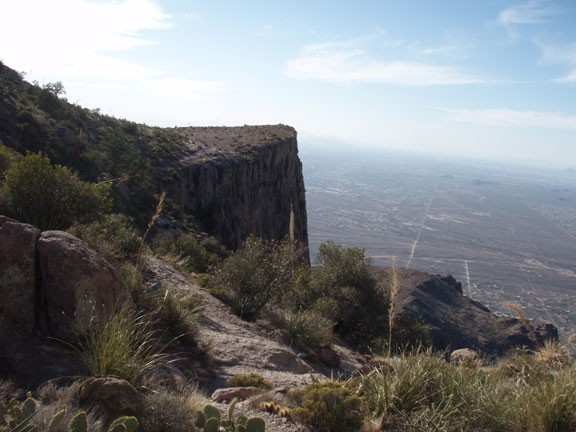
Between Superstition Mountain and the flat iron there is some more route finding and scrambling. As before, if you loose the trail, stop and look for the cairns. There's one scrambling section in particular that I think would be tough to notice coming from the flat iron trailhead that was much easier to see coming from the Carney Springs trailhead direction. The closer you get to the flat iron, the more views you'll enjoy of the Superstition Wilderness.
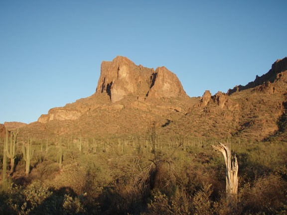
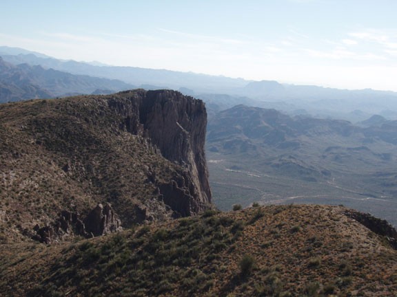
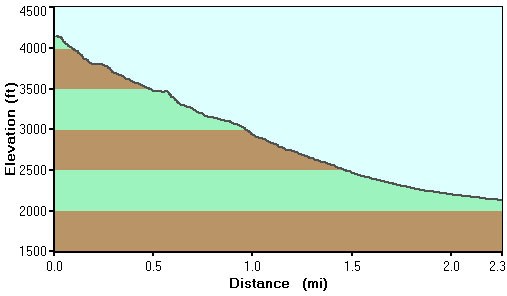
After all your hard work, you'll finally reach the flat iron. Now comes the 2500 ft descent to the Lost Dutchman State Park. Unfortunately, this is a steep scramble, so you will be using your hands as well as your feet. Doing this after the previous 8.5 miles of hiking can make you a bit lazy and inattentive. Guard against this, as a fall along this section could be quite dangerous. The route finding along this canyon is made easier (although much more annoying and ugly) by white and blue paint dots on the sides of the rock. If you ever feel the urge to do this to other wilderness areas, please suppress it. Marking trails in this way isn't necessary or desirable. There will be generally more people in this section of the trail too, as Flat Iron is a popular hike.
Soon you'll emerge onto Lost Dutchman State Park and your waiting car. Be sure to tell all your family and friends about your epic feat. Congratulations!
