
- Hikes in Arizona
- Grand Canyon / Marble Canyon
- Rim Trail
Rim Trail
Location
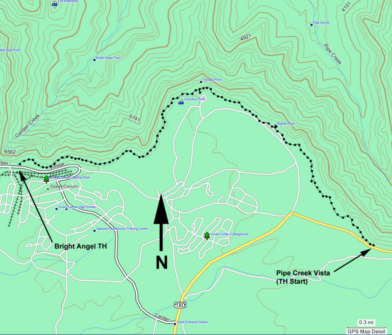
To get to the trailhead: From the South Rim, you can access this trail in several places. The hike described below started at Pipe Creek vista, which you can access by taking the green shuttle bus (towards South Kaibab and Yaki point).
Hike details
Season
- April
- May
- June
- September
- January
- February
- December
Solitude
Difficulty
Permits
Hike the rim trail along the South Rim of the Grand Canyon national park, Arizona.
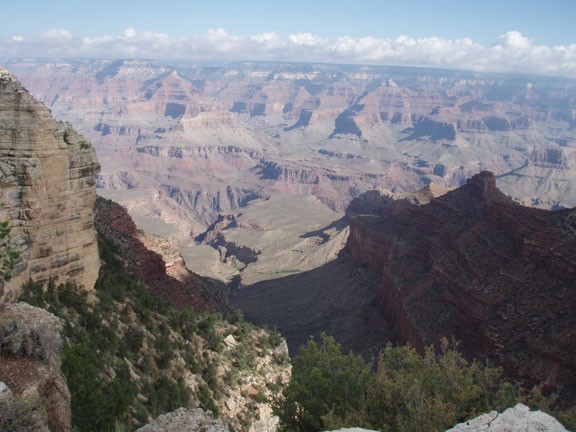
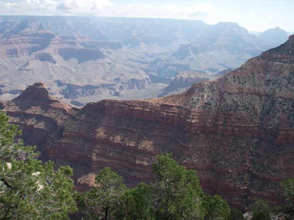
Day hikes along the South Rim of the Grand Canyon tend to be limited to short, steep hikes along the main routes to the bottom of the canyon (such as the Bright Angel or South Kaibab trails). However, there is one nice trail that has much less elevations changes while providing constantly changing views of the Grand Canyon. This is known as the Rim Trail.
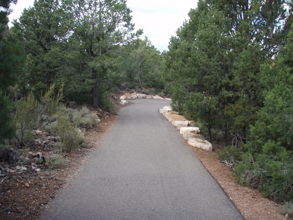
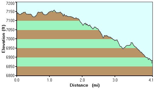
The Rim trail runs from the Pipe creek vista (East side) all the way to the Hermit Rest stop (West side) along the South rim of the Grand Canyon. Between Pipe creek vista and the Bright Angel trailhead, the trail is paved. Between Hermit’s Rest and the Bright Angel Trailhead, the trail alternates between paved and well groomed dirt.
I’ve hiked East to West, starting at Pipe creek and stopping at the Bright Angel Trailhead. I’ve also biked along the trail from Bright Angel Trailheads to Hermit’s rest. The trail is accessed in numerous places by the tram system at the canyon, so if you become tired, it is easy to take the shuttle back to your car. For this write-up, I’ll focus on the section between Pipe springs and Bright Angel Trailhead.
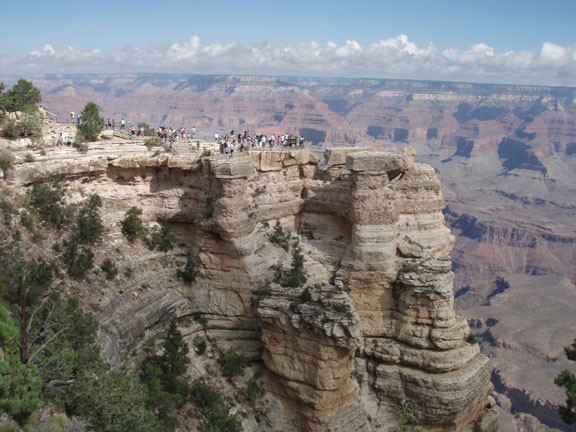
To get to the Pipe springs vista, take the green shuttle (bound for the South Kaibab trailhead and Yaki point). This shuttle can be reached from the Canyon view visitor’s center. From the Pipe springs viewpoint, start following the well signed trail west along the rim of the canyon. There are numerous changing views of the Grand Canyon along this paved and flat trail. This trail is not the best if you’re looking for solitude, but it will definitely be less crowded than the popular Mather point and Yavapai points. This trail provides a good opportunity for the day hiker to enjoy their own private view of the Grand Canyon.
The closer you get to one of the tram accesses (Mather point, Yavapai point, Bright Angel trailhead) the more people you will have to share the views with. Between these points you’ll have more solitude. The most enjoyable part of this trail is the changing views of the canyon you get as you walk along it.
Mather point is 1.3 miles away. Yavapai point is another 0.7 miles. The Bright Angel trailhead is 2.0 more miles. If you want to continue to Hermit’s rest, it’s another 7 miles.
The trail is easily followed, with an abundance of signs. Hike as long as you like and enjoy this natural wonder.
