
- Hikes in Arizona
- Grand Canyon / Marble Canyon
- New Hance
New Hance
Location
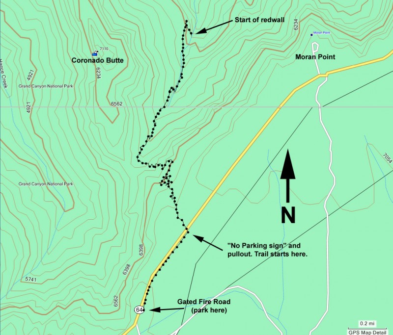
From Flagstaff, take HWY 180 north towards the Grand Canyon. Once you enter the park, you'll head east on the East Rim Drive. Take the East Rim drive until you reach the Buggeln picnic area. Go another mile past the picnic area and park at the gated forest road on your left side. If you reach mile marker 257 you've gone too far. Unfortunately, there is no parking at the trailhead and the trailhead is unsigned. Hike East along the east rim drive 0.6 miles (you'll pass mile marker 257) until you see a "no parking tow away zone" sign on your left, along with a small pullout. Take the trail here into the forest for a few hundred feet until you see the trail start sign.
Hike details
Season
- February
- March
- September
- October
- January
- June
- July
- August
- November
- December
SPECIAL CONSIDERATIONS FOR WINTER AND SUMMER TIMES:
, For Winter Hiking: Remember that the South Rim is damned cold in the winter. Snow and Ice will cover the trail for the first few miles. Crampons are recommended.
, For Summer Hiking: Get an early start and don't hike during the heat of the day. Remember that the bottom of the canyon will be MUCH hotter than the top. Taking this trail in the summer is NOT recommended.
Solitude
Difficulty
Permits
Hike the New Hance trail in Grand Canyon national park, Arizona.
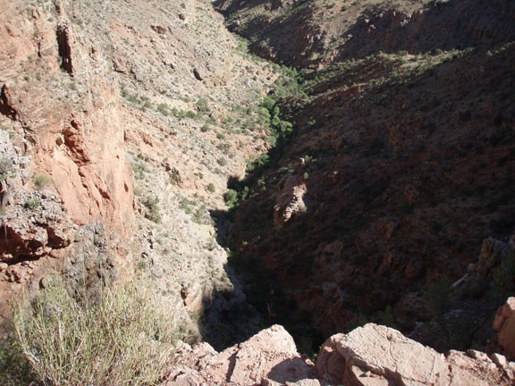
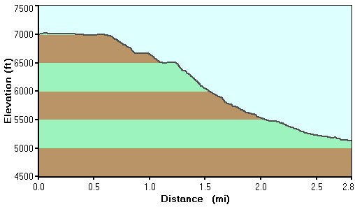
We were up in the Grand Canyon on a busy July and we were looking for a secluded day hike (not easy!). Incredibly, we were able to find one at New Hance. Hiking 2.8 miles to the start of the Redwall layer makes for an enjoyable (and secluded) day hike.
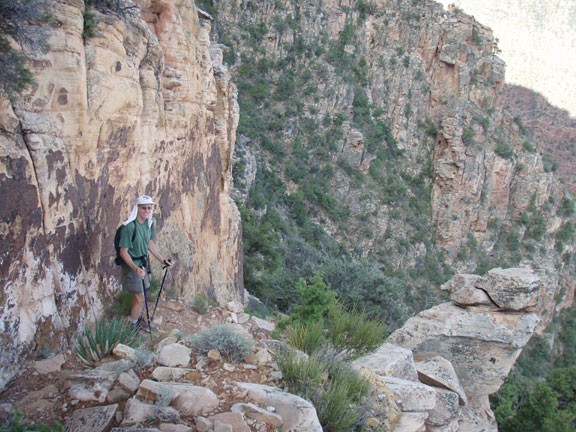
One of the reasons for the excellent solitude on the New Hance trail is the trailhead is poorly marked. This is an unmaintained trail and for experienced Grand Canyon hikers only. From the gated forest road, walk East along the rim drive for 0.6 miles until you see the "no parking" and "Tow away zone" signs. If the signs aren't obvious enough, you are not allowed to park at the trailhead start. From the "no parking" pullout, turn North and walk along the now visible trail deeper into the forest towards the hidden South Rim. After a few hundred feet of walking, you'll see a sign clearly marking the start of the trail.
The trail can be tricky to find at times, so you'll have to use those route finding skills. It's a very steep descent as well, almost as steep as the South Kaibab trail, which is the steepest trail to the depths of the Grand Canyon. It's a rocky descent, so use care. I fell once and my friend fell twice along this trail.
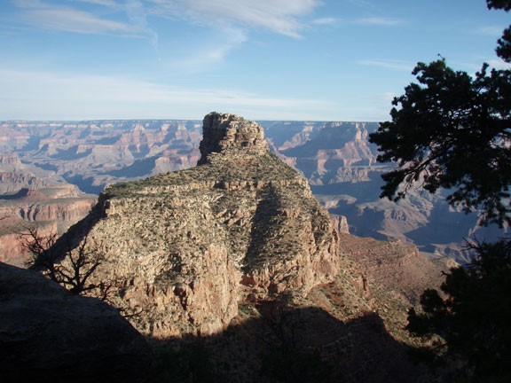
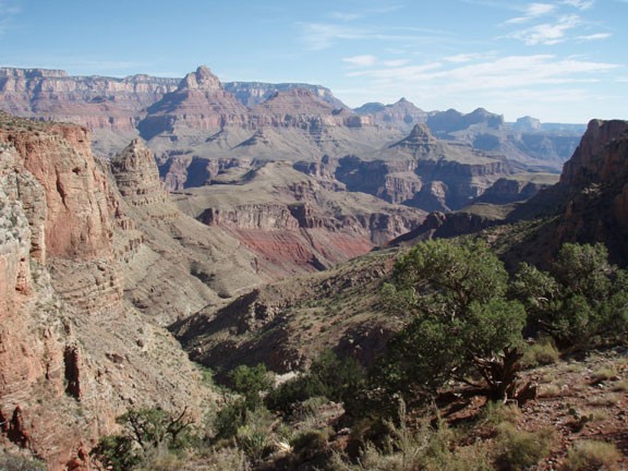
Very quickly, you'll be greeted with views of the Coronado Butte and the inner Grand Canyon. This trail follows a contour of Red Canyon, eventually reaching the Colorado River at Hance rapid. For this day hike, we stopped at the start of the redwall layer. If you're not sure where the redwall layer is, when the trail starts to leave the bottom of Red Canyon it's time to consider turning around. At least, you'll be greeted with some great views of the inner Grand Canyon from this excellent viewpoint.
Someday I hope to take this trail all the way to the river. Enjoy!
