
- Hikes in Arizona
- White Mountains and Eastern Arizona
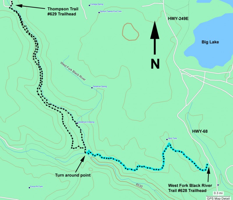
- West Fork Black River Trail
West Fork Black River Trail
Updated
Location
How to Get There
This hike is located near Greer, AZ.
To the Trailhead: From the Show Low area, go East on HWY260. Turn right onto the well graded dirt road HWY-273 and drive for about 14.5 miles to the junction with FR-116. Turn left onto FR116 (following the signs to Big Lake) and drive to the intersection with FR249. Turn left onto FR249E (again, following the signs to Big Lake). At the intersection with FR68, turn right and go about 1.5 miles to the signed trailhead and parking on the right. All the dirt roads to get to this trail are well graded.
To the Trailhead: From the Show Low area, go East on HWY260. Turn right onto the well graded dirt road HWY-273 and drive for about 14.5 miles to the junction with FR-116. Turn left onto FR116 (following the signs to Big Lake) and drive to the intersection with FR249. Turn left onto FR249E (again, following the signs to Big Lake). At the intersection with FR68, turn right and go about 1.5 miles to the signed trailhead and parking on the right. All the dirt roads to get to this trail are well graded.
city
Greer
state
AZ
country
USA
Region
White Mountains and Eastern Arizona
Hike details
Distance
5.00 [Miles] Total
Hike Distance- Details
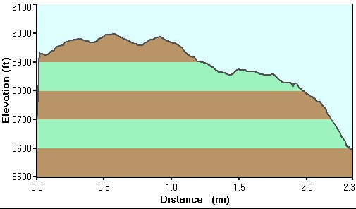
5.0 miles to the river and back
Time
2.50 [Hours]
Elevation Change
600 Total gain/loss [Feet]
Elevation Loss
300 Total Elevation Loss[Feet]
Hike Trail Type
Out and Back
Season
Best Season
- June
- July
- August
Worst Season
- January
- February
- December
Date Hike completed
May 02, 2009
Solitude
Solitude
Medium
Solitude Details
Average. Expect to share this trail with between 5-10 people.
Difficulty
Permits
Be Aware of
mountain bikes
Hike along the West fork of the Black river trail in the White mountains of Eastern Arizona.
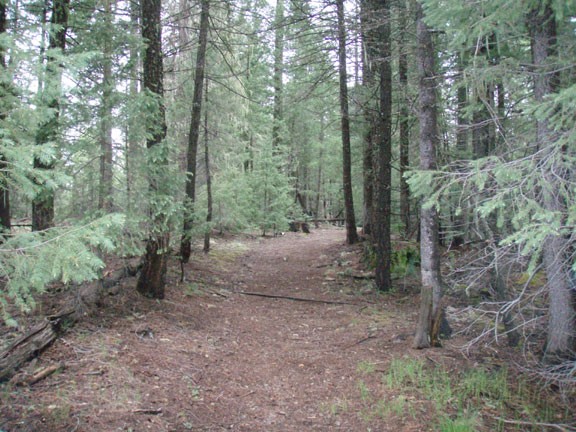
From the signed trailhead, walk along the well work trail through a peaceful pine forest. It's possible you'll share this trail with mountain bikers, so be aware. Fishermen also like this trail for it's access to the West Fork of the Black River.
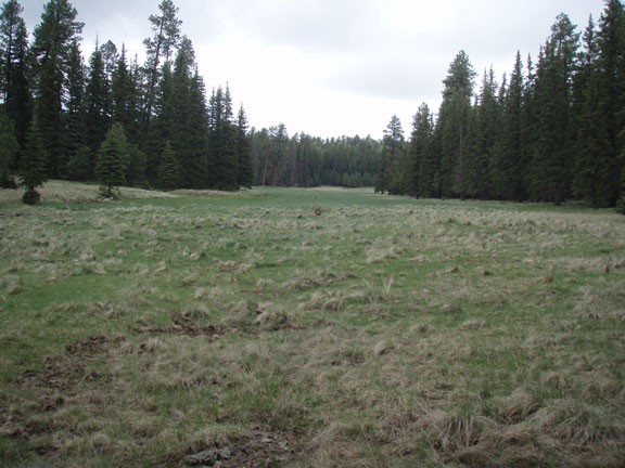
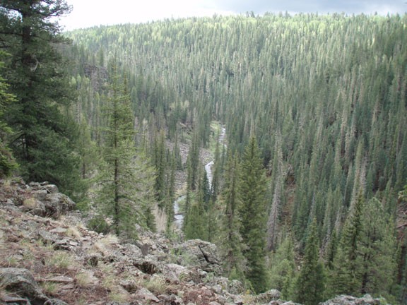
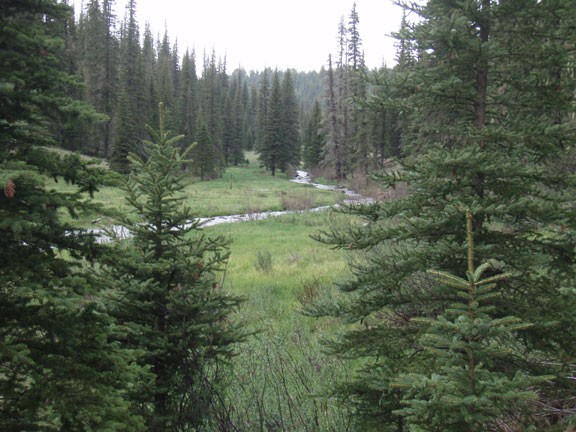
You'll cross a few meadows before reaching the impressive views of the rim of the river canyon. The trail becomes more rocky as it drops all the way down to the river. The rocks of the river are a great place to relax and enjoy the area.
When ready, return the way you came.
