
- Hikes in Arizona
- Superstition and Mazatzal Wilderness
- Weavers Needle - Summit
Weavers Needle - Summit
Location
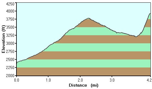
From the Phoenix area, take US-60 East, leaving the city limits. After leaving Apache Junction, continue about 8.5 miles, turning left onto signed Peralta Road (FR 77). After starting out as a paved road, this quickly turns into a maintained dirt road. The trailhead and parking appears after 7 miles on this road.
Hike details
Season
- January
- February
- March
- October
- November
- December
Solitude
Difficulty
Permits
Hike, technical climb, and scramble to the top of Weavers Needle in the Superstition mountains, Arizona.
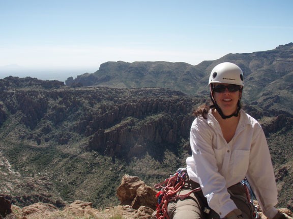
Anyone who has spent time in the Superstition Wilderness is familiar with the profile of Weavers Needle. This famous landmark is impressive for it's remoteness as well as it's perceived inaccessibility. Believe it or not, there is a route to the top of this legendary peak, although to do it safely requires training in technical rock climbing. To those with the necessary skills and stamina, summiting the Weavers Needle is sure to be an unforgettable experience.
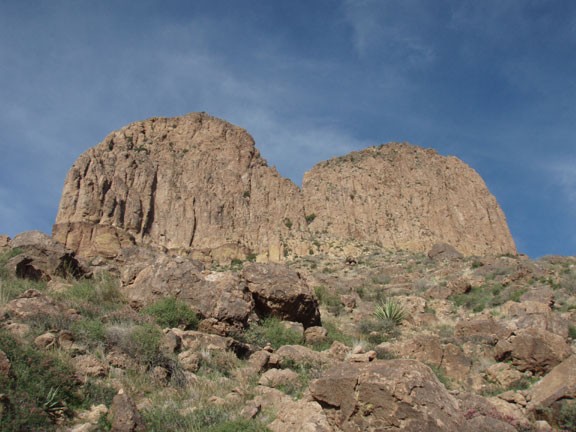
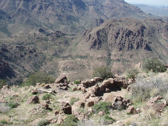
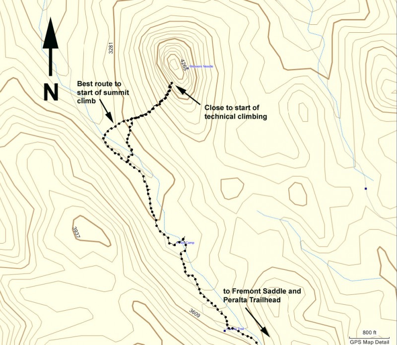
However, this adventure will require a good deal of planning and work to achieve. After acquiring the proper rope and protection gear, you'll need to hike the long approach to the base of the Weavers Needle. Details of the hike up to Freemont Saddle are here. From Freemont Saddle, you will continue walking into the depths of Boulder Canyon, with the Weavers Needle easily in sight on your right. As you walk along the trail, you will notice that Weavers Needle now morphs from one giant point into two distinct peaks. The notch between these peaks mark the start of the technical climbing portion of this ascent. Continue walking down the well worn trail in Boulder Canyon until you reach the faint trail (shown on the map) that turns off towards the notch in the needle. This turn off is marked by cairns, but is not easy to see.
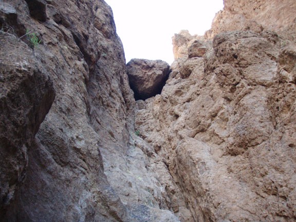
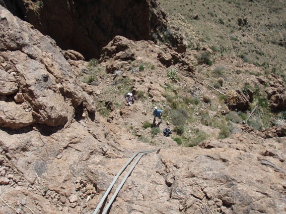
When you find this trail, you'll notice it becomes little more than a rock cairned marked route to the prominent notch at the needle. This climb is steep and slow, but following the cairns makes it easier to navigate. Eventually, you'll reach the notch. You'll know you've reached the technical climbing section when you see the chock stone in the notch. The top of this chock stone marks the first pitch.
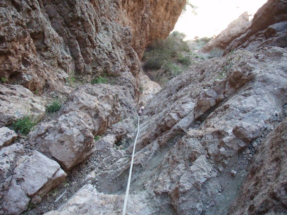
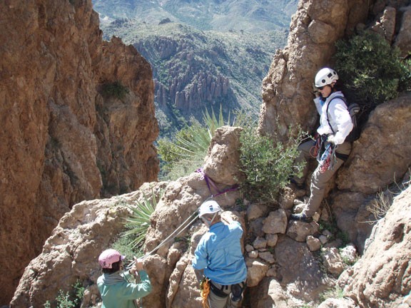
The first pitch is not difficult as technical climbs go. We decided the hardest climbing was probably 5.5 as you get over the chock stone, with most of the climbing around 5.3. However, a mistake would result in a potentially fatal fall, which is the reason for the climbing gear and protection. For setting pro on this pitch, there are two bolts, two rods hammered into the rock, and plenty of cracks for small nuts or small tri-cams. At the top of the first pitch are several bolts, some old, some new. Use the newer bolts and wrap a sling around the large boulder at the top for an anchor to belay the next climbers up.
Once everyone is at the top of the first pitch, there is a short (12') section of easy (5.3) climbing. After this, the rest of the climbing is class 4 scrambling. The best plan is to find a nearby tree to belay the short pitch, then start the scramble up to the summit. Even though you're scrambling now, take the rope with you !!
Once at the summit, your hard work is finally rewarded with unparalleled views of the surrounding Superstition Wilderness. Be sure to sign the log books in the green ammo can at the top to mark your achievement here.
You'll be glad you brought the rope, because there is a nice rappel station set up here to speed your descent from the top. Using the rope might be quicker to descend the fourth class scramble stuff too, so you can use the number of trees in the area for a solid anchor. You'll use rocks or trees to anchor your rappel down the 12' second pitch to get to the chock stone. Once at the chock stone, you'll use the bolts to set up a rappel station to rappel the final 200 ft or so. This final rappel is just a bit longer than the average 60 meter rope, so the best bet is to rappel about half way down and reset the rappel station for the final stretch.
Now all you have left is the long return hike to your car and the adventure will be complete!
