
- Hikes in Arizona
- Grand Canyon / Marble Canyon
- Ribbon Falls
Ribbon Falls
Location
Hike details
Season
- January
- February
- December
- June
- July
- August
Special Considerations for Fall and Winter hiking!
Solitude
Difficulty
Permits
Hike to Ribbon falls in Grand Canyon national park, Arizona.
So you're at Phantom ranch waiting for the next group of rafters to hike down so you can continue your river trip. Or perhaps you've hiked down the Bright Angel trail, camped at Bright Angel Campground, and you're looking for a hike to explore the area. Here's a good way to stretch your legs and still enjoy some nice scenery without too much climbing.
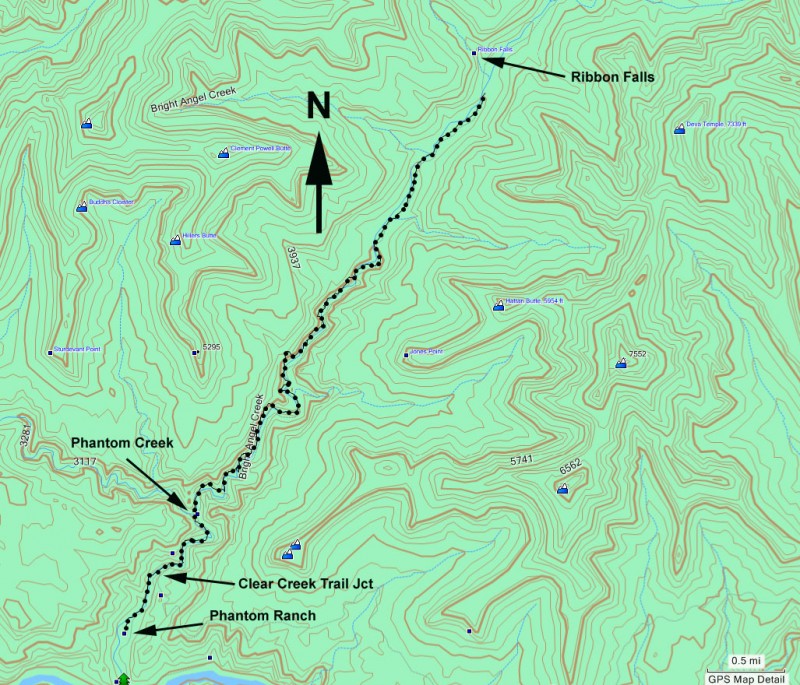
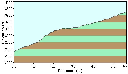
Ribbon Falls is a lovely oasis located about 5.7 miles up the Bright Angel canyon from Phantom Ranch. There has been a great deal of trail work on this section of the North Kaibab trail, so it makes for easy walking.
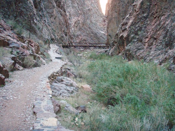
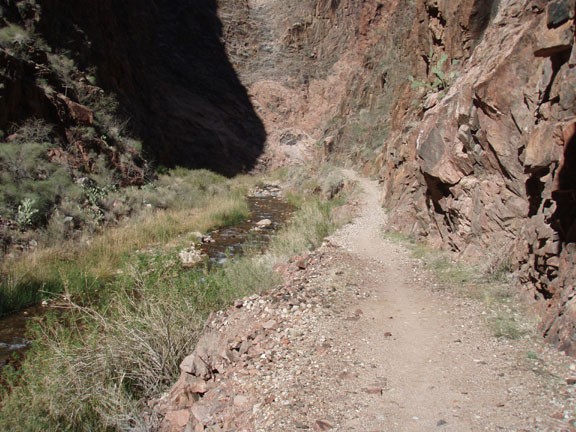
From Phantom Ranch, this trail heads north through an area known as 'the box' because the canyon narrows significantly and the trail crosses the creek a few times while staying high off the river. This section of the trail is especially enjoyable, as you'll be walking on a narrow trail above a perennial creek for several hours. There are also some bridges to cross the creek that add to the experience.
After this section the canyon starts to widen. Eventually, Ribbon Falls will be visible to your left across Bright Angel Creek. There is a sign on the trail pointing to 'Ribbon Falls bridge access'. If the water in the creek is high (or you don't feel comfortable rock hopping across the creek), continue on the North Kaibab trail to reach the bridge. Unfortunately, there is a healthy hill to climb and then descend to get to the bridge crossing. It is less work to take the faint trail to the left that heads directly to Ribbon Falls. There are a number of places to cross the creek without getting your feet wet. The trail to the base of Ribbon falls is more rocky and requires some minimal bush whacking to reach.
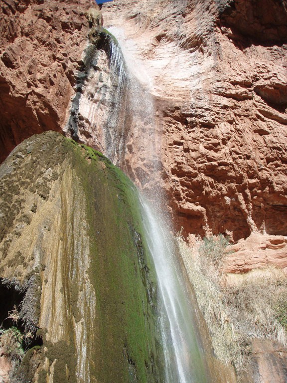
Ribbon falls is an excellent reward for your effort. The water falls onto a huge rock, completely covered in moss. There is also an alcove to your right to explore to give a different view of the waterfall.
When ready, return the way you came.
