
- Hikes in Arizona
- Phoenix Area and Central Arizona
- Stoney Mountain
Stoney Mountain
Location
From the Phoenix area, take state route 51 North to the Shea Boulevard exit. Take Shea Blvd West (left), turning left (South) onto 26th street. Take 26th street South, turning right (West) onto Mountain View Road. Take Mountain View Road until it ends in a cul-de-sac. Park in this area. This is a residential area, so be respectful. Alternate access points to this trail could be the Dreamy Draw park via trail 100 and taking Shea Blvd West until it ends, then parking there.
Hike details
Season
- January
- February
- March
- April
- October
- November
- December
Solitude
Difficulty
Permits
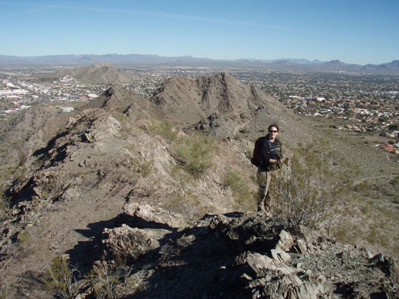
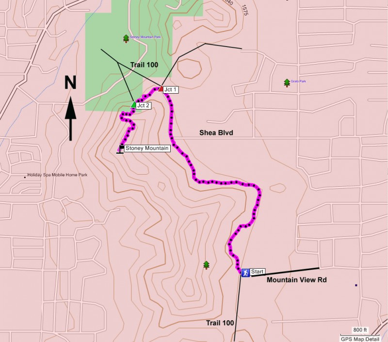
Hike up Stoney Mountain near Phoenix, Arizona.
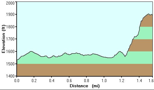
While recovering from a flu, I was looking for a short and easily accessed hike that would allow me to see if I had my energy level back. This hike did a good job of this, as well as providing some nice 360 views of the area as a reward.
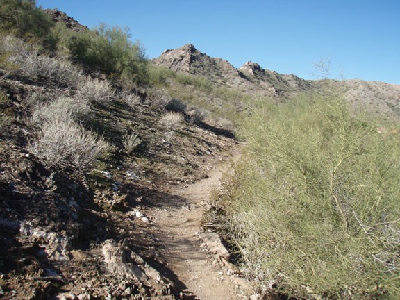
There are several ways to get to this peak. I think if I were to do it again, I'd park at the Dreamy Draw park and hike Trail 100 north to this area instead of parking in the neighborhood described. This is a pretty short hike, so starting at the park would add a bit of length and it leaves the neighborhood peaceful. However, since we started at the end of Mountain View Road, I'll describe the hike from that location.
Within a hundred yards of starting on this spur trail, you'll reach the well worn and popular Trail 100. Turn right here and walk about one mile to a trail junction (Jct 1 on the map). Trail 100 continues with a bend to the right. To your right is a trail that goes over a ridgeline towards civilization. To the left is a trail that heads West. Turn left on to the West trail. You'll climb for a bit, then the trail will drop down and head back towards Trail 100 again. When you reach a wash, turn left and follow the faint trail up this wash (Jct 2 on the map).
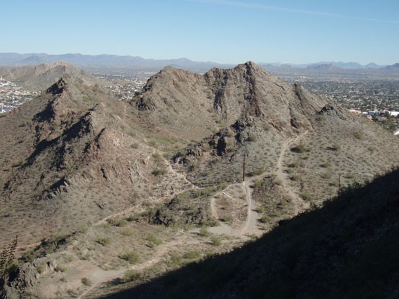
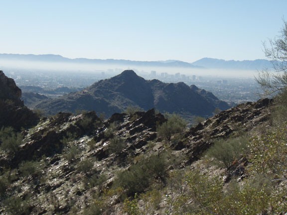
From this point, the hike becomes an exercise in route finding with some minor scrambling. Your goal is to get on top of the ridgeline. There are a few routes here, but no clear trails (at least none that we could see). Use your good judgment and make your way up to the highest point you can see. There will be some minor bushwhacking and some minor scrambling to get there. When you reach this point, you'll be on the ridgeline. Walk along this ridgeline to the top of Stoney Mountain. It's an airy summit and the views are a fitting reward for the scramble to get here.
After enjoying the views, you can take the same route back, or you can pick one of your own routes East to intersect with the unmistakable Trail 100. Which ever you choose, the rock is pretty crumbly here, so take your time.
