
- Hikes in Arizona
- White Mountains and Eastern Arizona
- Mount Baldy
Mount Baldy
Location
To the Trailhead: From the Phoenix area, take HWY-60 to Globe, turning north to Show Low. From Show Low, take HWY-260 east passing through Pinetop-Lakeside. Continue on HWY-260, turning right onto HWY-273. Drive 8.6 miles to the sign marking the Baldy Wilderness Trailhead. Turn right here and go the final 0.2 miles to the trailhead parking. There is a restroom here but no water.
Alternate route to the trailhead: If you're coming from the Greer area, instead of taking HWY-261, take HWY-373. Just outside the town of Greer, turn South on the well graded dirt road FR87 (also signed as Northwoods road. After following FR87 for 6.0 miles, turn left onto HWY-273 (also known as FR113). Drive 0.6 miles to the sign marking the drive to the Baldy Wilderness Trailhead. Turn right here and go the final 0.2 miles to the trailhead parking.
Hike details
Season
- June
- July
- August
- January
- February
- December
Solitude
Difficulty
Permits
Hike up to (almost) the top of Mount Baldy in Eastern Arizona.
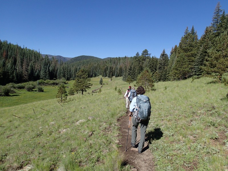
The Mount Baldy wilderness is an excellent summer destination for those of us trying to escape the desert heat. The extra drive to this area reduces the crowds significantly and the elevation rewards the added drive time. One of the more popular hikes in this area is the trail along the West Fork of the Little Colorado river to the (almost) peak of Mount Baldy.
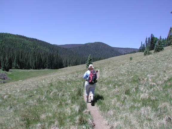
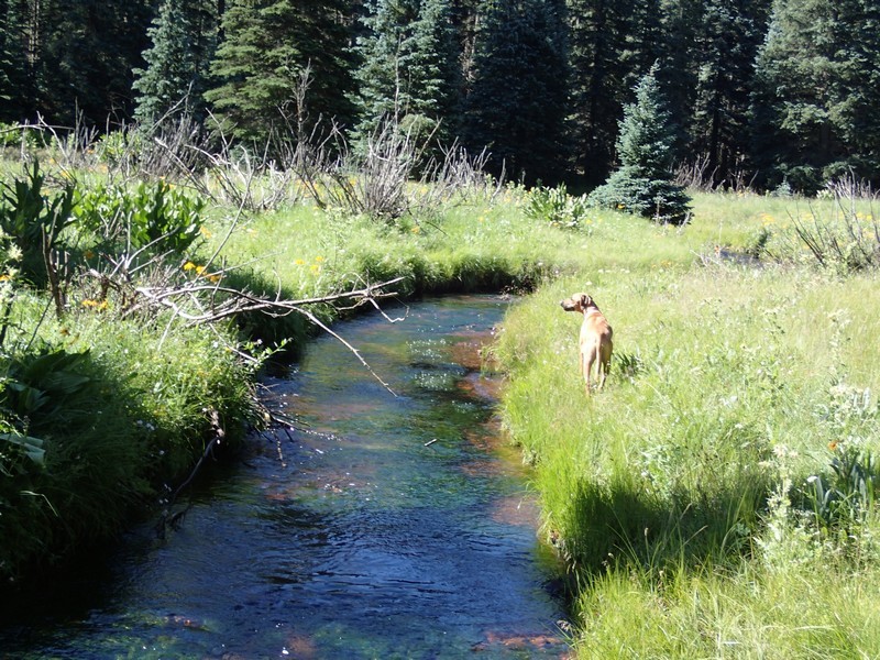
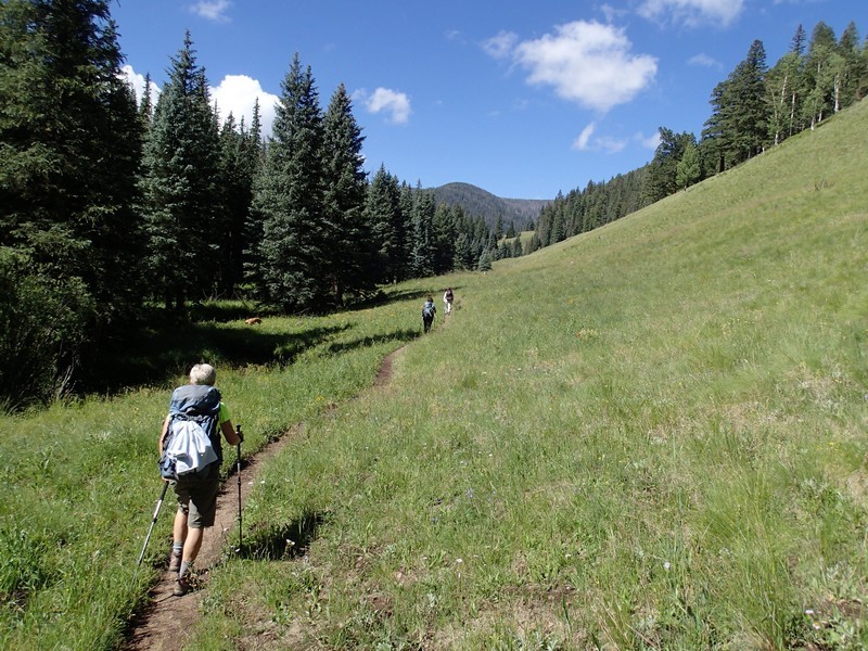
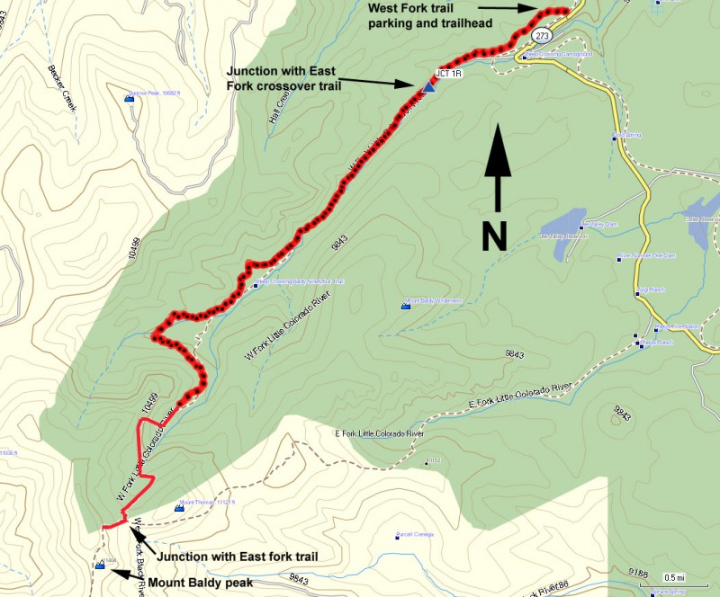
The well signed Mount Baldy trail #94 (also known as the Sheep Crossing trail) starts at 9200 ft, so you will feel the elevation in your hiking energy level. The trail is in excellent shape for the length of this hike and is easy to follow. The first two miles of this hike are some of the most charming as it follows along the bank of the West Fork of the Little Colorado river. Although the water level is really more like a creek, the proximity to the water and the periodic forest meadows add greatly to the joy of the hike. Butterflies and mountain wildflowers will be your companion on this section of the trail. After about 1.3 miles, you'll reach a signed junction with the Crossover trail (JCT 1R on the map). Turning left here will get you to the East Fork trail, which also leads to the top of Mount Baldy. Stay right here to keep on the West Fork trail.
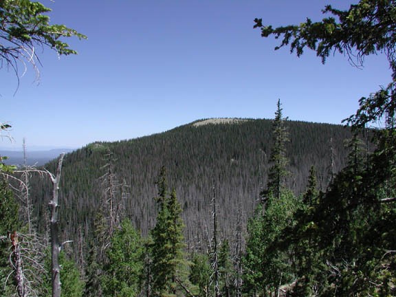
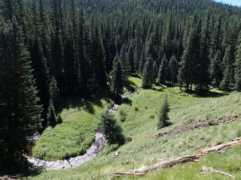
The trail starts to leave the side of the creek and becomes shadowed in a deep forest of spruce and fir trees. After about a mile of hiking in this forest, the trail begins a steady climb, including some switchbacks, to a ridgeline under the summit. This ridgeline is the highlight of the hike, as when the trees occasionally thin, excellent views open up of the surrounding lakes and mountains.
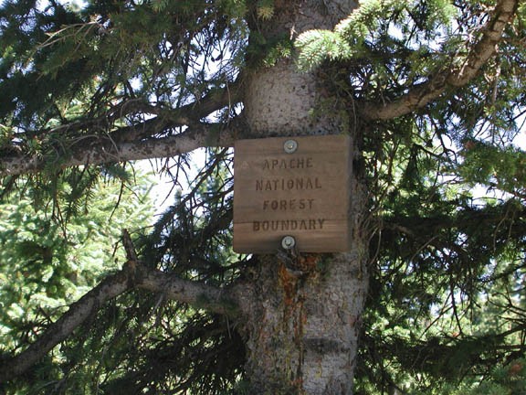
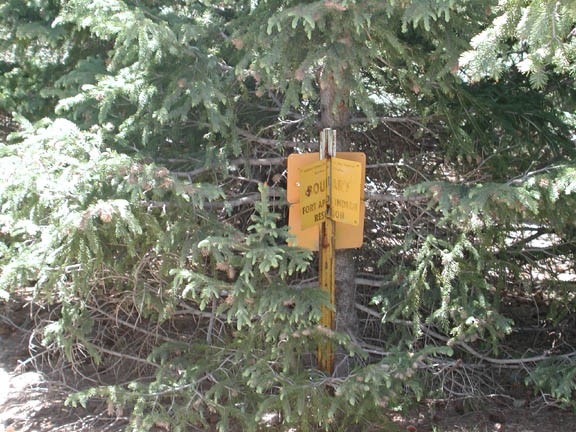
After hiking along the ridgeline, the trail begins to climb again as the forest becomes thinner still. After 6.5 miles of hiking, you will reach the junction of the East Fork trail that follows to this point along the East Fork of the Little Colorado river. This junction is signed, but the sign is in pretty bad shape and could be gone soon. Turning right at this junction allows you to continue a little way towards the top. Unfortunately, the trail soon enters Apache Reservation lands so the peak is off limits without a permit from the tribe. The junction from Mt. Baldy Wilderness to Apache Reservation is rather subtle, with a sign hammered to a tree and a yellow boundary marker (pictures below). As Mount Baldy is sacred to the Apache, we make this point the turn around. Please respect the Apache culture and resist the temptation to continue to the peak. Other accounts of this trail report backpacks of trespassers being confiscated... best not to risk it.
After snapping a few pictures, return the way you came.
Alternate hiking possibilities include a loop hike with the East Fork trail, however this would make for a very long day hike.
This hike peaks out at 11,300 ft so the altitude will very likely affect your energy level. At these elevations, it is necessary to drink more water than usual to stay hydrated.
The sign at the start of this trail gives 8 miles to the wilderness boundary, but we believe this is actually 6.5 miles.
Also, keep an eye out for wildlife here. We spotted four nice trophy size elk during our stay in this area.
