
- Hikes in Arizona
- Prescott Area
- West Spruce Mountain
West Spruce Mountain
Location
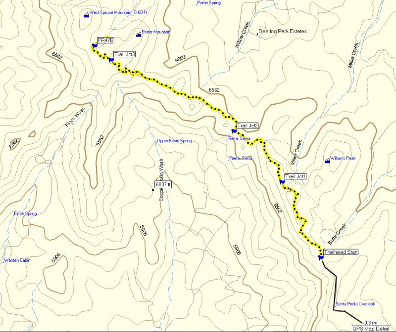
To the Trailhead: From the Phoenix area, take I-17 to the junction of HWY-69. Turn left onto HWY-69 towards Prescott. At the intersection between HWY-89 and HWY-69 towards the town of Prescott, turn left (HWY-69) and head towards the town of Prescott on Gurley Street. At the town square, turn left onto Montezuma Street (also HWY-89). Follow this street for 1 mile to the intersection with Copper Basin Road. Turn right onto Copper Basin Road and go 6 miles. After 3 miles on this road, it turns to well graded dirt. After 6 miles, turn right onto signed FR373. This intersection is a bit confusing, so make sure you check for the small brown sign marking FR373. Go 1.3 miles on this road (driving by the unsigned Sierra Prieta overlook and some great views) to the signed trailhead for #264. Park at one of the few pullouts near the trailhead.
Hike details
Season
- May
- June
- July
- August
- September
- January
- February
- December
Solitude
Difficulty
Permits
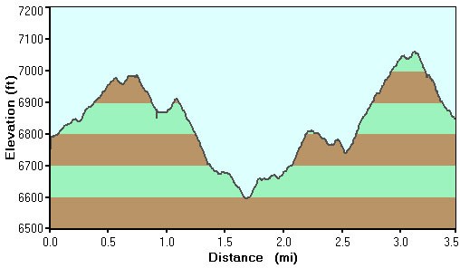
Hike up West Spruce Mountain in Prescott, Arizona.
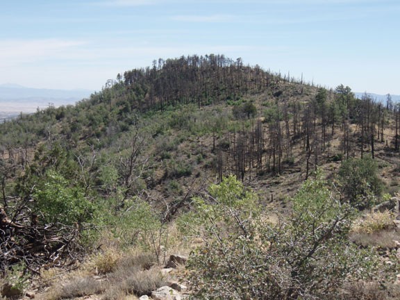
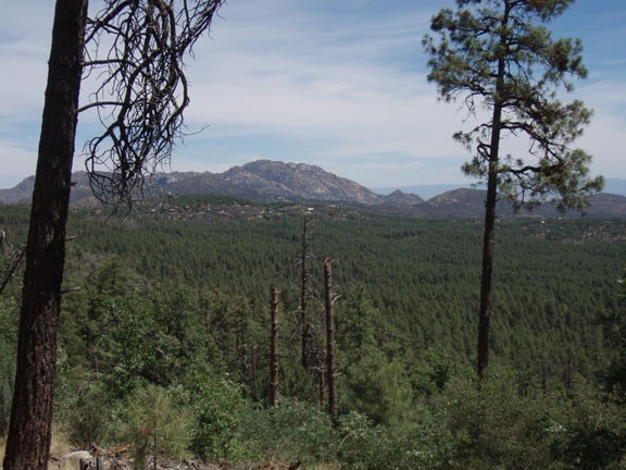
The Sierra Prieta mountains lie west of the city of Prescott. This hike follows along the ridgeline of that range, with great views on your left of Skull Basin and to the right of Granite mountain and Thumb Butte.
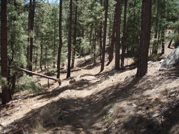
From the trailhead, follow this well worn trail along the ridgeline. This trail is the Eastern section of the West Spruce Trail. The views open up almost immediately as you walk through this Juniper forest. After about 0.8 miles of hiking, you'll reach a trail junction (Tr Jct1 on the map) heading off to the right, towards Williams Peak. This peak is easy to spot due to the fire damage. Stay left on this trail and continue along the ridgeline. This section of trail follows a barb wire fence to the left and passes next to (but does not go through) some gates in the fence. You'll start to see more fir trees here and more shade on the trail. After 1.4 miles, you'll reach another trail junction (Tr Jct2 on the map). This is where Trail 300 crosses your trail. You will want the trail that stays generally along the ridgeline (generally straight).
After 2.6 miles, you'll reach a signed junction (Tr Jct3 on the map), showing the distance of Copper Basin, Thumb Butte, and West Spruce Mountain. Stay on the trail headed towards West Spruce mountain until you reach FR47B. Calling FR47B a road is a bit generous, as it really looked more like a wide, rocky trail to me. FR47B is our turn around point for the hike.
Return the way you came.
