
- Hikes in Arizona
- Grand Canyon / Marble Canyon
- Fall Canyon
Fall Canyon
Updated
Location
How to Get There
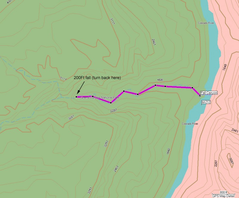
This hike is accessed from a river rafting trip on the Colorado River. Fall Canyon is located at river mile 212 on river right.
city
Grand Canyon
state
AZ
country
USA
Region
Grand Canyon and Marble Canyon area
Hike details
Distance
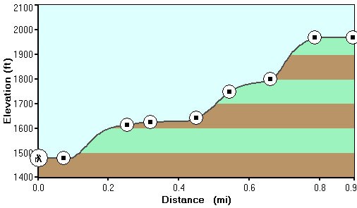
2.00 [Miles] Total
Hike Distance- Details
2.0 miles round trip (to the dead end wall and back)
Time
2.50 [Hours]
Time-details
It took us about 2.5 hours total.
Elevation Change
800 Total gain/loss [Feet]
Elevation Gain
400 Total Elevation Gain [Feet]
Elevation Details
400 ft gain.
Hike Trail Type
Out and Back
Season
Best Season
- April
- May
- September
- October
Worst Season
- June
- July
- August
Season Details
Spring, Winter, Fall.
Date Hike completed
October 01, 2007
Difficulty
difficulty detail
35 yr old Recommendation: Hard work for little reward. Unless you're camped here, I would recommend passing on this hike.
Permits
Be Aware of
Boulder hopping, scrambling, bush whacking
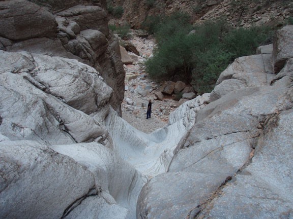
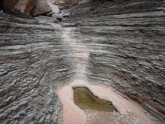
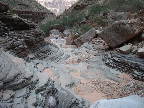
Hike up Fall canyon in Grand Canyon national park, Arizona.
If you find yourself camped at Fall Canyon and looking for a way to get some exercise, you may enjoy hiking and scrambling to the dead end of this canyon. There is a great deal of boulder hopping here with a little bush whacking, so be prepared. You can get around the first limestone fall by bush whacking on creek left and going around. From this fall, it is not too much farther to the end of the hike. The turn around point is a dead end in the canyon marked by a 200 ft red wall fall. This is a nice place to relax and restore your energy before heading back to the beach.
