
- Hikes in Arizona
- Grand Canyon / Marble Canyon
- Unkar Overlook and Ruin
Unkar Overlook and Ruin
Location
Hike details
Season
- April
- May
- September
- October
- June
- July
- August
Solitude
Difficulty
Permits
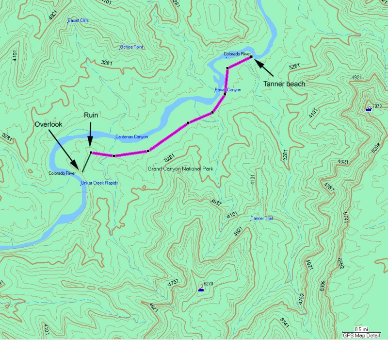
Hike to the Unkar overlook in Grand Canyon National park, Arizona.
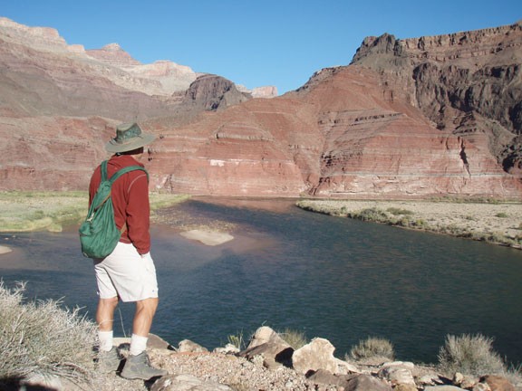
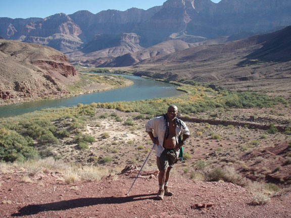
We took this hike starting from the Tanner beach, accessed via the Tanner trail. From the beach area, there is a well defined trail (known as the Escalante trail) that leads West along the Colorado river all the way to the Unkar mesa. The trail is dry and hot, so it would be a bear in the Summer. The wide open area this trail passes through is known as Furnace flats and it is easy to understand why. There is typically a breeze at the Unkar mesa that will help you cool down.
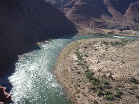
After you reach Cardenas Creek, the trail will start it's brief climb to near the top of Unkar mesa. There are a couple of trails here and you want to take care not to follow the Escalante trail too far. If you leave the immediate area of the Unkar mesa, you've gone too far. The overlook is easy to spot, as it lies at a saddle near the top of the mesa, facing West. From the overlook, you are rewarded with scary views of Unkar rapid and the Unkar delta. The Unkar delta is a treasure of native American ruins but unfortunately is on the wrong side of the river for hikers. If you have binoculars, you will be able to see the remains of some of the dwellings. This is a nice place to stop for lunch and relax.
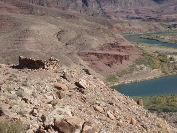
If you turn around and look towards the Colorado river to the North East, you will see the ruin. The ruin commands an impressive view of the inner canyon area and is worth exploring. It is a short walk over to the ruin.
