
- Hikes in Arizona
- Grand Canyon / Marble Canyon
- Rider Canyon
Rider Canyon

Location
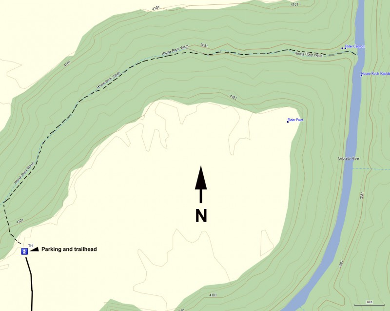
To get to the Trailhead: From the Flagstaff area, take HWY-89 North East towards Page. Turn North West on HWY-89A North West across Navajo Bridge and toward Vermillion Cliffs. Turn left on an unsigned dirt road on BLM land just after mile marker 557. Please close the gate behind you. 0.75 miles down this road, the road gets sandy, so be aware. After this sandy spot, the road improves significantly. After 2.1 miles, bear left at a road junction that goes over a cattle guard. At 3.3 miles, bear left again. At 4.6 miles, you will pass an old ranch, labeled as Kram Ranch on Topo maps. The road here will turn right and pass through a fence. At 5.6 miles, stay left. This road continues towards the Colorado River and the Marble Canyon area. There will be some signs here asking you to help save the Brady Pincushon cactus. There are some small brown hiker signs in this area to help you navigate. After 11.9 miles, bear left. At 12.2 miles, bear right. Around 14.2 miles, begin looking to your left when you see Rider Canyon. When you see the Cairns and small brown hiker signs, you know you're there. This road requires a high clearance vehicle.
Hike details
Season
- February
- March
- April
- October
- November
- June
- July
- August
Solitude
Difficulty
Skills
Permits
Hike in Rider canyon to the Colorado river in Arizona.
The road to get to this hike gave us many adventures when we took this hike in May of 2003. We made a wrong turn early and managed to get our truck mired in sand. It was hard work digging the truck out and we lost a great deal of hiking time because of it. After getting on the right road and powering through a short sandy turn, the road became much less sandy and it was passable by high clearance vehicles. There are a few rocky sections near the trailhead but they are on level ground, so going slow will be OK.
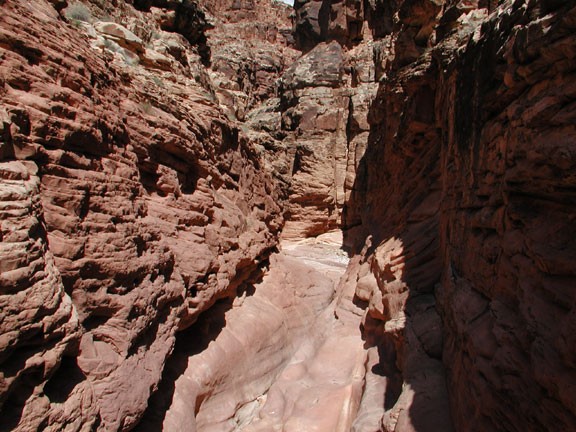
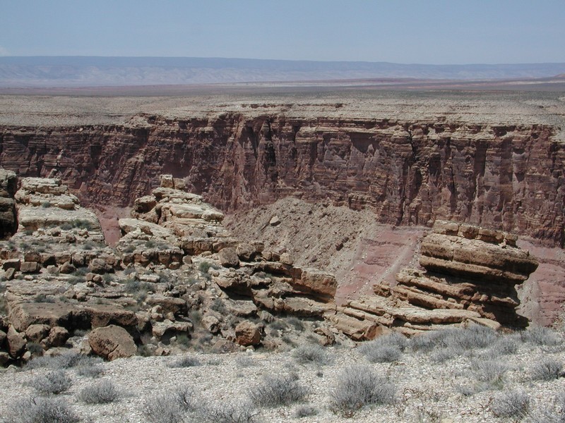
The other problem we had was the time of year. Late May turned out to be much too hot to comfortably do this hike. The hike starts at the rim of the canyon. The climb down requires a great deal of scrambling and route finding. One slide looks to block your progress, but there is a hidy-hole to your left that will get you down. Just before you leave this small canyon, try to find the natural air-conditioned cracks on the left. Footing is crumbly. About half way down, there are several routes down, so pick one and take your time. As you are making your way down, look back up the canyon once or twice to remember where you need to return. Although it isn't a great distance to the bottom of the canyon, this scrambling part took us a little over an hour. Once at the bottom of the canyon, make sure there are some Cairns to mark the climb back out. You could easily miss this exit if there aren't. Turn right and head down the canyon.
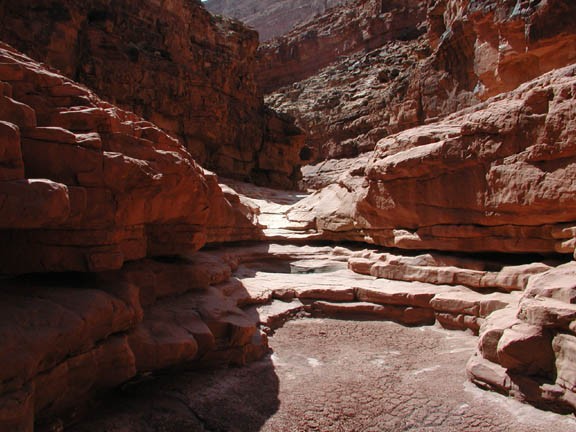
Once on the bottom of the canyon, the travel improves significantly as you get closer to the narrows of the canyon. There is some boulder hopping early, but soon changes to flat walking on slick rock. The first major obstacle is a 12' dry fall. You can either walk back up canyon and take the walk around on the right side of the canyon, which takes about 200 yards to re-enter the canyon, or jump down. We took the walk around on the way down, then changed tactics on the way up. We used one of our taller hikers as a foothold for the others and then helped him up afterwards. There are some pools past this point, but when we hiked this, they were mostly all dry and didn't present much of an obstacle. At different times of the year, these pools would exist and need to be navigated around. The frogs and lizards that live near the pools were still around, so watch your step, lest you squish a frog.
The final obstacle requires either a 15 foot rappel or the walk around route to the left, marked by Cairns. The Colorado River is only about 0.2 miles past this point, but we didn't make it past this obstacle because we were running low on time. From the notes I've read, there are some rapids here and flat rocks for resting and watching the Colorado go by.
The climb out in the heat was a killer. We even managed to pick up a nail in the tire as we drove back out. Hopefully, you have better luck than we did.
