
- Hikes in Arizona
- Grand Canyon / Marble Canyon
- South Kaibab
South Kaibab
Location
From Flagstaff, take HWY 180 north towards the Grand Canyon. Once you enter the park, you'll head east on the East Rim Drive (Yaki point turnoff). The trailhead is closed to parking, so you'll need to take the free shuttle bus from multiple points in the Grand Canyon village to get to the trailhead. There are pit toilets, but no water at the trailhead.
Hike details
Difficulty
Kids in good shape can make this hike with adult experience and supervision. Don't even mention this hike to Grandma... it would probably give her a heart attack just listening to the description. She can listen to the nice Ranger at the rim talk about geology.
Permits
SPECIAL CONSIDERATIONS FOR WINTER AND SUMMER TIMES:
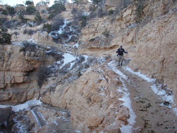
, For Winter Hiking: Remember that the South Rim is damned cold in the winter. Snow and Ice will cover the trail for the first few miles. Crampons recommended.
, For Summer Hiking: Get an early start and don't hike during the heat of the day. Remember that the bottom of the canyon will be MUCH hotter than the top.
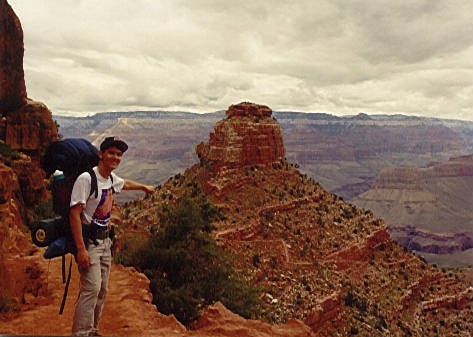
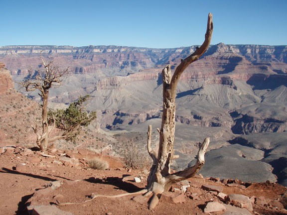
Hike the South Kaibab trail in Grand Canyon National park, Arizona.
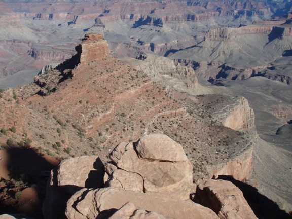
This is a well hiked and well maintained trail in the Grand Canyon. I prefer descending the Grand canyon from the South Kaibab and going back up the Bright Angel Trailhead. The views are amazing, as this is one of the few rim to river trails that stays along the ridgeline. Chances are you'll be hiking from one photo opportunity to another.
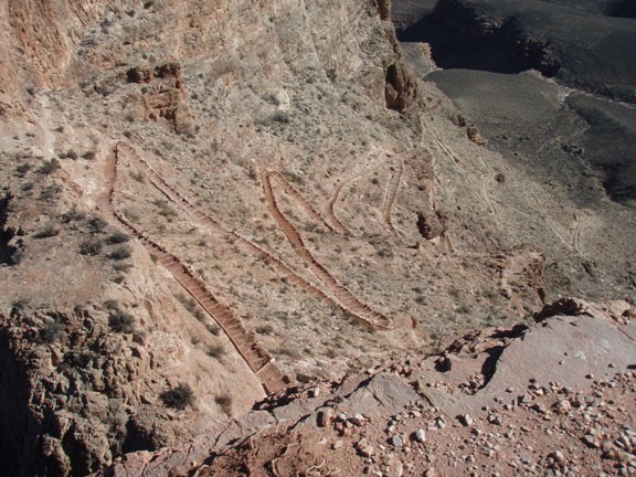
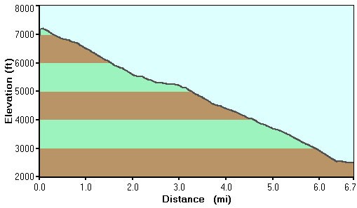
Simply put, this trail is steep. Flat doesn't exist on this trail.
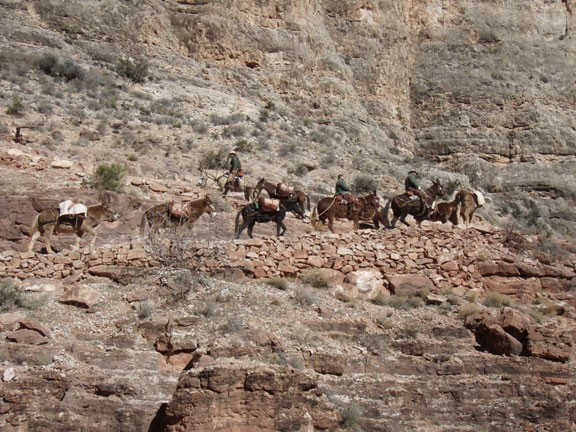
We have to share this hike with mules. When a mule train approaches, move to the side and wait for them to pass. Wave to the nice guides and sore bottomed people as they admire your amazing stamina in hiking the Grand Canyon.
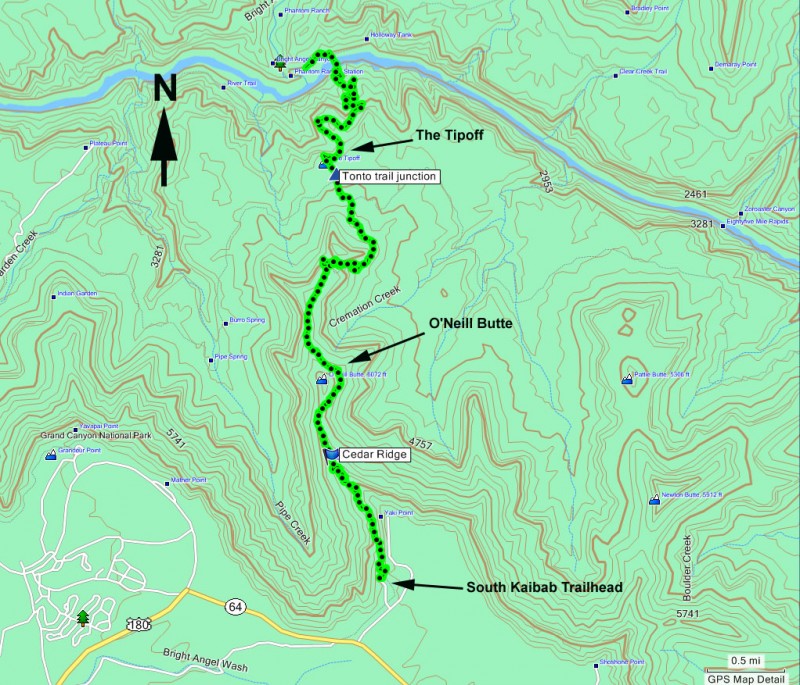
After about 1.5 miles of hiking, you will reach Cedar ridge. There are some wonderful views here to enjoy, which makes this a popular spot for day hikers. There are also toilets here. After 4.4 miles of hiking from the rim, you'll reach the trail junction with the Tonto trail (also known as 'The Tipoff'). There are bathrooms here as well. The Tonto trail parallels the river and is a popular route for creating loop hikes between the trails that descend from the rim to the river.
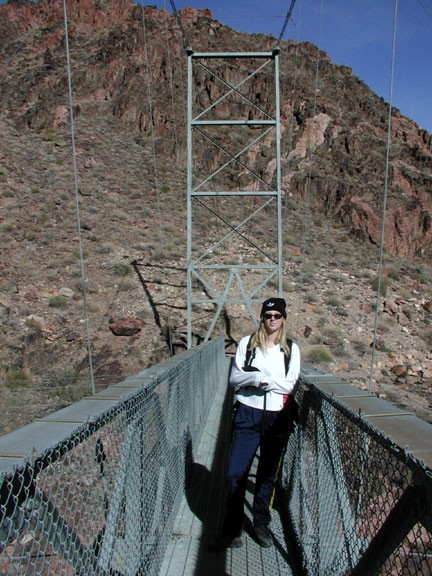
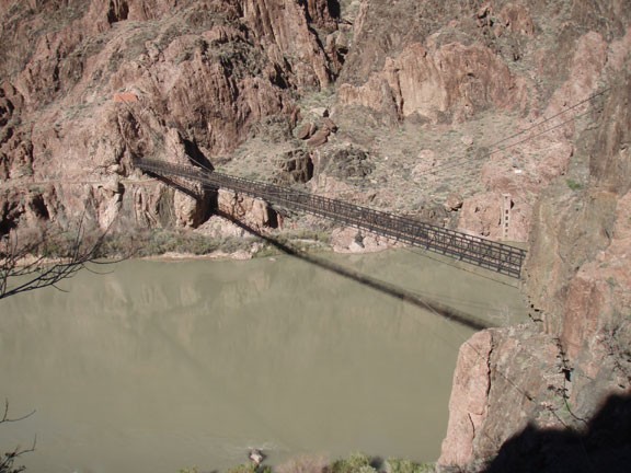
After much hiking, you'll reach the Colorado River and a really cool suspension bridge (Black Bridge) to cross to get to the campground. You will sleep good that night! Spend a few days in the canyon before climbing back out. You'll be glad you did.
