
- Hikes in Arizona
- Grand Canyon / Marble Canyon
- North Kaibab
North Kaibab

Location
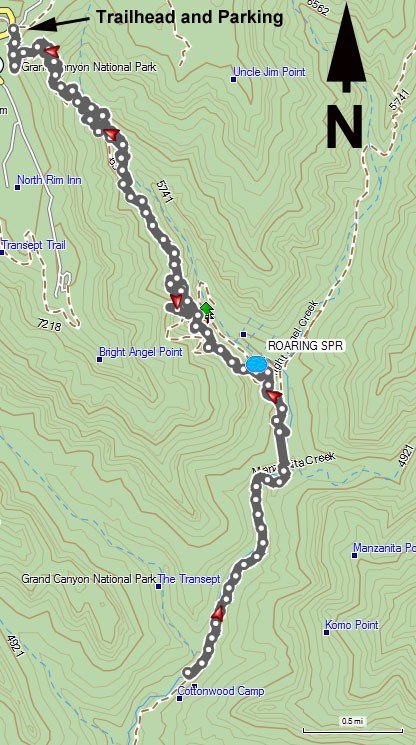
From Flagstaff, take HWY 67 south towards the Grand Canyon. Once you enter the park, you'll head 11 miles south of the park entrance (about 2 miles north of the lodge) to the signed parking area. This is a popular trailhead, so parking can be tricky to find.
Hike details
Season
- May
- June
- September
- October
- January
- February
- July
- August
- December
Solitude
Difficulty
Permits
SPECIAL CONSIDERATIONS FOR WINTER AND SUMMER TIMES:
, For Winter Hiking: Remember that the North Rim is damned cold in the winter. Snow and Ice will cover the trail for the first few miles. Crampons recommended. The North Rim road is closed from Mid November to Mid May due to heavy snows.
, For Summer Hiking: Get an early start and don't hike during the heat of the day. Remember that the bottom of the canyon will be MUCH hotter than the top.
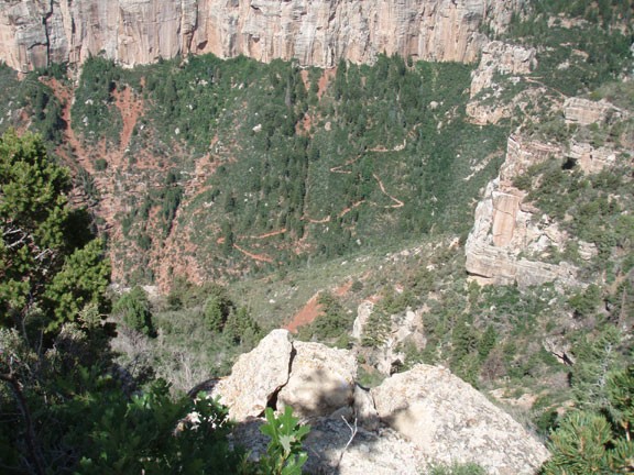
Hike the North Kaibab trail in Grand Canyon National Park, Arizona.
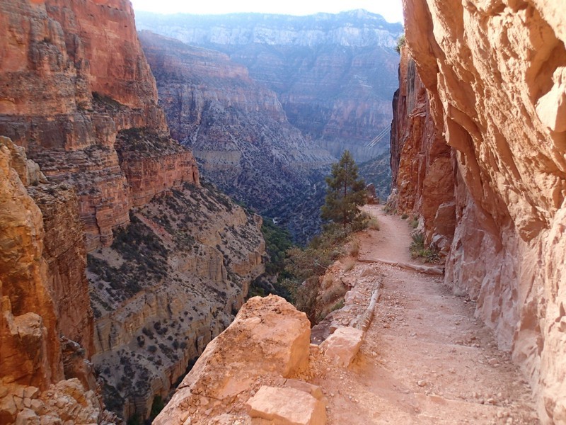
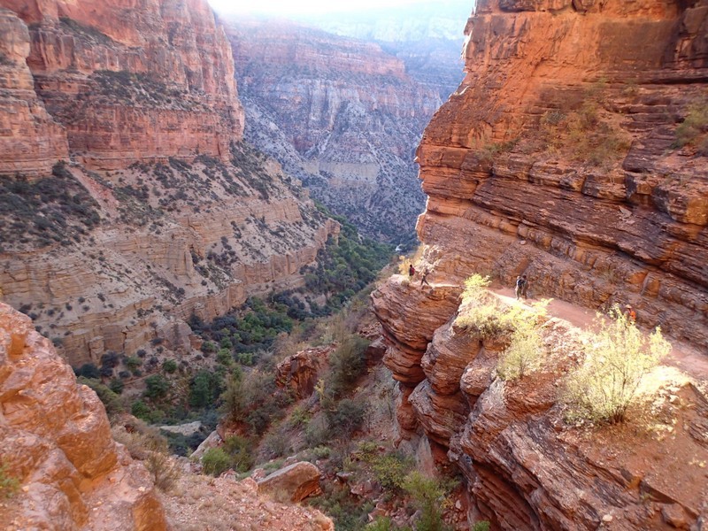
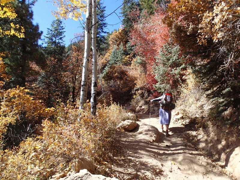
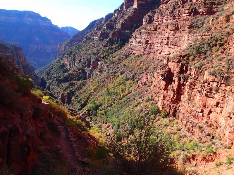
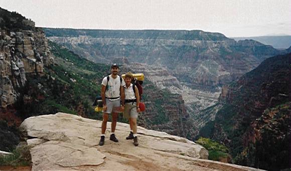
This is a well hiked and well maintained trail in the Grand Canyon. If you're on the North Rim of the Grand Canyon and you want to hike into the canyon, this is the only route to the Colorado River. The views are amazing. Chances are you'll be hiking from one photo opportunity to another.
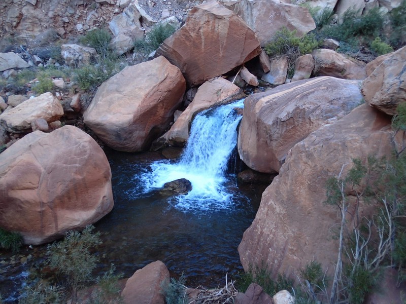
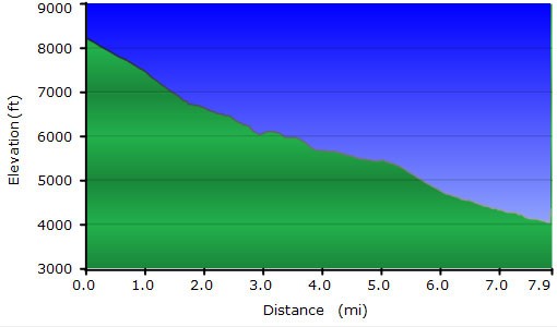
This hike is described only to the Cottonwood Campground. The hike follows Roaring Springs Canyon down to the Bright Angel Canyon. Roaring Springs appears a few miles into the hike and you can hear it's falling water get progressively louder as you get closer. After hiking 4.7 miles from the top, there's a short trail to the base of the Roaring Springs (ROARING SPR on the map). You can fill your water here or at nearby Manzanita rest area. After walking 6.8 miles, you arrive at the Cottonwood Campground along side the Bright Angel Creek.
Simply put, this trail is steep. Flat doesn't exist on this trail.
We have to share this hike with mules. When a mule train approaches, move to the side and wait for them to pass. Wave to the nice guides and sore bottomed people as they admire your amazing stamina in hiking the Grand Canyon.
The trail continues from the Cottonwood campground all the way to Bright Angel Campground, 7 miles further.
SPECIAL CONSIDERATIONS FOR WINTER AND SUMMER TIMES:
* For Winter Hiking: Remember that the North Rim is damned cold in the winter. Snow and Ice will cover the trail for the first few miles. Crampons recommended. The North Rim road is closed from Mid November to Mid May due to heavy snows.
* For Summer Hiking: Get an early start and don't hike during the heat of the day. Remember that the bottom of the canyon will be MUCH hotter than the top.
