
- Hikes in Arizona
- Grand Canyon / Marble Canyon
- Soap Creek
Soap Creek
Location
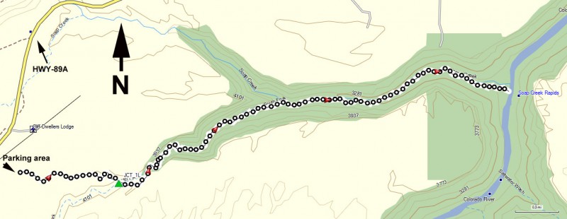
From Flagstaff, take US Highway 89 toward Page, AZ and then turn onto 89A toward Jacob's Lake, AZ. After crossing the Colorado River at Navajo Bridge, the BLM parking lot is near mile marker 548 and near the town of Cliff Dwellers, AZ. Follow the signed dirt road through a gate (please close it behind you). The trailhead is about 1/2 mile from 89A. From Flagstaff, the drive is about 2 hours.
Hike details
Season
- March
- April
- September
- October
- January
- February
- June
- July
- August
- December
Solitude
Difficulty
This is for the young, or those of us that are still young at heart, in good shape, and have our life insurance paid up.
Permits
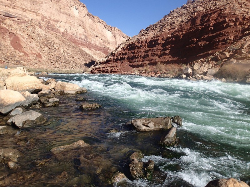
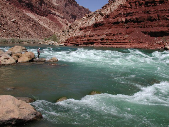
Hike Soap Creek near the Colorado River, Arizona
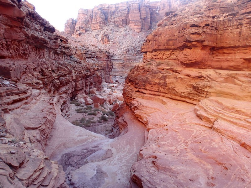
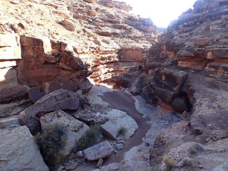
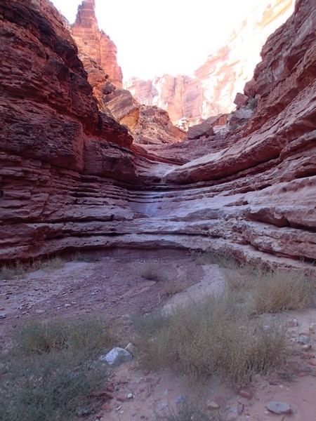
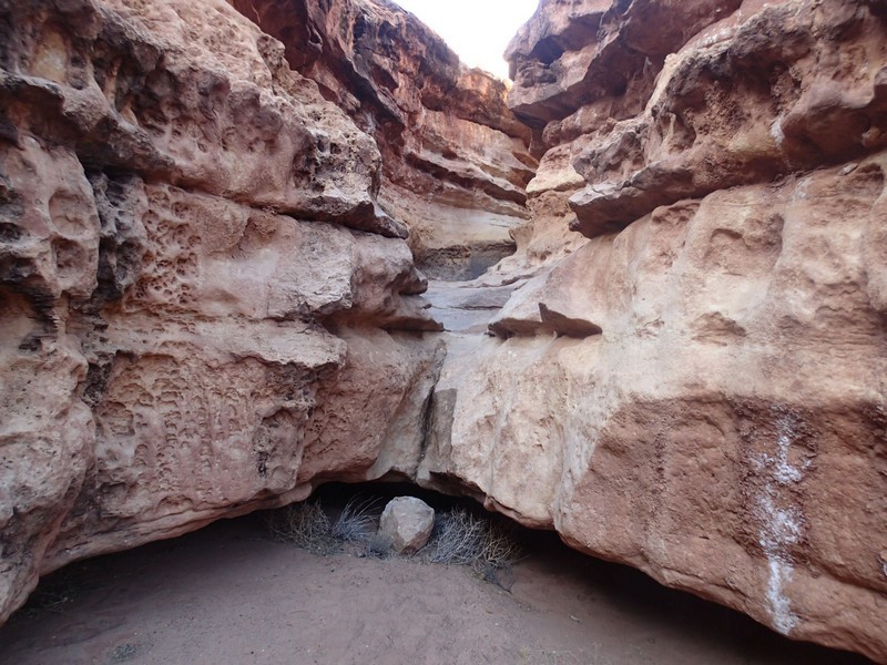
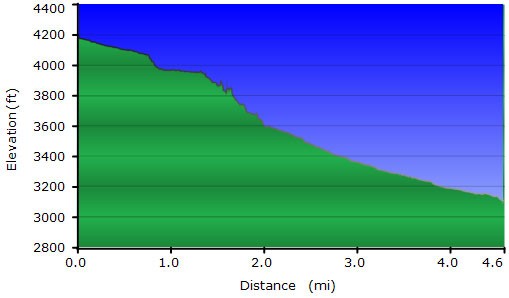
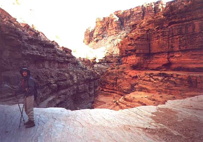
This was a very enjoyable hike through a canyon to the Colorado River. There are numerous points where you are not hiking, but scrambling and doing some mild climbing. There's some tricky route finding involved.... look for the helpful cairns when you're stumped. The start of the hike proceeds through a sandy wash but the walls quickly spring up around you and the scrambling begins. After 0.7 miles of hiking/scrambling you'll reach the South fork of soap creek. Turn left here (JCT_1L on the map) to continue down canyon. The walls grow higher and the canyon gets more scenic in this section. Most of the scrambling is in this section as well. Soon enough, the canyon flattens out and you'll be back on relatively flat ground most of the way to the Colorado river.
Soap Creek is one of the first rapids that river rafters hit when they start their trek down the Colorado River. We were lucky enough to see some brave rafters pick their way through the rapid. These were hearty folk, setting out on the 50 degree Colorado River in December!
