
- Hikes in Arizona
- Superstition and Mazatzal Wilderness
- Dripping Springs
Dripping Springs
Location
To get to the trailhead: From the Phoenix area, take US-60 East, leaving the city limits. After leaving Apache Junction, continue about 8.5 miles, turning left onto signed Peralta Road (FR 77). After starting out as a paved road, this quickly turns into a maintained dirt road. The trailhead and parking appears after 7 miles on this road. There is a restroom at the trailhead, but no water.
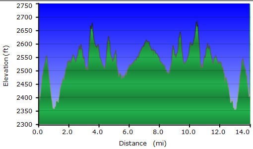
Hike details
Season
- January
- February
- March
- October
- November
- December
Solitude
Difficulty
Permits
Hike to Dripping Springs in the Superstition Wilderness, Arizona.
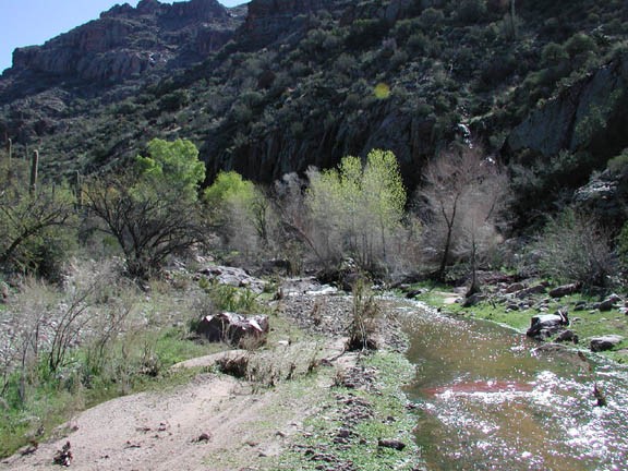
I should start by saying we took this hike under some rare circumstances. It had been raining for three days prior to a clear and sunny hiking day. Nearly every desert wash we crossed (which would usually be dry) was flowing. The wash near dripping springs was flowing like it was a perennial creek. The multiple crossings of this wash would have been a snap had it been dry, but the water made it more interesting. We were enchanted by all the water on this hike. In fact, the flowing wash made the arrival at dripping spring somewhat anti-climactic.
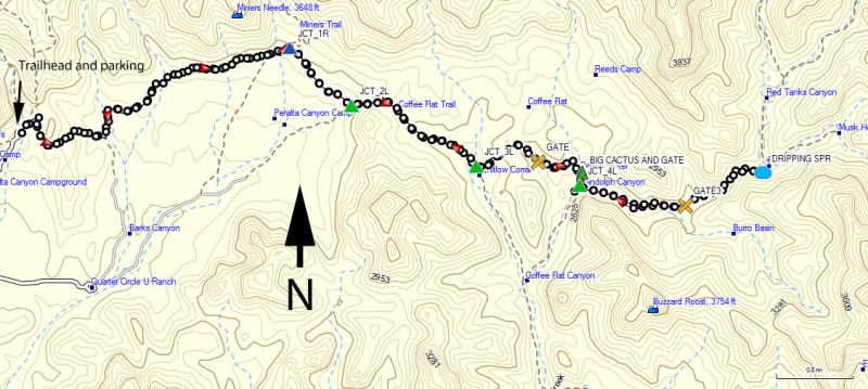
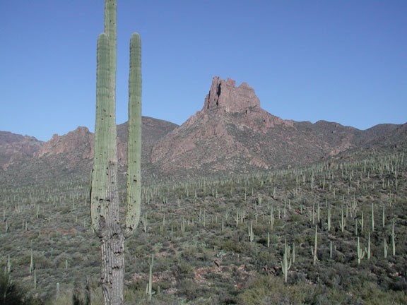
Start from the Peralta Trailhead. Take the Duchman's Trail (TR104) East, skirting along the South edge of the wilderness boundary. You can see the Quarter Circle U ranch to the south, which was a popular starting point for prospectors looking for the Lost Duchman's mine. This section of the trail is attractive for the abundance of Saguaro in this wide open valley. The trail continues past Miner's Needle on your left (look for the hole in the rock that suggested the name). After walking about 2.2 miles, you come to the well signed junction (JCT_1R on the map) of TR108 (Coffee Flat Trail). Turn right here. After another 0.6 miles on this trail, there is a signed trail junction to stay on the Coffee flat trail (JCT_2L on the map).
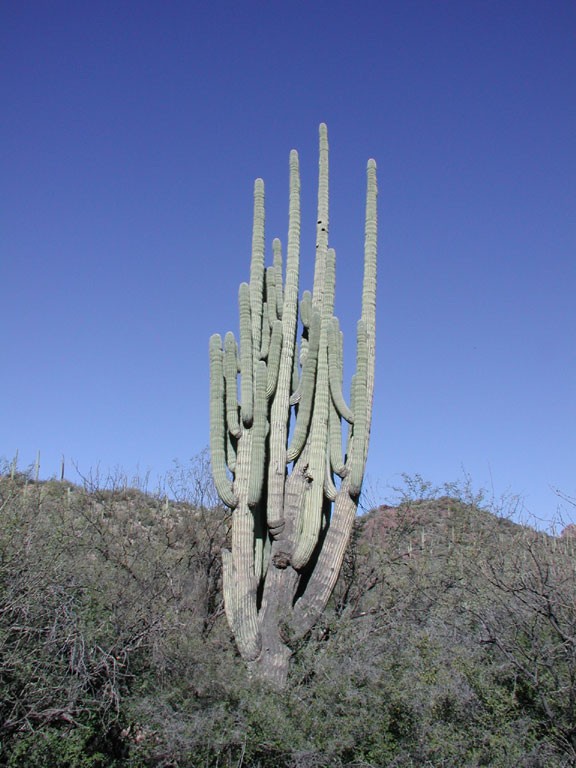
This area follows the Whitlow Canyon wash (JCT_3L on the map) eventually coming to a windmill. This windmill is known as Reids water. Go through the gate (close all gates behind you) and continue along the trail. The trail now enters Randolph Canyon. There is an enormous cactus here (BIG CACTUS AND GATE on the map). This next trail junction (JCT_4L on the map) is easy to miss. The trail junction is at a second windmill and a sign, but the sign is not easy to spot in a tree. Turn left here. Randolph canyon is very pretty and very different scenery from the previous desert hiking. After about 7 total miles of hiking, the trail starts to get very lush, with tall cottonwoods and greenery. Watch the right side of the trail for some water seepage from the rocks. You will notice some vegetation clinging to the walls. A closer look reveals dripping springs, with water dripping out of the rock into the wash.
This is a pretty place to have lunch, as there are good shade trees here. When you've finished relaxing, return the way you came.
