
- Hikes in Arizona
- Phoenix Area and Central Arizona
- Rock Knob Loop (Estrella Mountain Regional Park)
Rock Knob Loop (Estrella Mountain Regional Park)
Location
To get to the trailhead: from the Phoenix area, take I-10 West towards Los Angeles. Turn left (South) on the Estrella Parkway exit. Drive 5.1 miles South on this road and turn left onto West Vineyard Avenue (near a golf course). You'll very quickly make a right turn onto Casey Abbot Drive, which puts you in the Estrella Mountain Regional park. After stopping at the entrance shack to pay your toll, continue to follow Casey Abbot Drive. You'll be following the signs for the "Rodeo Arena and Trails". Park next to the trailhead near the Rodeo Arena.
Hike details
Season
- January
- February
- March
- April
- May
- October
- November
- December
Solitude
Difficulty
Permits
Hike the Rock Knob loop in the Estrella Mountain Regional Park in Arizona.
The Estrella Mountain Regional park south of Goodyear, Arizona contains nearly 20,000 acres of protected mountains and desert. It is located rather close to the Phoenix metropolitan area, which makes for a convenient location for a hike without a long drive. There are a number of enjoyable, well signed trails through this park. The one described here is a loop hike around a prominent feature known as Rock Knob hill.
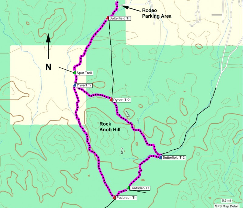
After parking near the Rodeo Arena, take the well signed trail heading south out of the parking area (signed as Coldwater Trail). This old jeep road is the main trail route into the desert area of the park. Since there are a myriad of trails you need to take for this loop, follow the instructions below to loop around the Rock Knob hill.
Mileage Trail Junction
0.2 miles Jct of Butterfield and Coldwater Trails (take right)
1.0 miles Jct of Coldwater and Spur Trails (take left)
1.2 miles Jct of Coldwater and Dysart Trails (take right)
2.7 miles Jct of Coldwater and Pedersen Trail (take left)
2.9 miles Jct of Pedersen and Gadsden Trail (take left)
3.6 miles Jct of Gadsden and Butterfield Trail (take left)
4.6 miles Jct of Dysart and Butterfield Trail (take left)
5.1 miles Jct of Coldwater and Dysart Trails (take right)
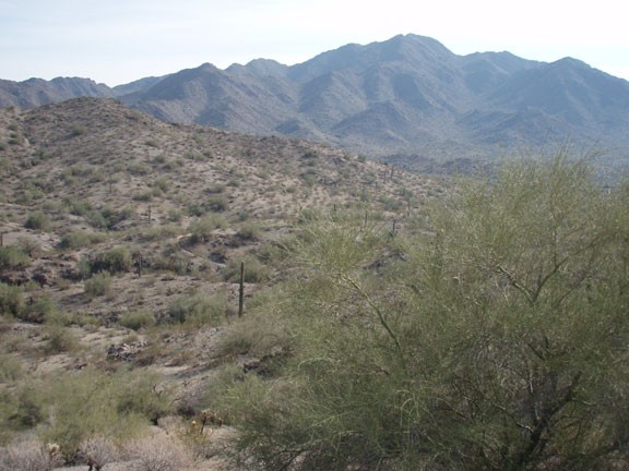
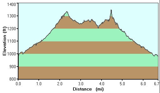
There are two highlights to this hike. The first is reached after about 1.5 miles of hiking, when you access views of the Southern part of the park. The desert goes on as far as the eye can see, and it is very easy to forget you are just a few miles from civilization.
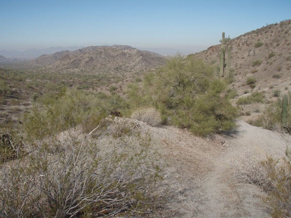
The second highlight of the hike is reaching the highest point of the Butterfield trail, which gives nice views of the surrounding area.
Enjoy !
