
- Hikes in Arizona
- Phoenix Area and Central Arizona
- Tom's Thumb
Tom's Thumb
Location
From the Phoenix area, take state HWY-101 North to the Pima Road exit. Drive north on Pima road and turn right onto Happy Valley road. Go east on Happy Valley road, which will turn North on it's own and become 118th street. Turn right onto signed Ranch Gate Road. Go 1.3 miles to 128th street and turn right. After 1 mile more of driving, you'll reach the signed trailhead. There are restrooms at the trailhead, but no water.
Hike details
Season
- January
- February
- March
- April
- October
- November
- December
Solitude
Difficulty
Permits
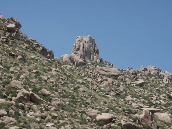
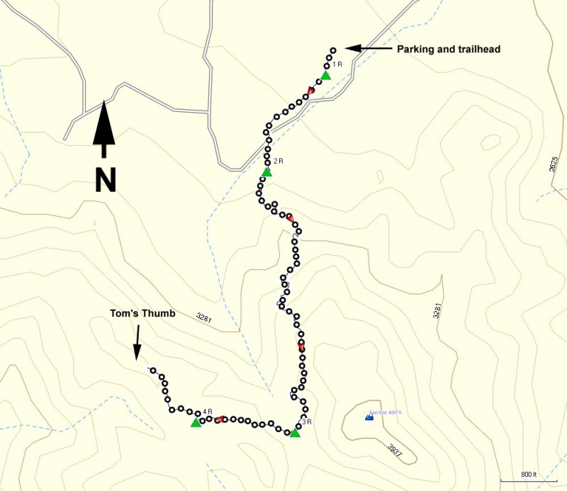
Hike to the base of Tom's Thumb near Scottsdale, Arizona.
Tom's thumb is a prominent granite bump in the McDowell Mountain preserve, easily visible from the Scottsdale area. This popular technical rock climbing destination is also a fun hike to some impressive views.
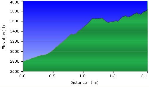
From the parking area, follow the signs from the main visitor center to start heading towards Tom's Thumb. The trail junctions are signed and the trail is easy to follow. It's a steady climb to the McDowell Mountains ridgeline. You'll stay right at the first trail junction after 0.1 miles of hiking (1R on the map) and stay right again at the signed trail junction with the Feldspar trail (2R on the map) after 0.4 miles of hiking. There are a few climbing trail spurs here (which are all signed) so just ignore them and keep following the main trail as it steadily climbs to Tom's Thumb. After 1.3 miles of hiking, stay right at the signed junction with the East end trail (3R on the map).
Once you get near Tom's thumb, you need to leave the Tom's Thumb trail and take the signed climbing trail to the base of Tom's thumb (4R on the map). This section of trail is a bit less defined, but still easy to follow.
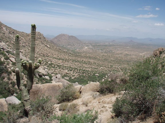
Tom's Thumb stays visible most of the hike, so it is easy to set your bearings in relation to your goal. After your climbing you are rewarded with the views of the surrounding area, including the Four peaks, Piestewa Peak, and Camelback mountain. If you're lucky, you may get to watch some rock climbers practicing their art here.
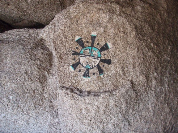
Interestingly, there's more! Just west of the Thumb is a path that leads to the Ogre's den. It is a cave that was created by boulders leaning up against each other. There is a hiker log there, along with some interesting trinkets and rock art. It is a bit tricky to find, so you may have to search around a bit.
While we were up at the top, we ran into fellow hikers Brent and Colleen, who showed us the location of the Ogre's Den (Brent and Colleen: thank you!). When ready, return the way you came.
