
- Hikes in Arizona
- Phoenix Area and Central Arizona
- Icehouse Canyon Trail #198
Icehouse Canyon Trail #198
Location
To get to the trailhead: from the Phoenix area, take US-60 East toward Globe. Once in Globe, turn right on Hill street, just past mile post 251. Please watch your speed in this area, as it is a residential area. Follow the Tonto Forest signs 1.2 miles and turn right onto Icehouse road. This soon becomes FR112. Drive 1.8 miles to a stop sign. Drive another 2 miles to the end of the pavement. Drive 0.5 more miles to the CCC picnic area and trailhead. The dirt road is in very good shape and passenger cars are no problem.
Hike details
Season
- March
- April
- May
- September
- October
- November
Solitude
Difficulty
Permits
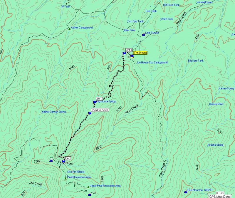
Hike along the Icehouse canyon trail near Globe, Arizona.
Driving through Globe on the way to other areas of the state, you would never know what kind of beauty lies in the mountains around this area if you never stop to see them. To the south of Globe is Pinal Mountain and there are some aggressive and impressive trails that head up to the top.
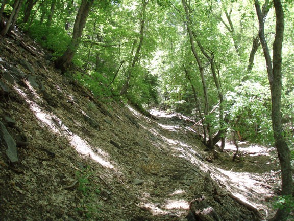
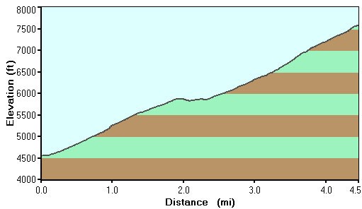
From the CCC picnic area, there are two trails that start from this location. From the east, the six shooter trail (Trail 197) heads towards the same destination. However, we are looking for the Telephone Trail (Trail 192) that starts from the west of the picnic area. The Telephone Trail quickly crosses a road and reaches a junction (JCT 1 on the map) between the Telephone Trail and the Icehouse Canyon Trail. There are two ways to take the lower part of this hike, either stay on the Telephone Trail (turn left at JCT 1 on the map) for two miles through the desert scrub and Manzinita, then join the Icehouse Canyon trail (Trail 198) at JCT 2 on the map. Alternatively, you can take the Icehouse Canyon Trail by turning right at JCT 1. We took the Telephone trail for the first 2 miles, as it was more interesting than the exposed dirt road that makes up the lower part of the Icehouse Canyon Trail. Enjoy the views here, as the higher up the trail goes, the more likely it is the views are hidden behind a thick forest. This trail climbs steadily here, even steeply in spots. This section has some shade from some larger than normal Manzinita. The trail is easy to follow and you will go through 3 gates (remember to close them behind you) before reaching the Icehouse Canyon trail at JCT 2 on the map. You will start to see pine and sycamore amidst the Manzinita and the forest will only get more green as you continue to climb. From this point the trail becomes an old jeep road, following a dry creek canyon up the mountain.
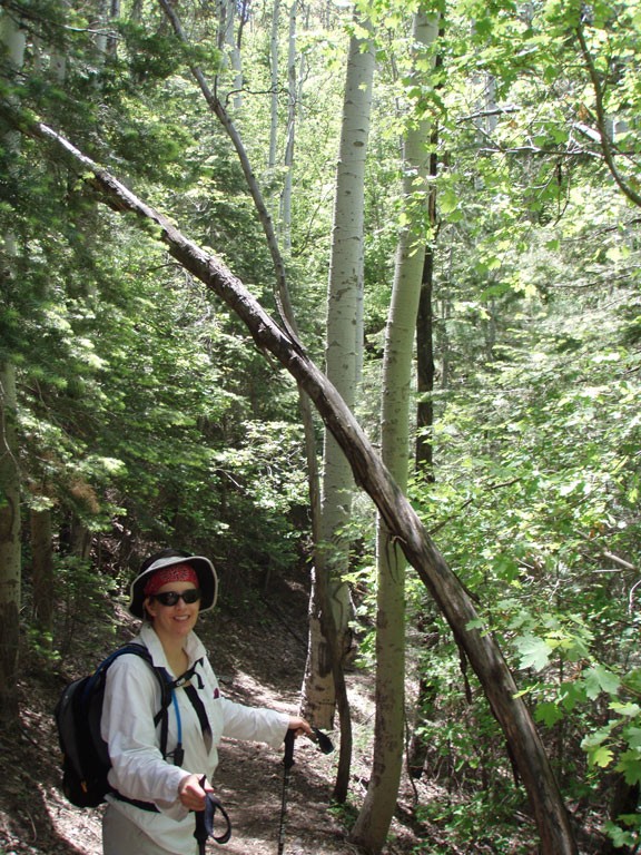
The remaining 2.5 miles also climbs at a steady pace, but now the trail has become heavily shaded by the forest. Shortly after leaving JCT 2, you will pass an old road going off to the right (marked as 'ROAD TO CAVE' on the map). As you can guess, this road goes to a cave (since filled in and not worth visiting). Stay left here and continue up the canyon. Look carefully at the trees and you will notice some Aspen among the forest. As you near the top, the trail leaves the canyon to the left and starts the final switchbacks up to FR 651 and the top of Pinal Mountain. This is a good place to have lunch and congratulate yourself on the climb.
You will return by the same route. On our way back down we found a rattlesnake (our third snake of the day). He was polite enough to rattle and let us know we were getting too close, so we were able to give him a wide birth.
