
- Hikes in Arizona
- Mogollon Rim
- Fossil Spring (via Fossil Spring trail)
Fossil Spring (via Fossil Spring trail)
Location
To get to the trailhead: from the Phoenix area, take HWY-87 North toward Payson. Stay on HWY -87 as you go through the town of Pine and in another 3 miles, you reach the town of Strawberry. Turn left (West) onto the only intersection in the town (FR708). This road starts paved, then after 3.4 miles turns into good condition graded dirt. The Fossil Creek trailhead is 4.7 miles from HWY-87. Turn right at the sign for the Fossil Creek trailhead. Drive this good dirt road another 0.25 miles to the trailhead. There are restrooms at the trailhead, but no water. Please note, FR708 is now closed about 0.5 miles further along the road, so there is no longer any vehicular access by this route to the Flume trail to Fossil Springs.
Hike details
Season
- May
- June
- July
- August
- January
- February
- December
Solitude
Difficulty
Permits
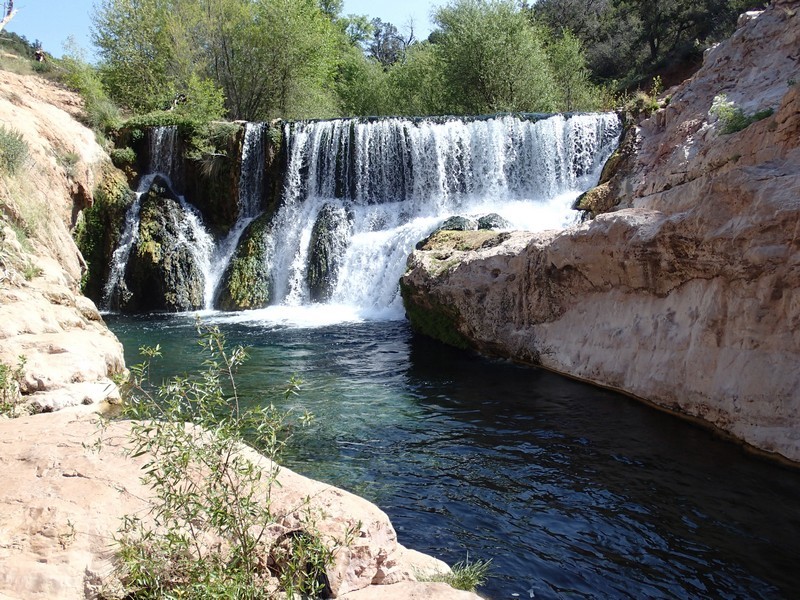
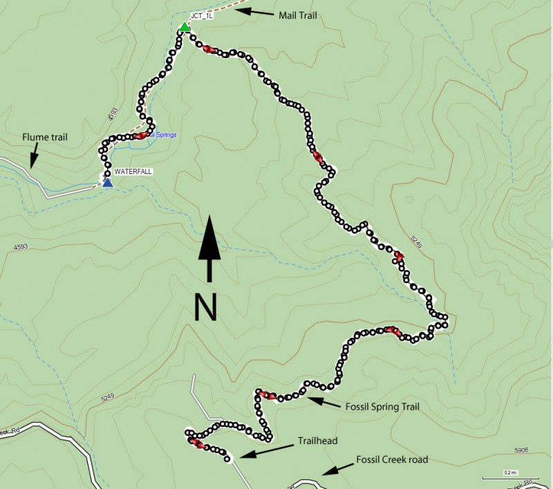
Hike to Fossil Creek via the Fossil Spring trail on the Mogollon Rim in Arizona.
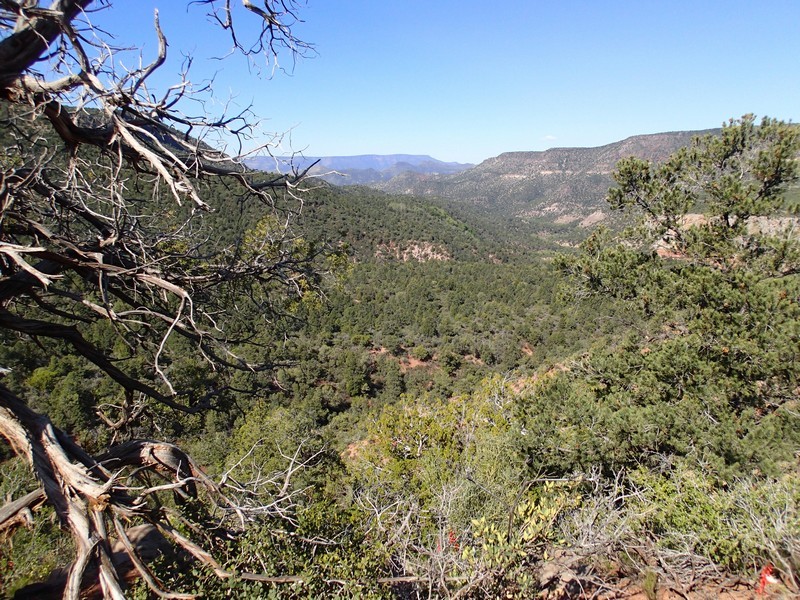
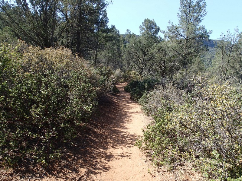
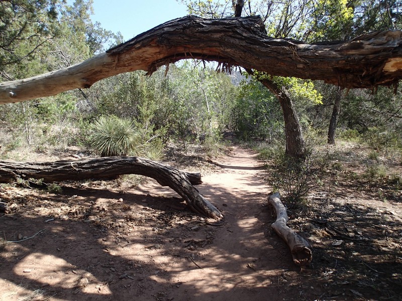
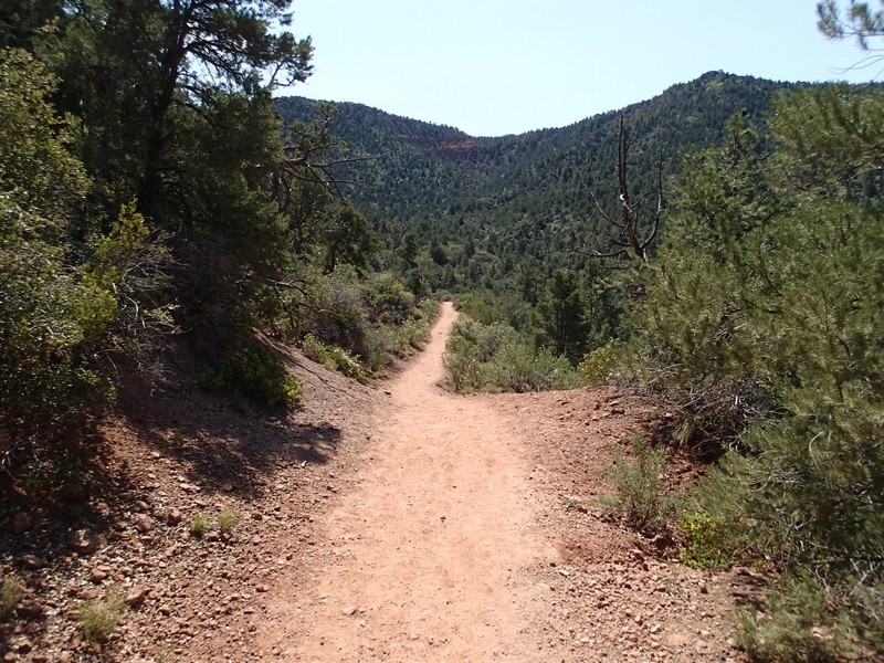
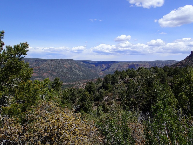
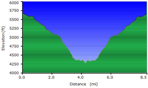
From the well signed trailhead, start along the wide trail down into the canyon that holds Fossil Creek. There are some nice views of the canyon along this trail, which descends gradually. While easy to follow, there is not much shade along this section of the trail. The trail narrows and becomes more rocky the closer you get to the creek.
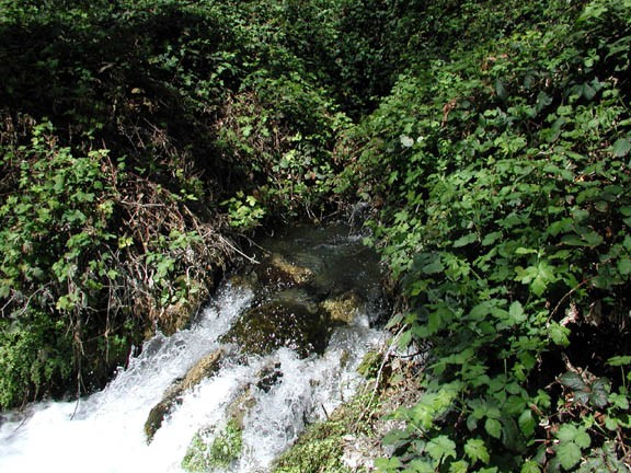
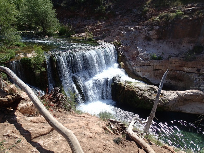
After about 3.6 miles of hiking, you'll reach the creek. You'll cross the gentle creek here (look for the cairns and trail marker signs) but don't be too disappointed at the water level here. It gets much more spectacular once you reach the spring area. Now the trail becomes more lush and overgrown, you'll see some great camping spots. You'll also see the abundance of water loving cottonwood and sycamore trees. After 4.2 miles of total hiking, you'll reach the signed ending of the Flume trail. Walk to the creek and enjoy the spectacular waterfall formed by Fossil creek. The water is quite nice and worth a swim, but you'll likely need to share it with others, as this is a popular place.
I was a bit disappointed with the amount of trash on the trail. On the hike out, I took five empty water bottles with me and none of them were mine. Please take your litter back with you. As a result of the poor treatment of this area, the forest service is considering a permit system to access this area. Hopefully hikers and backpackers can treat this area with the respect it deserves so the permit system does not become necessary.
When ready, return the way you came.
