
- Hikes in Arizona
- Mogollon Rim
- Upper West Clear Creek
Upper West Clear Creek

Location
TO GET TO THE UPPER TRAILHEAD: Take HWY-87 north from Payson, past the towns of Pine and Strawberry. After passing the town of Strawberry, turn left onto HWY-260 (Northwest). Drive 3.1 miles on HWY-260, turning right onto FR144. Take FR144 for 1.8 miles, turning left onto FR149. Take FR149 1.2 miles and turn right onto road FR142. Take FR142 for 1 mile and turn left onto FR142E. Take FR142E 2.7 miles to a parking area.
TO GET TO THE LOWER TRAILHEAD: Take HWY-87 north from Payson, past the towns of Pine and Strawberry. After passing the town of Strawberry, turn left onto HWY-260 (Northwest). Drive 3.1 miles on HWY-260, turning right onto FR144. Take FR144 for 1.8 miles, turning left onto FR149. Take FR149 1.2 miles and turn left onto road FR142. Take FR142 for 2.8 miles and turn right onto FR142B. It's about 2.4 miles on the very rocky 4WD road on FR142B to the trailhead.
Hike details
- One way - Shuttle
- Loop
Season
- June
- July
- August
- January
- February
- December
Solitude
Difficulty
Permits
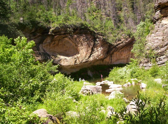
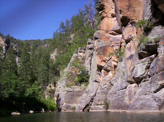
Hiking upper west clear creek on the Mogollon rim in Arizona.
After this hike, my legs and arms were very scratched up from thorny Mexican Locus bushes and I was scratching the multitude of mosquito bites on my body. Despite getting beat up by this hike, this section of west clear creek is an especially beautiful place. Sometimes the reward is worth the effort and this is one of those hikes. Be more prepared than I was, wear long pants and a long sleeved shirt. Also, bring mosquito repellant and a hiking stick.
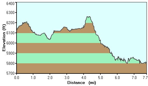
First step is to drop one car at the end of of the FR142B, which marks the beginning of Trail #33. Jump into your other car and head to the beginning of the trailhead, starting at the end of FR142E. The trail here is well signed and easy to follow. It is steep, so go slow and take your time. The nice part is you get into the canyon quickly. This is one of several routes into the canyon and there are usually a few people enjoying the creek here. As you hike down canyon (downstream) you will quickly leave them behind.
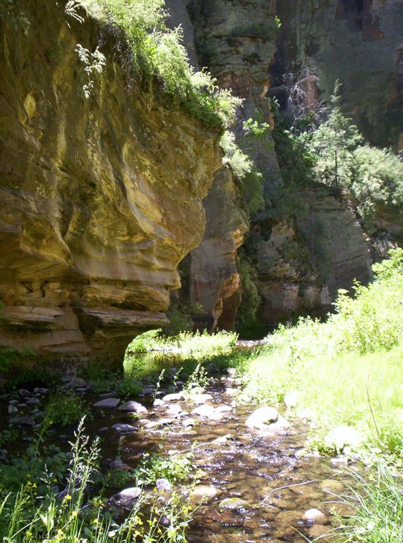
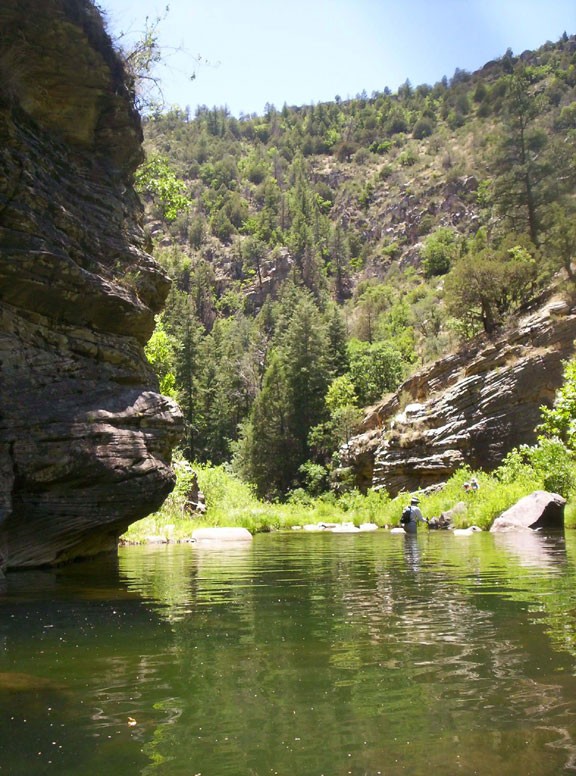
Don't bother trying to keep your feet dry, you will be wading through the creek through much of this hike. Of course, this is why you're doing this hike in the summer... hiking through the creek is a nice way to keep cool. There are game trails in this canyon, but all too often they fade away, forcing either bushwhacking or boulder hopping. Although the hiking is physically draining and slow, the reward is having this lush, watery canyon all to yourselves. There are plenty of good swimming holes and shade so plan on spending some time relaxing too.
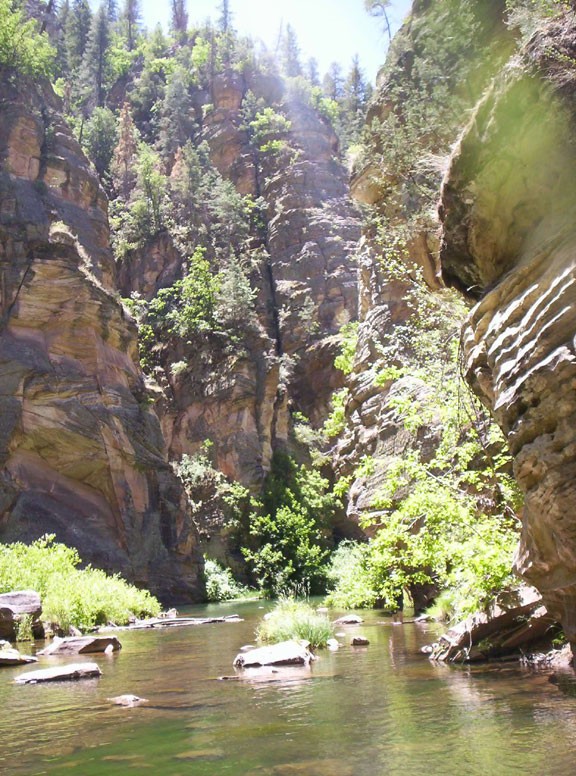
Navigation is easy, as you're in a canyon the whole time. One landmark is an obvious rock spire (about 40 ft high) on the right of the creek. A mile after this rock spire is a nice set of narrows that will require some wading, perhaps swimming during some times of the year. After the narrows, the canyon opens up a bit again. The vegetation gets really thick here, but there is a faint trail on creek right you can take for about a mile or so to avoid the worst of it.
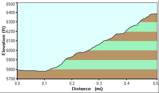
After wading, bushwhacking, and boulder hopping down the creek for a total of 8 miles, keep an eye out on the left of the creek for a cairned and well worn trail leading out of the canyon. If you're not paying attention, you could miss this trail. I'd recommend using a GPS and the map to mark a waypoint where the trail is so you don't miss it.
Here you'll finish the final 0.5 miles on trail #33 back to where you parked your car. Go get your shuttle vehicle and spend the rest of the drive home sharing stories about this lovely place.