
- Hikes in Arizona
- Northern Arizona
- Sycamore Rim Loop
Sycamore Rim Loop

Location
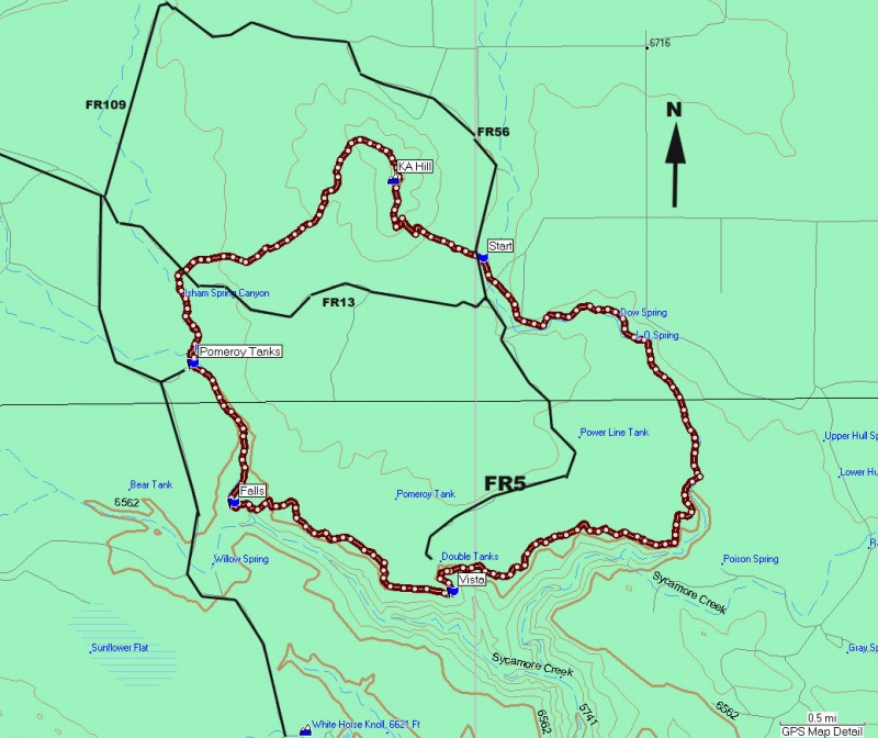
From the Flagstaff area, take I-40 West towards Williams. Just before reaching the exits for the town of Williams, take the Garland Prairie Road (exit 167) and head south (left). This trail soon turns to a well graded dirt road. Follow this road (also signed as FR141) for 9 miles until you reach the signed junction of FR56. Make a right onto FR56 and drive another 1.9 miles to the well signed trailhead on your left.
Hike details
Season
- June
- July
- August
Solitude
Difficulty
Permits
Hike along the Sycamore rim loop trail in Arizona.
This long loop hike is enjoyable for its variety of scenery and ease of hiking. The loop hike described is in a clockwise direction from the trailhead. From the well signed parking area, follow the signs for the Sycamore Rim trail that head into the meadow nearby. There are a number of trails that intersect the Sycamore Rim trail, but most of the tricky junctions are signed. Navigation is also easier because the majority of this hike skirts the unmistakable Sycamore Canyon.
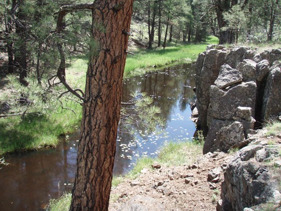
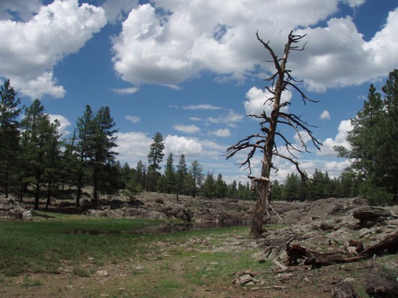
The first item of interest is the site of an old sawmill that dates back to the early 1900s. There's not much left except for some wood and evidence of a railroad tie. The well worn trail continues along the slowly widening canyon and after reaching Dow spring, there will likely be sporadic pools in this section of the canyon.
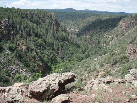
Further along, the canyon gets deeper and the views become more dramatic. Along this section of the trail, Sycamore canyon transforms from a 200 ft high canyon to a monumental gorge. Take the time to enjoy the multiple views of the changing canyon as it becomes more and more impressive.
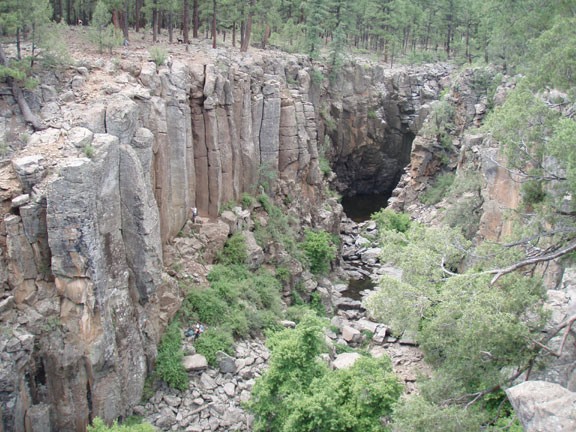
Now the canyon starts to reduce in size again as you near Sycamore falls. The fall is usually dry, but it is a pretty area nonetheless. Rock climbers enjoy this area for the crack climbs and easy access. If you're lucky, you may get the opportunity to watch them practice their skills. Keep following the signs for the "Sycamore Rim Trail" to stay on the right path.
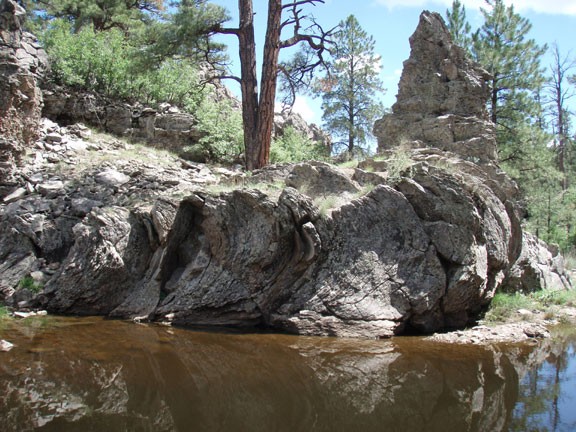
The next area is called Pomeroy tanks and it resembles the scenery from the beginning of the hike. There are a few perennial pools of water here that support a native fish population. The trail is a bit tricky to follow in this area. It descends into the canyon and crosses the water. Look for the hiker icons in the trees to help you stay on the trail. There are some interesting rock formations and pretty pools in this section.
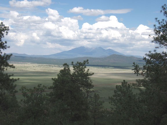
After heading through a meadow, the forest closes back in and you begin the gradual climb to KA hill. This hill represents the last obstacle between you and your car. The quick 500 ft climb is shaded, so the views hide themselves until you are nearly at the top. Once the views break out, they are impressive. You can easily see the San Francisco peaks to the East and Bill Williams mountain to the west. It is a fitting way to end the hike.
From the top of KA hill, it is an uneventful descent back to the trailhead.
