
- Hikes in Arizona
- Northern Arizona
- Walnut Canyon
Walnut Canyon
Updated
Location
How to Get There
This hike is East of Flagstaff, AZ.
From the Flagstaff area, take I-40 east for a few miles. Follow the signs to the Walnut Canyon National Park.
From the Flagstaff area, take I-40 east for a few miles. Follow the signs to the Walnut Canyon National Park.
city
flagstaff
state
az
Region
Northern Arizona
Hike details
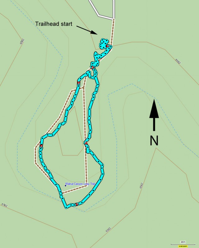
Distance
1.00 [Miles] Total
Hike Distance- Details
1.0 miles loop trail
Time
1.00 [Hours]
Time-details
Take an hour to leisurely enjoy the views and ruins.
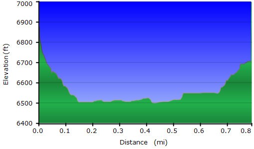
Elevation Change
400 Total gain/loss [Feet]
Elevation Details
about 400 ft change.
Hike Trail Type
Loop
Season
Best Season
- June
- July
- August
Date Hike completed
January 05, 2000
Solitude
Solitude
Low
Solitude Details
It's a national park, so expect to meet 50-150 people on this hike during a weekend. Tours like to stop here as well.
Difficulty
difficulty detail
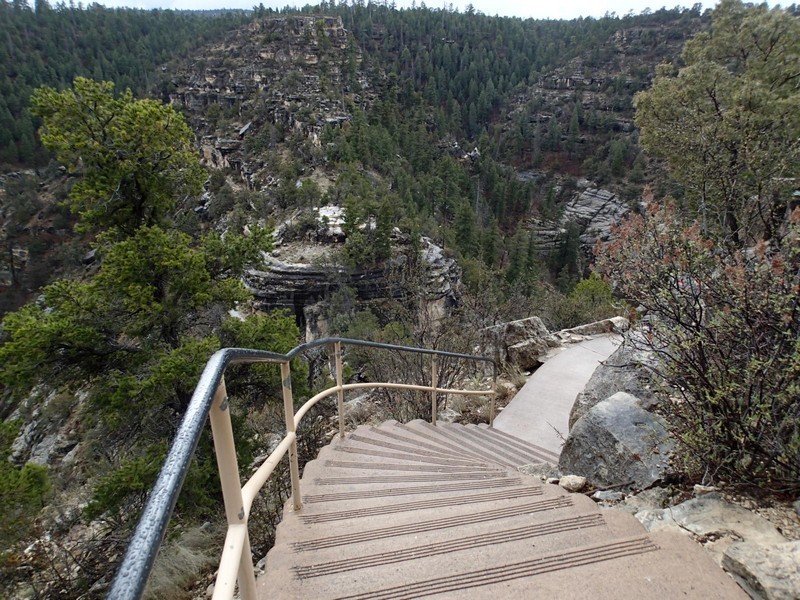
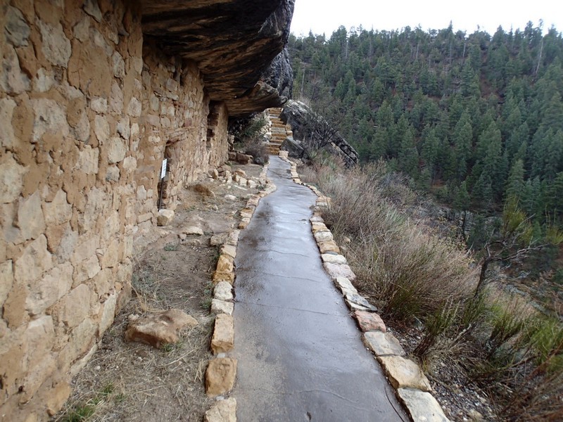
A paved walk to observe some Native American ruins. This is an Easy hike.
Permits
Be Aware of
Small fee required for entry
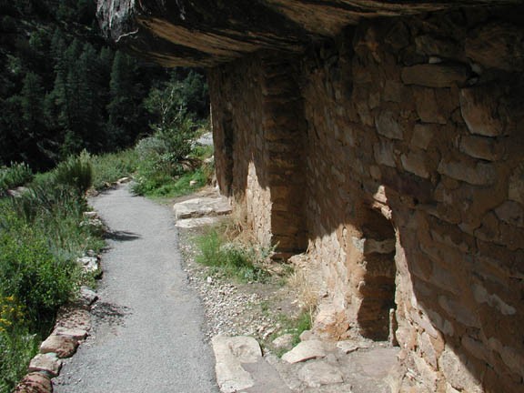
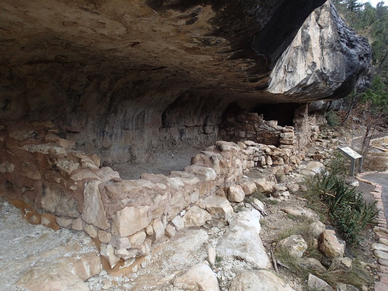
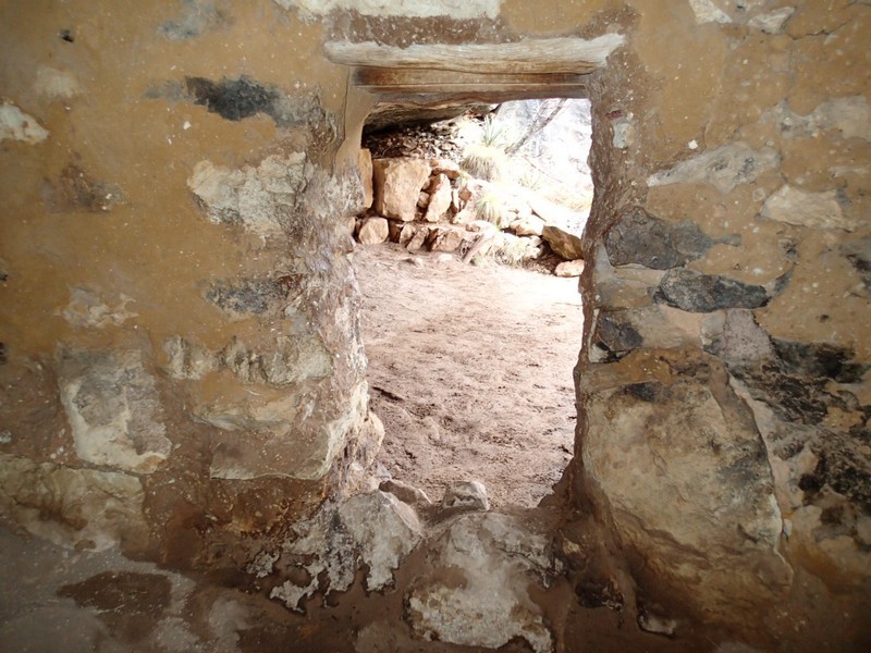
Hike above Walnut Canyon in Arizona.
This hike showcases some impressive native American ruins located east of the Flagstaff area. Bring binoculars to see all the ruins scattered among the cliffs of this Canyon.
This isn't a strenuous hike, so take the opportunity to sample some of the other hikes or bikes in the Flagstaff area after this one.
