
- Hikes in Arizona
- Northern Arizona
- Bear Jaw and Abineau Trails
Bear Jaw and Abineau Trails
Location
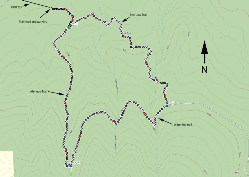
To get to the trailhead: from the Phoenix area, take I-17 North toward Flagstaff, AZ. Once in Flagstaff, take HWY #180 towards the Grand Canyon. About 19 miles from Flagstaff, turn right on FR 151, which is just past mile marker 235. After going 1.6 miles on this flat, graded dirt road, turn left on FR 418. After driving 3.1 miles on FR 418, turn right onto FR 9123J (there is a sign here for the trailhead). Go another 0.6 miles to the trailhead. This area is well signed.
Hike details
Season
- May
- June
- July
- August
- September
Solitude
Difficulty
Permits
Loop hike using the Bear Jaw and Abineau Trails near Flagstaff, Arizona.
This loop hike is located on the North side of the San Francisco peaks, overlooking Flagstaff, AZ.
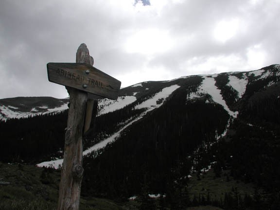
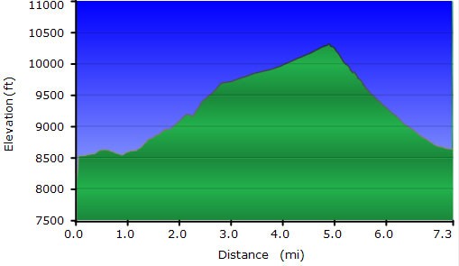
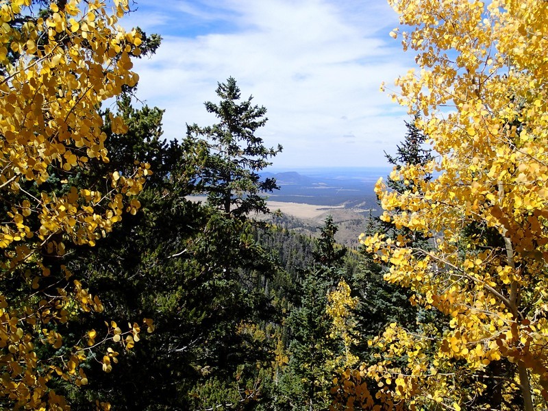
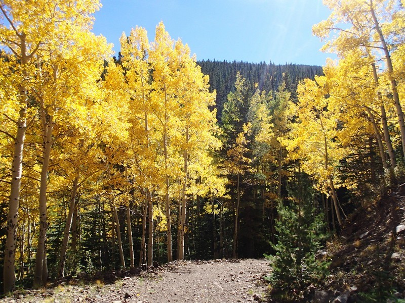
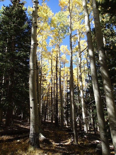
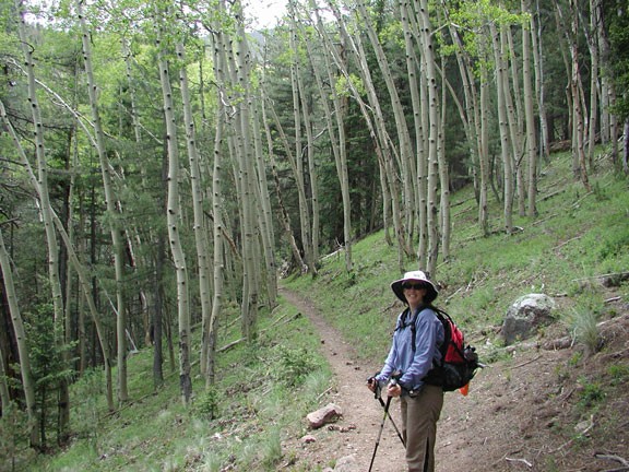
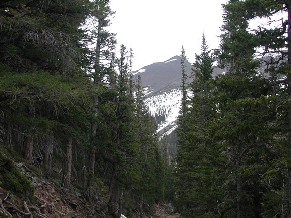
This well signed trail starts at the parking lot and slowly climbs in elevation (starting at about 8500 ft and ending up at 10500 ft). After about 0.4 miles, you will reach a fork. To the right is the Abineau trail. To the left is the Bear Jaw trail. Take a left here to travel up the Bear Jaw trail. As you climb, you are treated to forests of conifer and aspen. This would be a particularly nice hike in the fall with the changing leaves.
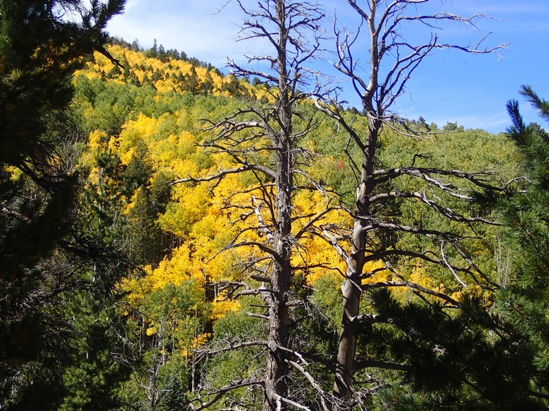
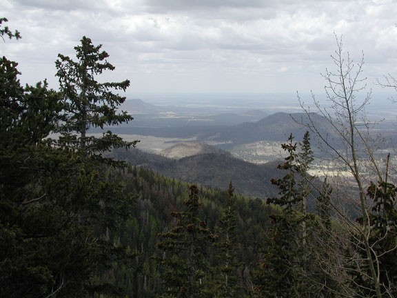
After 2.25 miles on the Bear Jaw trail, you reach the intersection of the Bear Jaw and Waterline trails. Make a right onto the Waterline trail. The Waterline trail used to be a service road to the water sources in the area and has now been declared a wilderness area. Continue on this wide trail along the edge of the San Francisco peaks. The views to the north peak through the forest once in a while. After 2.0 miles on this trail, you reach the intersection of the Waterline trail and the Abineau trail. Here you get the best views of the San Francisco Peaks (and Mt. Humphries) and the forests to the North. This a nice spot for lunch.
When you are ready, take the Abineau trail down the canyon. This trail is steeper than the others and would make for a good workout if you wanted to make this hike an out and back. After 2.0 miles of hiking on the Abineau trail, you loose most of the 2000 ft of elevation and make it back to the fork of Bear Jaw and Abineau trails.
It's a short 0.4 miles back to the trailhead, your car, and waiting civilization. Best to take your time on this hike and enjoy all it's beauty.
